Property Record
2865 Wilson Sharpsville Rd, Cortland, OH 44410

NEARBY LISTINGS FOR SALE OR LEASE
-
-
View all Cortland listings for sale on LoopNet.com
Property Detail
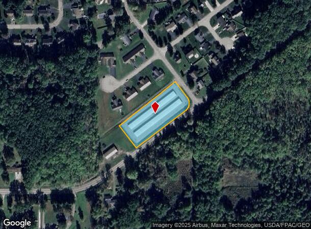
2865 Wilson Sharpsville Rd
Youngstown-Warren-Boardman, OH-PA
Shepherds Hill Allotment Plat
34-107921
367BB 365.32F 1.6182A PER SURVEY SHEP HILL ALLOT #22 WILSON SHARPSVILLE RD
Publicstorage
Trumbull
X
Ohio
39155C0287D
22
2024
1.62 AC
2024
Trumbull County
931000
Youngstown/Warren/Boardman
9,900 SF
DEMOGRAPHICS near 2865 Wilson Sharpsville Rd
1 Mile
3 Mile
5 Mile
2024 Total Population
3,205
12,140
26,773
2029 Population
3,163
11,931
26,339
Pop Growth 2024-2029
(1.31%)
(1.72%)
(1.62%)
Average Age
43
45
46
2024 Total Households
1,367
5,286
11,717
HH Growth 2024-2029
(1.32%)
(1.74%)
(1.65%)
Median Household Inc
$74,351
$68,505
$68,582
Avg Household Size
2.30
2.20
2.20
2024 Avg HH Vehicles
2.00
2.00
2.00
Median Home Value
$183,657
$168,621
$163,321
Median Year Built
1989
1980
1977
Nearby Places
Map Layers
Map Styles
 Street
 Aerial
- Restaurants
- Banks
- Shops
- Fitness
- Groceries
SALE & LEASE HISTORY
LISTING DATE
SALE/LEASE

Sep 24, 2016
For Sale
Nearby Properties
Address
Land Use
TOTAL SIZE
Lot Size
Zoning
Address
Land Use
TOTAL SIZE
Lot Size
Zoning
124,990 SF
11.44 AC
Address
Land Use
TOTAL SIZE
Lot Size
Zoning
2,891 SF
21.77 AC
Address
Land Use
TOTAL SIZE
Lot Size
Zoning
145,998 SF
32.90 AC
Address
Land Use
TOTAL SIZE
Lot Size
Zoning
27,241 SF
15.10 AC
Address
Land Use
TOTAL SIZE
Lot Size
Zoning
49.97 AC
Address
Land Use
TOTAL SIZE
Lot Size
Zoning
1,852.59 AC
Address
Land Use
TOTAL SIZE
Lot Size
Zoning
30,295 SF
8.18 AC
Address
Land Use
TOTAL SIZE
Lot Size
Zoning
21,681 SF
4.98 AC
Address
Land Use
TOTAL SIZE
Lot Size
Zoning
164,800 SF
33.73 AC
Address
Land Use
TOTAL SIZE
Lot Size
Zoning
14,736 SF
2.12 AC
Address
Land Use
TOTAL SIZE
Lot Size
Zoning
2,584 SF
1.25 AC
Address
Land Use
TOTAL SIZE
Lot Size
Zoning
20,046 SF
5.86 AC
Address
Land Use
TOTAL SIZE
Lot Size
Zoning
11,388 SF
1.46 AC
Address
Land Use
TOTAL SIZE
Lot Size
Zoning
3,456 SF
3.98 AC
Address
Land Use
TOTAL SIZE
Lot Size
Zoning
3,239 SF
8.58 AC
Address
Land Use
TOTAL SIZE
Lot Size
Zoning
12,060 SF
11.90 AC
Address
Land Use
TOTAL SIZE
Lot Size
Zoning
10,844 SF
2.72 AC
Address
Land Use
TOTAL SIZE
Lot Size
Zoning
4,271 SF
0.76 AC
Address
Land Use
TOTAL SIZE
Lot Size
Zoning
1,798 SF
121.81 AC
Address
Land Use
TOTAL SIZE
Lot Size
Zoning
971.74 AC
Address
Land Use
TOTAL SIZE
Lot Size
Zoning
7,686 SF
1 AC
Address
Land Use
TOTAL SIZE
Lot Size
Zoning
Address
Land Use
TOTAL SIZE
Lot Size
Zoning
12,715 SF
2.50 AC
Address
Land Use
TOTAL SIZE
Lot Size
Zoning
16,965 SF
2.18 AC
Address
Land Use
TOTAL SIZE
Lot Size
Zoning
9,580 SF
17.37 AC
Address
Land Use
TOTAL SIZE
Lot Size
Zoning
13.98 AC
Address
Land Use
TOTAL SIZE
Lot Size
Zoning
6,120 SF
2.12 AC
Address
Land Use
TOTAL SIZE
Lot Size
Zoning
21,102 SF
3.11 AC
Address
Land Use
TOTAL SIZE
Lot Size
Zoning
13,538 SF
3.15 AC
Address
Land Use
TOTAL SIZE
Lot Size
Zoning
4,102 SF
56.51 AC
The World's #1 Commercial Real Estate Marketplace
Connect with us
© 2026 CoStar Group
The information above has been obtained from sources believed reliable. While we do not doubt its accuracy we have not verified it and make no guarantee, warranty or representation about it. It is your responsibility to independently confirm its accuracy and completeness. Any projections, opinions, assumptions, or estimates used are for example only and do not represent the current or future performance of the property. The value of this transaction to you depends on tax and other factors which should be evaluated by your tax, financial, and legal advisors. You and your advisors should conduct a careful, independent investigation of the property to determine to your satisfaction the suitability of the property for your needs.