Property Record
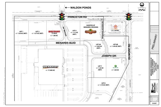
2866 Menards Blvd, Hamilton, OH 45011


NEARBY LISTINGS FOR SALE OR LEASE
Property Detail
2866 Menards Blvd
Cincinnati, OH-KY-IN
Fairfield
A0300-025-000-087
9162 ENT MENARDS CROSSINGS OF FAIRFIELD TOWNSHIP SEE TIF PCL 087T - BYPASS 4 TIF
Restaurantdrivein
Butler
X
Ohio
39017C0194E
1.53 AC
2024
Butler County
2024
Cincinnati/Dayton
011004
DEMOGRAPHICS near 2866 Menards Blvd
1 Mile
3 Mile
5 Mile
2024 Total Population
8,110
61,858
148,799
2029 Population
8,374
62,845
151,109
Pop Growth 2024-2029
+ 3.26%
+ 1.60%
+ 1.55%
Average Age
41
38
39
2024 Total Households
3,071
22,581
56,256
HH Growth 2024-2029
+ 3.71%
+ 1.71%
+ 1.59%
Median Household Inc
$83,360
$62,902
$70,644
Avg Household Size
2.50
2.60
2.60
2024 Avg HH Vehicles
2.00
2.00
2.00
Median Home Value
$234,973
$188,220
$201,326
Median Year Built
1998
1970
1975
Nearby Places
Map Layers
Map Styles
 Street
 Aerial
- Restaurants
- Banks
- Shops
- Fitness
- Groceries
PUBLIC TRANSPORTATION
AIRPORT
Cincinnati/Northern Kentucky International
DRIVE
WALK
Distance
Cincinnati/Northern Kentucky International
64 min
40.1 mi
Freight Ports
Port of Toledo
DRIVE
WALK
Distance
Port of Toledo
223 min
189.3 mi
SALE & LEASE HISTORY
LISTING DATE
SALE/LEASE

Sep 24, 2016
For Sale
Feb 05, 2019
For Sale
Apr 25, 2019
For Lease
Nearby Properties
Address
Land Use
TOTAL SIZE
Lot Size
Zoning
Address
Land Use
TOTAL SIZE
Lot Size
Zoning
659,723 SF
27.80 AC
Address
Land Use
TOTAL SIZE
Lot Size
Zoning
1,602,242 SF
36.46 AC
Address
Land Use
TOTAL SIZE
Lot Size
Zoning
336,010 SF
5.56 AC
ADV
Address
Land Use
TOTAL SIZE
Lot Size
Zoning
14.65 AC
Address
Land Use
TOTAL SIZE
Lot Size
Zoning
510,080 SF
60.87 AC
Address
Land Use
TOTAL SIZE
Lot Size
Zoning
112,027 SF
0.78 AC
Address
Land Use
TOTAL SIZE
Lot Size
Zoning
283,527 SF
28.17 AC
Address
Land Use
TOTAL SIZE
Lot Size
Zoning
28.47 AC
Address
Land Use
TOTAL SIZE
Lot Size
Zoning
317,472 SF
23.73 AC
Address
Land Use
TOTAL SIZE
Lot Size
Zoning
287,433 SF
23.36 AC
Address
Land Use
TOTAL SIZE
Lot Size
Zoning
Address
Land Use
TOTAL SIZE
Lot Size
Zoning
30.51 AC
Address
Land Use
TOTAL SIZE
Lot Size
Zoning
2.75 AC
Address
Land Use
TOTAL SIZE
Lot Size
Zoning
50,753 SF
19.74 AC
Address
Land Use
TOTAL SIZE
Lot Size
Zoning
1.38 AC
Address
Land Use
TOTAL SIZE
Lot Size
Zoning
215,969 SF
16.08 AC
ADV
Address
Land Use
TOTAL SIZE
Lot Size
Zoning
178,152 SF
63.48 AC
Address
Land Use
TOTAL SIZE
Lot Size
Zoning
147,898 SF
15.34 AC
Address
Land Use
TOTAL SIZE
Lot Size
Zoning
124,549 SF
9.75 AC
Address
Land Use
TOTAL SIZE
Lot Size
Zoning
11.84 AC
Address
Land Use
TOTAL SIZE
Lot Size
Zoning
32,000 SF
10.24 AC
Address
Land Use
TOTAL SIZE
Lot Size
Zoning
220,612 SF
1.79 AC
Address
Land Use
TOTAL SIZE
Lot Size
Zoning
446,660 SF
30.51 AC
Address
Land Use
TOTAL SIZE
Lot Size
Zoning
Address
Land Use
TOTAL SIZE
Lot Size
Zoning
310,200 SF
28.23 AC
Address
Land Use
TOTAL SIZE
Lot Size
Zoning
75,402 SF
0.45 AC
Address
Land Use
TOTAL SIZE
Lot Size
Zoning
158,332 SF
16.96 AC
Address
Land Use
TOTAL SIZE
Lot Size
Zoning
225,687 SF
22.43 AC
Address
Land Use
TOTAL SIZE
Lot Size
Zoning
111,418 SF
9.44 AC
Address
Land Use
TOTAL SIZE
Lot Size
Zoning
203,940 SF
11.01 AC
The World's #1 Commercial Real Estate Marketplace
Connect with us
© 2025 CoStar Group
The information above has been obtained from sources believed reliable. While we do not doubt its accuracy we have not verified it and make no guarantee, warranty or representation about it. It is your responsibility to independently confirm its accuracy and completeness. Any projections, opinions, assumptions, or estimates used are for example only and do not represent the current or future performance of the property. The value of this transaction to you depends on tax and other factors which should be evaluated by your tax, financial, and legal advisors. You and your advisors should conduct a careful, independent investigation of the property to determine to your satisfaction the suitability of the property for your needs.