Property Record
2867 Post Rd, Orefield, PA 18069
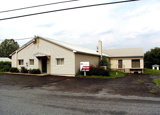

Property Detail
2867 Post Rd
545755575316-1
LOTS: 001, C
Manufacturinglight
Lehigh
RV
Pennsylvania
B and X Area of moderate flood hazard, usually the area between the limits of the 100-year and 500-year floods.
1 c
2026
0.46 AC
2026
Lehigh Valley
005401
Philadelphia
7,400 SF
Allentown-Bethlehem-Easton, PA-NJ
NEARBY LISTINGS FOR SALE OR LEASE
DEMOGRAPHICS near 2867 Post Rd
1 mile
3 mile
5 mile
2025 Total Population
767
12,255
42,737
2030 Population
788
12,724
44,333
Pop Growth 2025-2030
+ 2.74%
+ 3.83%
+ 3.73%
Average Age
44
43
43
2025 Total Households
283
4,535
16,235
HH Growth 2025-2030
+ 2.83%
+ 3.99%
+ 3.87%
Median Household Inc
$133,695
$129,382
$119,658
Avg Household Size
2.70
2.70
2.60
2025 Avg HH Vehicles
3.00
2.00
2.00
Median Home Value
$588,889
$538,232
$453,915
Median Year Built
1980
1988
1988
Nearby Places
Map Layers
Map Styles
 Street
 Aerial
Layers
 Traffic
 Biking
Places
Listings with unknown addresses are not visible on the map
- Restaurants
- Banks
- Shops
- Fitness
- Groceries
PUBLIC TRANSPORTATION
AIRPORT
Lehigh Valley International
Drive
Walk
Distance
Lehigh Valley International
29 min
16.0 mi
Nearby Properties
Address
Land Use
TOTAL SIZE
Lot Size
Zoning
Address
Land Use
TOTAL SIZE
Lot Size
Zoning
585,664 SF
41.93 AC
LI
Address
Land Use
TOTAL SIZE
Lot Size
Zoning
4,948 SF
51.05 AC
R3
Address
Land Use
TOTAL SIZE
Lot Size
Zoning
244,481 SF
30.24 AC
LI
Address
Land Use
TOTAL SIZE
Lot Size
Zoning
525,868 SF
32.38 AC
LI
Address
Land Use
TOTAL SIZE
Lot Size
Zoning
170,208 SF
41.40 AC
R-3
Address
Land Use
TOTAL SIZE
Lot Size
Zoning
112,200 SF
25.05 AC
LI
Address
Land Use
TOTAL SIZE
Lot Size
Zoning
11,966 SF
134.70 AC
AR-I
Address
Land Use
TOTAL SIZE
Lot Size
Zoning
352,946 SF
19.83 AC
LI-B
Address
Land Use
TOTAL SIZE
Lot Size
Zoning
22,007 SF
55.21 AC
AR-I
Address
Land Use
TOTAL SIZE
Lot Size
Zoning
240,747 SF
30.64 AC
LI
Address
Land Use
TOTAL SIZE
Lot Size
Zoning
289,300 SF
18.66 AC
LI
Address
Land Use
TOTAL SIZE
Lot Size
Zoning
71,108 SF
13 AC
R-3
Address
Land Use
TOTAL SIZE
Lot Size
Zoning
111,833 SF
12.97 AC
LI
Address
Land Use
TOTAL SIZE
Lot Size
Zoning
299,399 SF
17.32 AC
LI
Address
Land Use
TOTAL SIZE
Lot Size
Zoning
82,305 SF
198.43 AC
SR
Address
Land Use
TOTAL SIZE
Lot Size
Zoning
81.45 AC
LIL
Address
Land Use
TOTAL SIZE
Lot Size
Zoning
178,856 SF
13.71 AC
LI
Address
Land Use
TOTAL SIZE
Lot Size
Zoning
26,834 SF
5.10 AC
HC
Address
Land Use
TOTAL SIZE
Lot Size
Zoning
124,408 SF
10.89 AC
LI
Address
Land Use
TOTAL SIZE
Lot Size
Zoning
40.61 AC
PC
Address
Land Use
TOTAL SIZE
Lot Size
Zoning
139,236 SF
13.42 AC
LI
Address
Land Use
TOTAL SIZE
Lot Size
Zoning
153,188 SF
9.20 AC
LI
Address
Land Use
TOTAL SIZE
Lot Size
Zoning
187,342 SF
11.87 AC
LI
Address
Land Use
TOTAL SIZE
Lot Size
Zoning
80,527 SF
10.71 AC
NC
Address
Land Use
TOTAL SIZE
Lot Size
Zoning
59,864 SF
6.17 AC
LI
Address
Land Use
TOTAL SIZE
Lot Size
Zoning
174,300 SF
11 AC
LI
Address
Land Use
TOTAL SIZE
Lot Size
Zoning
28,758 SF
10.37 AC
LI
Address
Land Use
TOTAL SIZE
Lot Size
Zoning
100,521 SF
13.43 AC
LI
Address
Land Use
TOTAL SIZE
Lot Size
Zoning
134,000 SF
13.91 AC
LI
Address
Land Use
TOTAL SIZE
Lot Size
Zoning
141,392 SF
9.37 AC
LI
The World's #1 Commercial Real Estate Marketplace
Connect with us
© 2026 CoStar Group
The information above has been obtained from sources believed reliable. While we do not doubt its accuracy we have not verified it and make no guarantee, warranty or representation about it. It is your responsibility to independently confirm its accuracy and completeness. Any projections, opinions, assumptions, or estimates used are for example only and do not represent the current or future performance of the property. The value of this transaction to you depends on tax and other factors which should be evaluated by your tax, financial, and legal advisors. You and your advisors should conduct a careful, independent investigation of the property to determine to your satisfaction the suitability of the property for your needs.