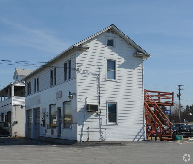
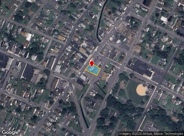
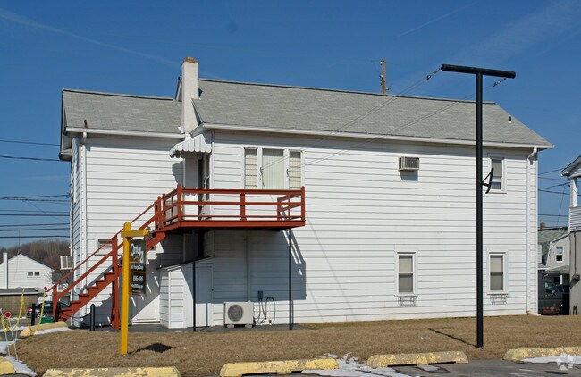
Property Record
287 Main St, Dupont, PA 18641
NEARBY LISTINGS FOR SALE OR LEASE
Property Detail
287 Main St
Scranton--Wilkes-Barre--Hazelton, PA
15-145-4 287 MAIN ST
15-E12NE4-024-009-000
Luzerne
Commercialofficeresidentialmixeduse
Pennsylvania
AE
9
42079C0253E
0.16 AC
2025
I-81 Corridor
2025
Philadelphia
210200
DEMOGRAPHICS near 287 Main St
1 Mile
3 Mile
5 Mile
2024 Total Population
3,559
31,797
61,519
2029 Population
3,522
31,624
61,127
Pop Growth 2024-2029
(1.04%)
(0.54%)
(0.64%)
Average Age
45
43
44
2024 Total Households
1,642
14,135
27,270
HH Growth 2024-2029
(1.10%)
(0.57%)
(0.63%)
Median Household Inc
$60,770
$63,591
$66,711
Avg Household Size
2.20
2.20
2.20
2024 Avg HH Vehicles
2.00
2.00
2.00
Median Home Value
$135,349
$146,063
$153,927
Median Year Built
1948
1949
1956
Nearby Places
Map Layers
Map Styles
 Street
 Aerial
- Restaurants
- Banks
- Shops
- Fitness
- Groceries
PUBLIC TRANSPORTATION
AIRPORT
Wilkes-Barre/Scranton International
DRIVE
WALK
Distance
Wilkes-Barre/Scranton International
6 min
2.0 mi
Freight Ports
Maher Terminal
DRIVE
WALK
Distance
Maher Terminal
152 min
122.2 mi
Nearby Properties
Address
Land Use
TOTAL SIZE
Lot Size
Zoning
Address
Land Use
TOTAL SIZE
Lot Size
Zoning
225.55 AC
Address
Land Use
TOTAL SIZE
Lot Size
Zoning
48.95 AC
Address
Land Use
TOTAL SIZE
Lot Size
Zoning
100 AC
Address
Land Use
TOTAL SIZE
Lot Size
Zoning
Address
Land Use
TOTAL SIZE
Lot Size
Zoning
130.63 AC
Address
Land Use
TOTAL SIZE
Lot Size
Zoning
92.99 AC
Address
Land Use
TOTAL SIZE
Lot Size
Zoning
59.28 AC
Address
Land Use
TOTAL SIZE
Lot Size
Zoning
58.45 AC
Address
Land Use
TOTAL SIZE
Lot Size
Zoning
46.01 AC
Address
Land Use
TOTAL SIZE
Lot Size
Zoning
51.15 AC
Address
Land Use
TOTAL SIZE
Lot Size
Zoning
43.65 AC
Address
Land Use
TOTAL SIZE
Lot Size
Zoning
50.85 AC
Address
Land Use
TOTAL SIZE
Lot Size
Zoning
67.25 AC
Address
Land Use
TOTAL SIZE
Lot Size
Zoning
46.47 AC
Address
Land Use
TOTAL SIZE
Lot Size
Zoning
42.72 AC
Address
Land Use
TOTAL SIZE
Lot Size
Zoning
24.33 AC
Address
Land Use
TOTAL SIZE
Lot Size
Zoning
34.07 AC
Address
Land Use
TOTAL SIZE
Lot Size
Zoning
15.60 AC
Address
Land Use
TOTAL SIZE
Lot Size
Zoning
28.06 AC
Address
Land Use
TOTAL SIZE
Lot Size
Zoning
27.12 AC
Address
Land Use
TOTAL SIZE
Lot Size
Zoning
24.30 AC
Address
Land Use
TOTAL SIZE
Lot Size
Zoning
21.31 AC
Address
Land Use
TOTAL SIZE
Lot Size
Zoning
5.93 AC
Address
Land Use
TOTAL SIZE
Lot Size
Zoning
13.59 AC
Address
Land Use
TOTAL SIZE
Lot Size
Zoning
14.35 AC
Address
Land Use
TOTAL SIZE
Lot Size
Zoning
4.56 AC
Address
Land Use
TOTAL SIZE
Lot Size
Zoning
9.70 AC
Address
Land Use
TOTAL SIZE
Lot Size
Zoning
Address
Land Use
TOTAL SIZE
Lot Size
Zoning
21.81 AC
The World's #1 Commercial Real Estate Marketplace
Connect with us
© 2025 CoStar Group
The information above has been obtained from sources believed reliable. While we do not doubt its accuracy we have not verified it and make no guarantee, warranty or representation about it. It is your responsibility to independently confirm its accuracy and completeness. Any projections, opinions, assumptions, or estimates used are for example only and do not represent the current or future performance of the property. The value of this transaction to you depends on tax and other factors which should be evaluated by your tax, financial, and legal advisors. You and your advisors should conduct a careful, independent investigation of the property to determine to your satisfaction the suitability of the property for your needs.