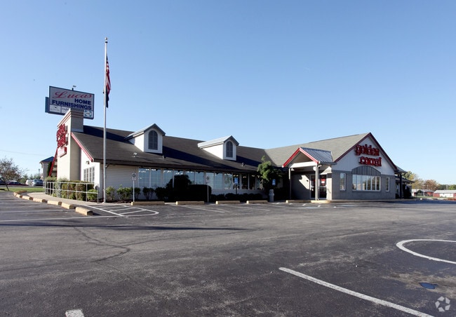
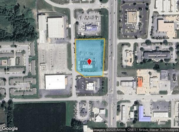
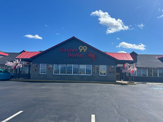
Property Record
287 S Ew, Kokomo, IN 46902
NEARBY LISTINGS FOR SALE OR LEASE
Property Detail
287 S Ew
Kokomo, IN
Pine Valley Sub
34-09-13-400-031.000-006
PINE VALLEY S/D LOT 1 A RE-S/D OF PT BLOCK C PINE VALLEY MINOR S/D 2.44 AC SUBJ TO UTIL EASE
Restaurantdrivein
Howard
X
Indiana
18067C0217C
1
2023
2.44 AC
2024
Lafayette/Kokomo
001400
Other Market Areas
10,377 SF
DEMOGRAPHICS near 287 S Ew
1 Mile
3 Mile
5 Mile
2024 Total Population
7,394
31,817
63,354
2029 Population
7,329
31,594
63,381
Pop Growth 2024-2029
(0.88%)
(0.70%)
+ 0.04%
Average Age
40
42
42
2024 Total Households
3,159
14,119
27,668
HH Growth 2024-2029
(0.85%)
(0.74%)
+ 0.01%
Median Household Inc
$55,300
$53,071
$53,802
Avg Household Size
2.30
2.20
2.20
2024 Avg HH Vehicles
2.00
2.00
2.00
Median Home Value
$129,418
$147,724
$140,006
Median Year Built
1968
1970
1966
Nearby Places
Map Layers
Map Styles
 Street
 Aerial
- Restaurants
- Banks
- Shops
- Fitness
- Groceries
SALE & LEASE HISTORY
LISTING DATE
SALE/LEASE

Sep 11, 2020
For Lease
Oct 14, 2021
For Lease
Oct 06, 2021
For Sale
May 24, 2024
For Sale
Nearby Properties
Address
Land Use
TOTAL SIZE
Lot Size
Zoning
Address
Land Use
TOTAL SIZE
Lot Size
Zoning
3,633,252 SF
0.02 AC
Address
Land Use
TOTAL SIZE
Lot Size
Zoning
377,850 SF
87 SF
Address
Land Use
TOTAL SIZE
Lot Size
Zoning
399,910 SF
131 SF
Address
Land Use
TOTAL SIZE
Lot Size
Zoning
417,744 SF
174 SF
Address
Land Use
TOTAL SIZE
Lot Size
Zoning
117,279 SF
0.01 AC
Address
Land Use
TOTAL SIZE
Lot Size
Zoning
254,213 SF
87 SF
Address
Land Use
TOTAL SIZE
Lot Size
Zoning
98,951 SF
131 SF
Address
Land Use
TOTAL SIZE
Lot Size
Zoning
2,639,746 SF
0.02 AC
Address
Land Use
TOTAL SIZE
Lot Size
Zoning
175,236 SF
44 SF
Address
Land Use
TOTAL SIZE
Lot Size
Zoning
83,164 SF
0.01 AC
Address
Land Use
TOTAL SIZE
Lot Size
Zoning
64,326 SF
16.34 AC
Address
Land Use
TOTAL SIZE
Lot Size
Zoning
104,910 SF
44 SF
Address
Land Use
TOTAL SIZE
Lot Size
Zoning
59,824 SF
3.01 AC
Address
Land Use
TOTAL SIZE
Lot Size
Zoning
240,144 SF
131 SF
Address
Land Use
TOTAL SIZE
Lot Size
Zoning
116,821 SF
44 SF
Address
Land Use
TOTAL SIZE
Lot Size
Zoning
3,696 SF
174 SF
Address
Land Use
TOTAL SIZE
Lot Size
Zoning
188,114 SF
87 SF
Address
Land Use
TOTAL SIZE
Lot Size
Zoning
428,684 SF
0.01 AC
Address
Land Use
TOTAL SIZE
Lot Size
Zoning
72,476 SF
3.87 AC
Address
Land Use
TOTAL SIZE
Lot Size
Zoning
109,429 SF
44 SF
Address
Land Use
TOTAL SIZE
Lot Size
Zoning
66,400 SF
44 SF
Address
Land Use
TOTAL SIZE
Lot Size
Zoning
59,702 SF
Address
Land Use
TOTAL SIZE
Lot Size
Zoning
158,656 SF
44 SF
Address
Land Use
TOTAL SIZE
Lot Size
Zoning
62,020 SF
1.59 AC
Address
Land Use
TOTAL SIZE
Lot Size
Zoning
95,495 SF
44 SF
Address
Land Use
TOTAL SIZE
Lot Size
Zoning
239,259 SF
87 SF
Address
Land Use
TOTAL SIZE
Lot Size
Zoning
63,336 SF
3.73 AC
Address
Land Use
TOTAL SIZE
Lot Size
Zoning
150,196 SF
87 SF
Address
Land Use
TOTAL SIZE
Lot Size
Zoning
55,980 SF
44 SF
Address
Land Use
TOTAL SIZE
Lot Size
Zoning
59,843 SF
2.80 AC
The World's #1 Commercial Real Estate Marketplace
Connect with us
© 2025 CoStar Group
The information above has been obtained from sources believed reliable. While we do not doubt its accuracy we have not verified it and make no guarantee, warranty or representation about it. It is your responsibility to independently confirm its accuracy and completeness. Any projections, opinions, assumptions, or estimates used are for example only and do not represent the current or future performance of the property. The value of this transaction to you depends on tax and other factors which should be evaluated by your tax, financial, and legal advisors. You and your advisors should conduct a careful, independent investigation of the property to determine to your satisfaction the suitability of the property for your needs.