Property Record
2871 Edenvale Rd, Johns Island, SC 29455

Property Detail
2871 Edenvale Rd
Charleston-North Charleston, SC
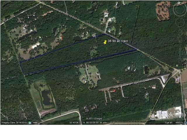
SUBDIVISION NAME -JOHNS ISLAND DESCRIPTION -TRACT A
258-00-00-017
CHARLESTON
Residentialacreage
South Carolina
C and X Area of minimal flood hazard, usually depicted on FIRMs as above the 500-year flood level.
30.90 AC
2025
West Islands
2024
Charleston/N Charleston
002103
NEARBY LISTINGS FOR SALE OR LEASE
-
-
View all Johns Island listings for sale on LoopNet.com
DEMOGRAPHICS near 2871 Edenvale Rd
1 mile
3 mile
5 mile
2025 Total Population
534
4,000
21,218
2030 Population
565
4,206
22,598
Pop Growth 2025-2030
+ 5.81%
+ 5.15%
+ 6.50%
Average Age
44
44
44
2025 Total Households
203
1,576
8,893
HH Growth 2025-2030
+ 5.91%
+ 5.14%
+ 6.85%
Median Household Inc
$112,068
$108,703
$117,507
Avg Household Size
2.50
2.40
2.30
2025 Avg HH Vehicles
2.00
2.00
2.00
Median Home Value
$557,432
$521,576
$535,300
Median Year Built
2001
2003
2007
Nearby Places
Map Layers
Map Styles
 Street
 Aerial
Layers
 Traffic
 Biking
Places
Listings with unknown addresses are not visible on the map
- Restaurants
- Banks
- Shops
- Fitness
- Groceries
PUBLIC TRANSPORTATION
AIRPORT
Charleston AFB/International
Drive
Walk
Distance
Charleston AFB/International
48 min
26.3 mi
Freight Ports
Columbus Street Terminal
Drive
Walk
Distance
Columbus Street Terminal
34 min
15.4 mi
SALE & LEASE HISTORY
LISTING DATE
SALE/LEASE

Sep 24, 2016
For Sale
Nearby Properties
Address
Land Use
TOTAL SIZE
Lot Size
Zoning
Address
Land Use
TOTAL SIZE
Lot Size
Zoning
12.45 AC
Address
Land Use
TOTAL SIZE
Lot Size
Zoning
301.64 AC
Address
Land Use
TOTAL SIZE
Lot Size
Zoning
2,050 SF
3.71 AC
Address
Land Use
TOTAL SIZE
Lot Size
Zoning
2,184 SF
14 AC
Address
Land Use
TOTAL SIZE
Lot Size
Zoning
Address
Land Use
TOTAL SIZE
Lot Size
Zoning
Address
Land Use
TOTAL SIZE
Lot Size
Zoning
1,248 SF
105.11 AC
Address
Land Use
TOTAL SIZE
Lot Size
Zoning
Address
Land Use
TOTAL SIZE
Lot Size
Zoning
672 SF
11.50 AC
Address
Land Use
TOTAL SIZE
Lot Size
Zoning
1,720 SF
23.57 AC
Address
Land Use
TOTAL SIZE
Lot Size
Zoning
Address
Land Use
TOTAL SIZE
Lot Size
Zoning
18.82 AC
Address
Land Use
TOTAL SIZE
Lot Size
Zoning
31.96 AC
Address
Land Use
TOTAL SIZE
Lot Size
Zoning
Address
Land Use
TOTAL SIZE
Lot Size
Zoning
73.38 AC
Address
Land Use
TOTAL SIZE
Lot Size
Zoning
Address
Land Use
TOTAL SIZE
Lot Size
Zoning
Address
Land Use
TOTAL SIZE
Lot Size
Zoning
Address
Land Use
TOTAL SIZE
Lot Size
Zoning
Address
Land Use
TOTAL SIZE
Lot Size
Zoning
Address
Land Use
TOTAL SIZE
Lot Size
Zoning
Address
Land Use
TOTAL SIZE
Lot Size
Zoning
11.70 AC
Address
Land Use
TOTAL SIZE
Lot Size
Zoning
Address
Land Use
TOTAL SIZE
Lot Size
Zoning
Address
Land Use
TOTAL SIZE
Lot Size
Zoning
1.78 AC
Address
Land Use
TOTAL SIZE
Lot Size
Zoning
8.47 AC
Address
Land Use
TOTAL SIZE
Lot Size
Zoning
Address
Land Use
TOTAL SIZE
Lot Size
Zoning
10.10 AC
Address
Land Use
TOTAL SIZE
Lot Size
Zoning
The World's #1 Commercial Real Estate Marketplace
Connect with us
© 2026 CoStar Group
The information above has been obtained from sources believed reliable. While we do not doubt its accuracy we have not verified it and make no guarantee, warranty or representation about it. It is your responsibility to independently confirm its accuracy and completeness. Any projections, opinions, assumptions, or estimates used are for example only and do not represent the current or future performance of the property. The value of this transaction to you depends on tax and other factors which should be evaluated by your tax, financial, and legal advisors. You and your advisors should conduct a careful, independent investigation of the property to determine to your satisfaction the suitability of the property for your needs.