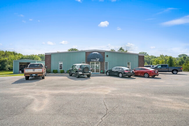
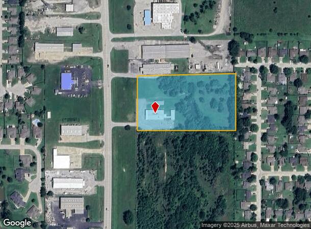
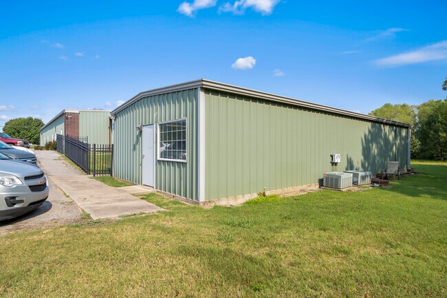
Property Record
2871 N Highway 167, Claremore, OK 74019
NEARBY LISTINGS FOR SALE OR LEASE
-
-
View all Claremore listings for sale on LoopNet.com
Property Detail
2871 N Highway 167
660066449
20N-15E
Officebuilding
TR IN SW NE SW DESC AS BEG; NE/C SW NE SW, TH S01-13-16E 210.98' TO POB, TH S88-42-47W 617.31' TO E ROW/L HWY 167, TH ALG CUR
X
Rogers
40145C0025H
Oklahoma
0
4.84 AC
2024
Rogers County
050101
Tulsa
1,440 SF
Tulsa, OK
DEMOGRAPHICS near 2871 N Highway 167
1 Mile
3 Mile
5 Mile
2024 Total Population
1,667
9,459
19,236
2029 Population
1,817
10,345
20,934
Pop Growth 2024-2029
+ 9.00%
+ 9.37%
+ 8.83%
Average Age
38
39
39
2024 Total Households
654
3,684
7,155
HH Growth 2024-2029
+ 9.02%
+ 9.45%
+ 8.86%
Median Household Inc
$55,340
$60,955
$70,445
Avg Household Size
2.50
2.50
2.60
2024 Avg HH Vehicles
2.00
2.00
2.00
Median Home Value
$164,244
$155,819
$193,590
Median Year Built
1992
1983
1987
Nearby Places
Map Layers
Map Styles
 Street
 Aerial
- Restaurants
- Banks
- Shops
- Fitness
- Groceries
PUBLIC TRANSPORTATION
AIRPORT
Tulsa International
DRIVE
WALK
Distance
Tulsa International
17 min
11.6 mi
Freight Ports
Tulsa Port Of Catoosa
DRIVE
WALK
Distance
Tulsa Port Of Catoosa
6 min
3.6 mi
SALE & LEASE HISTORY
LISTING DATE
SALE/LEASE

Aug 13, 2021
For Sale
Nearby Properties
Address
Land Use
TOTAL SIZE
Lot Size
Zoning
Address
Land Use
TOTAL SIZE
Lot Size
Zoning
11,184 SF
638.56 AC
Address
Land Use
TOTAL SIZE
Lot Size
Zoning
3,720 SF
158.66 AC
Address
Land Use
TOTAL SIZE
Lot Size
Zoning
6,000 SF
346.13 AC
Address
Land Use
TOTAL SIZE
Lot Size
Zoning
62,644 SF
12.38 AC
Address
Land Use
TOTAL SIZE
Lot Size
Zoning
153,297 SF
16.29 AC
Address
Land Use
TOTAL SIZE
Lot Size
Zoning
103,820 SF
2.70 AC
Address
Land Use
TOTAL SIZE
Lot Size
Zoning
133,875 SF
7.68 AC
Address
Land Use
TOTAL SIZE
Lot Size
Zoning
87,500 SF
4.12 AC
IL
Address
Land Use
TOTAL SIZE
Lot Size
Zoning
2,456 SF
2.18 AC
Address
Land Use
TOTAL SIZE
Lot Size
Zoning
68,725 SF
2.74 AC
Address
Land Use
TOTAL SIZE
Lot Size
Zoning
11,115 SF
2.61 AC
RS3
Address
Land Use
TOTAL SIZE
Lot Size
Zoning
57,268 SF
6.87 AC
Address
Land Use
TOTAL SIZE
Lot Size
Zoning
60,000 SF
11.53 AC
Address
Land Use
TOTAL SIZE
Lot Size
Zoning
6,568 SF
6.51 AC
RS1
Address
Land Use
TOTAL SIZE
Lot Size
Zoning
9,710 SF
3.91 AC
RS3
Address
Land Use
TOTAL SIZE
Lot Size
Zoning
35,000 SF
4.55 AC
Address
Land Use
TOTAL SIZE
Lot Size
Zoning
60,000 SF
Address
Land Use
TOTAL SIZE
Lot Size
Zoning
101,980 SF
5.49 AC
CS
Address
Land Use
TOTAL SIZE
Lot Size
Zoning
3,815 SF
20.82 AC
Address
Land Use
TOTAL SIZE
Lot Size
Zoning
44,476 SF
2.40 AC
IL
Address
Land Use
TOTAL SIZE
Lot Size
Zoning
1 SF
12.50 AC
CS
Address
Land Use
TOTAL SIZE
Lot Size
Zoning
51,950 SF
9.10 AC
Address
Land Use
TOTAL SIZE
Lot Size
Zoning
22,952 SF
3.88 AC
Address
Land Use
TOTAL SIZE
Lot Size
Zoning
900 SF
48.42 AC
Address
Land Use
TOTAL SIZE
Lot Size
Zoning
24,000 SF
6.75 AC
Address
Land Use
TOTAL SIZE
Lot Size
Zoning
45,886 SF
20 AC
Address
Land Use
TOTAL SIZE
Lot Size
Zoning
3,000 SF
Address
Land Use
TOTAL SIZE
Lot Size
Zoning
42,450 SF
4.60 AC
RS1
Address
Land Use
TOTAL SIZE
Lot Size
Zoning
39,136 SF
1.25 AC
The World's #1 Commercial Real Estate Marketplace
Connect with us
© 2026 CoStar Group
The information above has been obtained from sources believed reliable. While we do not doubt its accuracy we have not verified it and make no guarantee, warranty or representation about it. It is your responsibility to independently confirm its accuracy and completeness. Any projections, opinions, assumptions, or estimates used are for example only and do not represent the current or future performance of the property. The value of this transaction to you depends on tax and other factors which should be evaluated by your tax, financial, and legal advisors. You and your advisors should conduct a careful, independent investigation of the property to determine to your satisfaction the suitability of the property for your needs.