Property Record
2875 E Frontage Rd, Amado, AZ 85645

Property Detail
2875 E Frontage Rd
Nogales, AZ
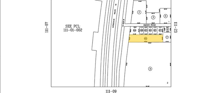
A PORTION OF LOT 2 IN SECTION 12 T20S R12E
111-08-006G
SANTA CRUZ
Stateproperty
Arizona
B and X Area of moderate flood hazard, usually the area between the limits of the 100-year and 500-year floods.
2
0
4 AC
2025
Arizona SE & Sierra Vista Area
004129
Other Market Areas
6,431 SF
NEARBY LISTINGS FOR SALE OR LEASE
DEMOGRAPHICS near 2875 E Frontage Rd
1 mile
3 mile
5 mile
2025 Total Population
16
912
1,386
2030 Population
17
948
1,443
Pop Growth 2025-2030
+ 6.25%
+ 3.95%
+ 4.11%
Average Age
42
40
46
2025 Total Households
6
309
530
HH Growth 2025-2030
0.00%
+ 4.21%
+ 3.96%
Median Household Inc
$39,999
$66,847
$68,590
Avg Household Size
2.40
2.70
2.40
2025 Avg HH Vehicles
2.00
2.00
2.00
Median Home Value
$250,000
$190,243
$276,288
Median Year Built
1984
1977
1983
Nearby Places
Map Layers
Map Styles
 Street
 Aerial
Transit
 Traffic
 Biking
Places
Listings with unknown addresses are not visible on the map
- Restaurants
- Banks
- Shops
- Fitness
- Groceries
PUBLIC TRANSPORTATION
AIRPORT
Tucson International
Drive
Walk
Distance
Tucson International
45 min
34.4 mi
Freight Ports
Port of San Diego
Drive
Walk
Distance
Port of San Diego
475 min
444.8 mi
SALE & LEASE HISTORY
LISTING DATE
SALE/LEASE

Mar 20, 2020
For Sale
Nearby Properties
Address
Land Use
TOTAL SIZE
Lot Size
Zoning
Address
Land Use
TOTAL SIZE
Lot Size
Zoning
20,048 SF
140.29 AC
Address
Land Use
TOTAL SIZE
Lot Size
Zoning
45,217 SF
17.18 AC
Address
Land Use
TOTAL SIZE
Lot Size
Zoning
4,515 SF
50 AC
Address
Land Use
TOTAL SIZE
Lot Size
Zoning
2,619 SF
17 AC
Address
Land Use
TOTAL SIZE
Lot Size
Zoning
45,398 SF
10.30 AC
GR1
Address
Land Use
TOTAL SIZE
Lot Size
Zoning
6,859 SF
3.01 AC
CB1
Address
Land Use
TOTAL SIZE
Lot Size
Zoning
10,715 SF
126.71 AC
RH
Address
Land Use
TOTAL SIZE
Lot Size
Zoning
8,820 SF
72.07 AC
RH
Address
Land Use
TOTAL SIZE
Lot Size
Zoning
8,191 SF
21.74 AC
Address
Land Use
TOTAL SIZE
Lot Size
Zoning
9,100 SF
1.80 AC
GR1
Address
Land Use
TOTAL SIZE
Lot Size
Zoning
17,220 SF
1.07 AC
CB2
Address
Land Use
TOTAL SIZE
Lot Size
Zoning
1,470 SF
4.55 AC
Address
Land Use
TOTAL SIZE
Lot Size
Zoning
1,476 SF
1.37 AC
Address
Land Use
TOTAL SIZE
Lot Size
Zoning
2,922 SF
2.67 AC
Address
Land Use
TOTAL SIZE
Lot Size
Zoning
6,044 SF
6.36 AC
Address
Land Use
TOTAL SIZE
Lot Size
Zoning
4,790 SF
2 AC
Address
Land Use
TOTAL SIZE
Lot Size
Zoning
6,500 SF
2.32 AC
Address
Land Use
TOTAL SIZE
Lot Size
Zoning
5,977 SF
1.46 AC
Address
Land Use
TOTAL SIZE
Lot Size
Zoning
1,592 SF
467.28 AC
Address
Land Use
TOTAL SIZE
Lot Size
Zoning
2,491 SF
104.25 AC
Address
Land Use
TOTAL SIZE
Lot Size
Zoning
3,899 SF
0.85 AC
Address
Land Use
TOTAL SIZE
Lot Size
Zoning
319 SF
5.35 AC
Address
Land Use
TOTAL SIZE
Lot Size
Zoning
1,234 SF
3.68 AC
Address
Land Use
TOTAL SIZE
Lot Size
Zoning
2,840 SF
0.09 AC
Address
Land Use
TOTAL SIZE
Lot Size
Zoning
9,465 SF
4 AC
Address
Land Use
TOTAL SIZE
Lot Size
Zoning
3,059 SF
1.50 AC
Address
Land Use
TOTAL SIZE
Lot Size
Zoning
8,379 SF
0.64 AC
GR1
Address
Land Use
TOTAL SIZE
Lot Size
Zoning
4,993 SF
0.46 AC
Address
Land Use
TOTAL SIZE
Lot Size
Zoning
16.54 AC
The World's #1 Commercial Real Estate Marketplace
Connect with us
© 2026 CoStar Group
The information above has been obtained from sources believed reliable. While we do not doubt its accuracy we have not verified it and make no guarantee, warranty or representation about it. It is your responsibility to independently confirm its accuracy and completeness. Any projections, opinions, assumptions, or estimates used are for example only and do not represent the current or future performance of the property. The value of this transaction to you depends on tax and other factors which should be evaluated by your tax, financial, and legal advisors. You and your advisors should conduct a careful, independent investigation of the property to determine to your satisfaction the suitability of the property for your needs.