Property Record
2875 E Sharon Rd, Cincinnati, OH 45241
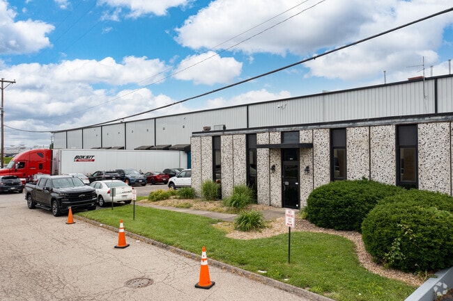

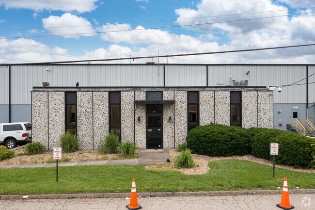

Property Detail
2875 E Sharon Rd
Cincinnati, OH-KY-IN
SHARON RD 9.7304 AC R1-T4-S29 PARS 160-171 CONS
611-0030-0160
HAMILTON
Warehouse
Ohio
AE The base floodplain where base flood elevations are provided. AE Zones are now used on new format FIRMs instead of A1-A30 Zones.
9.78 AC
2025
Woodlawn/Evendale
2025
Cincinnati/Dayton
023100
NEARBY LISTINGS FOR SALE OR LEASE
DEMOGRAPHICS near 2875 E Sharon Rd
1 mile
3 mile
5 mile
2025 Total Population
988
39,616
157,770
2030 Population
1,004
40,215
159,760
Pop Growth 2025-2030
+ 1.62%
+ 1.51%
+ 1.26%
Average Age
43
41
41
2025 Total Households
440
16,512
64,411
HH Growth 2025-2030
+ 1.82%
+ 1.45%
+ 1.33%
Median Household Inc
$86,989
$76,117
$83,917
Avg Household Size
2.20
2.30
2.40
2025 Avg HH Vehicles
2.00
2.00
2.00
Median Home Value
$231,343
$264,571
$272,126
Median Year Built
1968
1972
1969
Nearby Places
Map Layers
Map Styles
 Street
 Aerial
Transit
 Traffic
 Biking
Places
Listings with unknown addresses are not visible on the map
- Restaurants
- Banks
- Shops
- Fitness
- Groceries
PUBLIC TRANSPORTATION
AIRPORT
Cincinnati/Northern Kentucky International
Drive
Walk
Distance
Cincinnati/Northern Kentucky International
43 min
27.2 mi
Nearby Properties
Address
Land Use
TOTAL SIZE
Lot Size
Zoning
Address
Land Use
TOTAL SIZE
Lot Size
Zoning
47.52 AC
Address
Land Use
TOTAL SIZE
Lot Size
Zoning
6.03 AC
Address
Land Use
TOTAL SIZE
Lot Size
Zoning
119.08 AC
R1
Address
Land Use
TOTAL SIZE
Lot Size
Zoning
15.33 AC
Address
Land Use
TOTAL SIZE
Lot Size
Zoning
10.85 AC
Address
Land Use
TOTAL SIZE
Lot Size
Zoning
Address
Land Use
TOTAL SIZE
Lot Size
Zoning
29.79 AC
M1
Address
Land Use
TOTAL SIZE
Lot Size
Zoning
4,620 SF
85.80 AC
Address
Land Use
TOTAL SIZE
Lot Size
Zoning
Address
Land Use
TOTAL SIZE
Lot Size
Zoning
124.81 AC
Address
Land Use
TOTAL SIZE
Lot Size
Zoning
68.49 AC
Address
Land Use
TOTAL SIZE
Lot Size
Zoning
29.95 AC
Address
Land Use
TOTAL SIZE
Lot Size
Zoning
Address
Land Use
TOTAL SIZE
Lot Size
Zoning
26.63 AC
Address
Land Use
TOTAL SIZE
Lot Size
Zoning
Address
Land Use
TOTAL SIZE
Lot Size
Zoning
Address
Land Use
TOTAL SIZE
Lot Size
Zoning
8,964 SF
11.61 AC
Address
Land Use
TOTAL SIZE
Lot Size
Zoning
25,098 SF
21.31 AC
Address
Land Use
TOTAL SIZE
Lot Size
Zoning
25.89 AC
Address
Land Use
TOTAL SIZE
Lot Size
Zoning
555 SF
7.20 AC
M1
Address
Land Use
TOTAL SIZE
Lot Size
Zoning
5,085 SF
15.17 AC
Address
Land Use
TOTAL SIZE
Lot Size
Zoning
8.06 AC
Address
Land Use
TOTAL SIZE
Lot Size
Zoning
Address
Land Use
TOTAL SIZE
Lot Size
Zoning
Address
Land Use
TOTAL SIZE
Lot Size
Zoning
54.92 AC
Address
Land Use
TOTAL SIZE
Lot Size
Zoning
9,744 SF
8.15 AC
Address
Land Use
TOTAL SIZE
Lot Size
Zoning
Address
Land Use
TOTAL SIZE
Lot Size
Zoning
113,400 SF
53.19 AC
Address
Land Use
TOTAL SIZE
Lot Size
Zoning
3,608 SF
8.05 AC
M1
Address
Land Use
TOTAL SIZE
Lot Size
Zoning
1,788 SF
9.55 AC
M1
The World's #1 Commercial Real Estate Marketplace
Connect with us
© 2026 CoStar Group
The information above has been obtained from sources believed reliable. While we do not doubt its accuracy we have not verified it and make no guarantee, warranty or representation about it. It is your responsibility to independently confirm its accuracy and completeness. Any projections, opinions, assumptions, or estimates used are for example only and do not represent the current or future performance of the property. The value of this transaction to you depends on tax and other factors which should be evaluated by your tax, financial, and legal advisors. You and your advisors should conduct a careful, independent investigation of the property to determine to your satisfaction the suitability of the property for your needs.