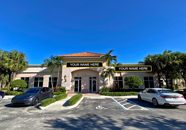
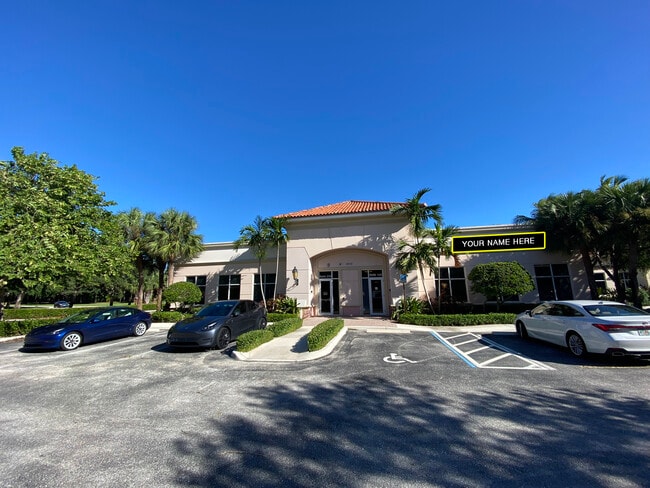
Property Record
2875 Pga Blvd, Palm Beach Gardens, FL 33410

Current Lease Availabilities
NEARBY LISTINGS FOR SALE OR LEASE
Property Detail
2875 Pga Blvd
52-43-42-05-26-027-0067
Regional Center
Officebuilding
REGIONAL CENTER PARS 27.05~ 27.06 & 27.R02~ NLY 310.10 FT OF ELY 190.87 FT OF WLY 581.93 FT OF PAR 27.06 (LESS NLY 157.73 FT OF ELY 17.86 FT & SLY 79 FT OF ELY 71.94 FT)
X
Palm Beach
12099C0377F
Florida
2024
1.17 AC
2024
North Palm Beach
000304
South Florida
9,936 SF
West Palm Beach-Boca Raton-Delray Beach, FL
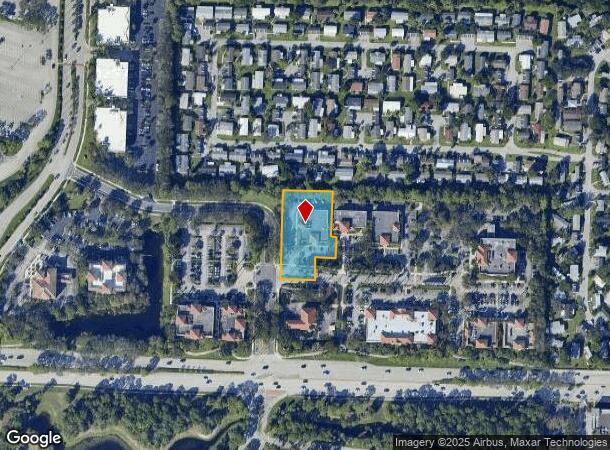
DEMOGRAPHICS near 2875 Pga Blvd
1 Mile
3 Mile
5 Mile
2024 Total Population
11,186
70,263
168,927
2029 Population
11,757
73,393
177,387
Pop Growth 2024-2029
+ 5.10%
+ 4.45%
+ 5.01%
Average Age
47
47
46
2024 Total Households
5,235
31,750
73,426
HH Growth 2024-2029
+ 4.64%
+ 4.21%
+ 4.81%
Median Household Inc
$81,577
$92,691
$90,323
Avg Household Size
2.00
2.10
2.20
2024 Avg HH Vehicles
1.00
2.00
2.00
Median Home Value
$400,667
$448,267
$451,889
Median Year Built
1999
1986
1989
Nearby Places
- Restaurants
- Banks
- Shops
- Fitness
- Groceries
PUBLIC TRANSPORTATION
COMMUTER RAIL
Mangonia Park (Tri-County Commuter - South Florida Regional Transportation Authority (Tri-Rail))
DRIVE
WALK
Distance
Mangonia Park (Tri-County Commuter - South Florida Regional Transportation Authority (Tri-Rail))
16 min
9.5 mi
AIRPORT
Palm Beach International
DRIVE
WALK
Distance
Palm Beach International
24 min
15.5 mi
Nearby Properties
Address
Land Use
TOTAL SIZE
Lot Size
Zoning
Address
Land Use
TOTAL SIZE
Lot Size
Zoning
736,483 SF
43.51 AC
CG1
Address
Land Use
TOTAL SIZE
Lot Size
Zoning
1,086,259 SF
58.36 AC
CO
Address
Land Use
TOTAL SIZE
Lot Size
Zoning
557,199 SF
46.91 AC
PCD
Address
Land Use
TOTAL SIZE
Lot Size
Zoning
545,613 SF
19.47 AC
PCD
Address
Land Use
TOTAL SIZE
Lot Size
Zoning
574,456 SF
43.11 AC
PCD
Address
Land Use
TOTAL SIZE
Lot Size
Zoning
362,386 SF
22.51 AC
PCD
Address
Land Use
TOTAL SIZE
Lot Size
Zoning
351,267 SF
11.12 AC
PUD
Address
Land Use
TOTAL SIZE
Lot Size
Zoning
390,319 SF
44.34 AC
PCD
Address
Land Use
TOTAL SIZE
Lot Size
Zoning
308,087 SF
68.94 AC
P/I
Address
Land Use
TOTAL SIZE
Lot Size
Zoning
351,788 SF
13.75 AC
PCD
Address
Land Use
TOTAL SIZE
Lot Size
Zoning
399,171 SF
6.60 AC
PCD
Address
Land Use
TOTAL SIZE
Lot Size
Zoning
195,263 SF
2.73 AC
PCD
Address
Land Use
TOTAL SIZE
Lot Size
Zoning
680,979 SF
44.87 AC
PCD
Address
Land Use
TOTAL SIZE
Lot Size
Zoning
406,434 SF
40.60 AC
P/I
Address
Land Use
TOTAL SIZE
Lot Size
Zoning
248,945 SF
10.87 AC
PO
Address
Land Use
TOTAL SIZE
Lot Size
Zoning
270,888 SF
8.93 AC
RH
Address
Land Use
TOTAL SIZE
Lot Size
Zoning
59,520 SF
19.04 AC
C-S
Address
Land Use
TOTAL SIZE
Lot Size
Zoning
347,834 SF
8.92 AC
PCD
Address
Land Use
TOTAL SIZE
Lot Size
Zoning
150,114 SF
3.20 AC
MXD
Address
Land Use
TOTAL SIZE
Lot Size
Zoning
291,437 SF
22.02 AC
PO
Address
Land Use
TOTAL SIZE
Lot Size
Zoning
266,196 SF
17.61 AC
R-3
Address
Land Use
TOTAL SIZE
Lot Size
Zoning
109,243 SF
9.14 AC
CG1
Address
Land Use
TOTAL SIZE
Lot Size
Zoning
180,563 SF
54.46 AC
P/I
Address
Land Use
TOTAL SIZE
Lot Size
Zoning
286,353 SF
22.12 AC
RH
Address
Land Use
TOTAL SIZE
Lot Size
Zoning
381,665 SF
26.01 AC
PCD
Address
Land Use
TOTAL SIZE
Lot Size
Zoning
150,123 SF
25.97 AC
PCD
Address
Land Use
TOTAL SIZE
Lot Size
Zoning
368,848 SF
15.86 AC
CO
Address
Land Use
TOTAL SIZE
Lot Size
Zoning
204,232 SF
22.81 AC
PCD
Address
Land Use
TOTAL SIZE
Lot Size
Zoning
213,817 SF
6.49 AC
PCD
Address
Land Use
TOTAL SIZE
Lot Size
Zoning
209,467 SF
15.20 AC
R-3
The World's #1 Commercial Real Estate Marketplace
Connect with us
© 2025 CoStar Group
The information above has been obtained from sources believed reliable. While we do not doubt its accuracy we have not verified it and make no guarantee, warranty or representation about it. It is your responsibility to independently confirm its accuracy and completeness. Any projections, opinions, assumptions, or estimates used are for example only and do not represent the current or future performance of the property. The value of this transaction to you depends on tax and other factors which should be evaluated by your tax, financial, and legal advisors. You and your advisors should conduct a careful, independent investigation of the property to determine to your satisfaction the suitability of the property for your needs.