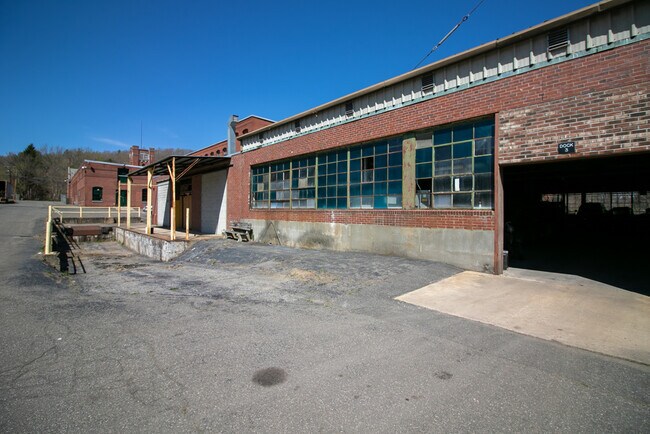
Property Record
288 Main St, Monson, MA 01057


Current Lease Availabilities
NEARBY LISTINGS FOR SALE OR LEASE
Property Detail
288 Main St
MONS-000115-000000-000135
Hampden
Industrialgeneral
Massachusetts
AE
16.55 AC
25013C0458E
Hampden County
2025
Hartford
2025
Springfield, MA
813701
DEMOGRAPHICS near 288 Main St
1 Mile
3 Mile
5 Mile
2024 Total Population
1,968
5,929
14,459
2029 Population
1,927
5,806
14,209
Pop Growth 2024-2029
(2.08%)
(2.07%)
(1.73%)
Average Age
44
45
44
2024 Total Households
823
2,464
6,005
HH Growth 2024-2029
(2.19%)
(2.07%)
(1.75%)
Median Household Inc
$72,569
$72,847
$73,454
Avg Household Size
2.40
2.40
2.40
2024 Avg HH Vehicles
2.00
2.00
2.00
Median Home Value
$285,737
$284,277
$284,905
Median Year Built
1968
1969
1969
Nearby Places
Map Layers
Map Styles
 Street
 Aerial
- Restaurants
- Banks
- Shops
- Fitness
- Groceries
PUBLIC TRANSPORTATION
AIRPORT
Bradley International
DRIVE
WALK
Distance
Bradley International
57 min
28.5 mi
Worcester Regional
DRIVE
WALK
Distance
Worcester Regional
59 min
36.1 mi
Freight Ports
Port of Davisville, RI
DRIVE
WALK
Distance
Port of Davisville, RI
117 min
87.4 mi
Nearby Properties
Address
Land Use
TOTAL SIZE
Lot Size
Zoning
Address
Land Use
TOTAL SIZE
Lot Size
Zoning
112,556 SF
20 AC
RR
Address
Land Use
TOTAL SIZE
Lot Size
Zoning
91,544 SF
18.47 AC
RV
Address
Land Use
TOTAL SIZE
Lot Size
Zoning
85,228 SF
46.53 AC
RV
Address
Land Use
TOTAL SIZE
Lot Size
Zoning
50,656 SF
5.62 AC
I
Address
Land Use
TOTAL SIZE
Lot Size
Zoning
21,928 SF
2 AC
CC
Address
Land Use
TOTAL SIZE
Lot Size
Zoning
22.57 AC
I
Address
Land Use
TOTAL SIZE
Lot Size
Zoning
320 AC
Address
Land Use
TOTAL SIZE
Lot Size
Zoning
4 AC
RV
Address
Land Use
TOTAL SIZE
Lot Size
Zoning
5.59 AC
CC
Address
Land Use
TOTAL SIZE
Lot Size
Zoning
2.75 AC
CC
Address
Land Use
TOTAL SIZE
Lot Size
Zoning
2.37 AC
RV
Address
Land Use
TOTAL SIZE
Lot Size
Zoning
12,516 SF
1.19 AC
CC
Address
Land Use
TOTAL SIZE
Lot Size
Zoning
8,880 SF
1.64 AC
CC
Address
Land Use
TOTAL SIZE
Lot Size
Zoning
48,750 SF
24.38 AC
I
Address
Land Use
TOTAL SIZE
Lot Size
Zoning
10,427 SF
0.33 AC
CC
Address
Land Use
TOTAL SIZE
Lot Size
Zoning
6,450 SF
1.36 AC
CC
Address
Land Use
TOTAL SIZE
Lot Size
Zoning
191.29 AC
RL
Address
Land Use
TOTAL SIZE
Lot Size
Zoning
12,006 SF
1 AC
CC
Address
Land Use
TOTAL SIZE
Lot Size
Zoning
2,476 SF
2.86 AC
RV
Address
Land Use
TOTAL SIZE
Lot Size
Zoning
4,912 SF
1.50 AC
CR
Address
Land Use
TOTAL SIZE
Lot Size
Zoning
16,000 SF
4.84 AC
CC
Address
Land Use
TOTAL SIZE
Lot Size
Zoning
241.90 AC
INDUST
Address
Land Use
TOTAL SIZE
Lot Size
Zoning
1,664 SF
87.54 AC
RR
Address
Land Use
TOTAL SIZE
Lot Size
Zoning
11,475 SF
2.60 AC
GC
Address
Land Use
TOTAL SIZE
Lot Size
Zoning
2,798 SF
23.14 AC
RR
Address
Land Use
TOTAL SIZE
Lot Size
Zoning
1.49 AC
I
Address
Land Use
TOTAL SIZE
Lot Size
Zoning
1.40 AC
RV
Address
Land Use
TOTAL SIZE
Lot Size
Zoning
9,422 SF
0.75 AC
CC
Address
Land Use
TOTAL SIZE
Lot Size
Zoning
386.40 AC
RR
Address
Land Use
TOTAL SIZE
Lot Size
Zoning
5,920 SF
2 AC
I
The World's #1 Commercial Real Estate Marketplace
Connect with us
© 2025 CoStar Group
The information above has been obtained from sources believed reliable. While we do not doubt its accuracy we have not verified it and make no guarantee, warranty or representation about it. It is your responsibility to independently confirm its accuracy and completeness. Any projections, opinions, assumptions, or estimates used are for example only and do not represent the current or future performance of the property. The value of this transaction to you depends on tax and other factors which should be evaluated by your tax, financial, and legal advisors. You and your advisors should conduct a careful, independent investigation of the property to determine to your satisfaction the suitability of the property for your needs.