Property Record
2880 Hull Rd, Camden, NJ 08104
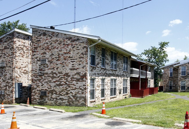


Property Detail
2880 Hull Rd
Philadelphia-Camden-Wilmington, PA-NJ-DE-MD
Camden
08-00714-0000-00020
New Jersey
Apartment
20
AE The base floodplain where base flood elevations are provided. AE Zones are now used on new format FIRMs instead of A1-A30 Zones.
5.42 AC
2025
Fairview
2026
Philadelphia
602000
NEARBY LISTINGS FOR SALE OR LEASE
-
-
No Photo
-
-
-
View all Camden listings for sale on LoopNet.com
DEMOGRAPHICS near 2880 Hull Rd
1 mile
3 mile
5 mile
2025 Total Population
23,159
158,927
538,315
2030 Population
23,889
162,922
543,982
Pop Growth 2025-2030
+ 3.15%
+ 2.51%
+ 1.05%
Average Age
36
39
39
2025 Total Households
8,887
61,826
232,428
HH Growth 2025-2030
+ 3.21%
+ 2.38%
+ 0.82%
Median Household Inc
$50,141
$67,475
$84,441
Avg Household Size
2.60
2.50
2.20
2025 Avg HH Vehicles
1.00
1.00
1.00
Median Home Value
$203,453
$270,473
$337,031
Median Year Built
1949
1949
1951
Nearby Places
Map Layers
Map Styles
 Street
 Aerial
Layers
 Traffic
 Biking
Places
Listings with unknown addresses are not visible on the map
- Restaurants
- Banks
- Shops
- Fitness
- Groceries
PUBLIC TRANSPORTATION
COMMUTER RAIL
Cherry Hill (Atlantic City Line - NJ Transit Commuter Rail (NJ Transit))
Drive
Walk
Distance
Cherry Hill (Atlantic City Line - NJ Transit Commuter Rail (NJ Transit))
10 min
5.2 mi
Market East (R1 - Southeastern Pennsylvania Transportation Authority Regional Rail (SEPTA Regional Rail), R2 - Southeastern Pennsylvania Transportation Authority Regional Rail (SEPTA Regional Rail), R3 - Southeastern Pennsylvania Transportation Authority Regional Rail (SEPTA Regional Rail), R5 - Southeastern Pennsylvania Transportation Authority Regional Rail (SEPTA Regional Rail), R6 - Southeastern Pennsylvania Transportation Authority Regional Rail (SEPTA Regional Rail), R7 - Southeastern Pennsylvania Transportation Authority Regional Rail (SEPTA Regional Rail), R8 - Southeastern Pennsylvania Transportation Authority Regional Rail (SEPTA Regional Rail))
Drive
Walk
Distance
Market East (R1 - Southeastern Pennsylvania Transportation Authority Regional Rail (SEPTA Regional Rail), R2 - Southeastern Pennsylvania Transportation Authority Regional Rail (SEPTA Regional Rail), R3 - Southeastern Pennsylvania Transportation Authority Regional Rail (SEPTA Regional Rail), R5 - Southeastern Pennsylvania Transportation Authority Regional Rail (SEPTA Regional Rail), R6 - Southeastern Pennsylvania Transportation Authority Regional Rail (SEPTA Regional Rail), R7 - Southeastern Pennsylvania Transportation Authority Regional Rail (SEPTA Regional Rail), R8 - Southeastern Pennsylvania Transportation Authority Regional Rail (SEPTA Regional Rail))
12 min
6.1 mi
AIRPORT
Philadelphia International
Drive
Walk
Distance
Philadelphia International
22 min
11.0 mi
Trenton Mercer
Drive
Walk
Distance
Trenton Mercer
54 min
37.1 mi
Freight Ports
Broadway Terminal - Pier 5
Drive
Walk
Distance
Broadway Terminal - Pier 5
6 min
1.9 mi
Nearby Properties
Address
Land Use
TOTAL SIZE
Lot Size
Zoning
Address
Land Use
TOTAL SIZE
Lot Size
Zoning
1.17 AC
Address
Land Use
TOTAL SIZE
Lot Size
Zoning
7.17 AC
Address
Land Use
TOTAL SIZE
Lot Size
Zoning
124.13 AC
Address
Land Use
TOTAL SIZE
Lot Size
Zoning
Address
Land Use
TOTAL SIZE
Lot Size
Zoning
80,064 SF
51.52 AC
I3
Address
Land Use
TOTAL SIZE
Lot Size
Zoning
12.53 AC
Address
Land Use
TOTAL SIZE
Lot Size
Zoning
Address
Land Use
TOTAL SIZE
Lot Size
Zoning
11.06 AC
CMX3
Address
Land Use
TOTAL SIZE
Lot Size
Zoning
2.32 AC
Address
Land Use
TOTAL SIZE
Lot Size
Zoning
7.11 AC
Address
Land Use
TOTAL SIZE
Lot Size
Zoning
8.50 AC
Address
Land Use
TOTAL SIZE
Lot Size
Zoning
1.68 AC
Address
Land Use
TOTAL SIZE
Lot Size
Zoning
Address
Land Use
TOTAL SIZE
Lot Size
Zoning
31.99 AC
Address
Land Use
TOTAL SIZE
Lot Size
Zoning
272,918 SF
23.03 AC
CA2
Address
Land Use
TOTAL SIZE
Lot Size
Zoning
16,872 SF
RH
Address
Land Use
TOTAL SIZE
Lot Size
Zoning
1,504 SF
61.44 AC
Address
Land Use
TOTAL SIZE
Lot Size
Zoning
39,080 SF
18.60 AC
C2
Address
Land Use
TOTAL SIZE
Lot Size
Zoning
1.48 AC
PCR
Address
Land Use
TOTAL SIZE
Lot Size
Zoning
17.62 AC
Address
Land Use
TOTAL SIZE
Lot Size
Zoning
35 AC
R1
Address
Land Use
TOTAL SIZE
Lot Size
Zoning
21.13 AC
Address
Land Use
TOTAL SIZE
Lot Size
Zoning
14.11 AC
RG
Address
Land Use
TOTAL SIZE
Lot Size
Zoning
315,375 SF
20.41 AC
CMX3
Address
Land Use
TOTAL SIZE
Lot Size
Zoning
12.68 AC
RG
Address
Land Use
TOTAL SIZE
Lot Size
Zoning
2.09 AC
Address
Land Use
TOTAL SIZE
Lot Size
Zoning
16,796 SF
RH
Address
Land Use
TOTAL SIZE
Lot Size
Zoning
50,464 SF
20.22 AC
RH
Address
Land Use
TOTAL SIZE
Lot Size
Zoning
Address
Land Use
TOTAL SIZE
Lot Size
Zoning
2.32 AC
The World's #1 Commercial Real Estate Marketplace
Connect with us
© 2026 CoStar Group
The information above has been obtained from sources believed reliable. While we do not doubt its accuracy we have not verified it and make no guarantee, warranty or representation about it. It is your responsibility to independently confirm its accuracy and completeness. Any projections, opinions, assumptions, or estimates used are for example only and do not represent the current or future performance of the property. The value of this transaction to you depends on tax and other factors which should be evaluated by your tax, financial, and legal advisors. You and your advisors should conduct a careful, independent investigation of the property to determine to your satisfaction the suitability of the property for your needs.