Property Record
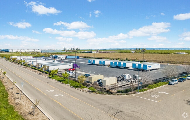
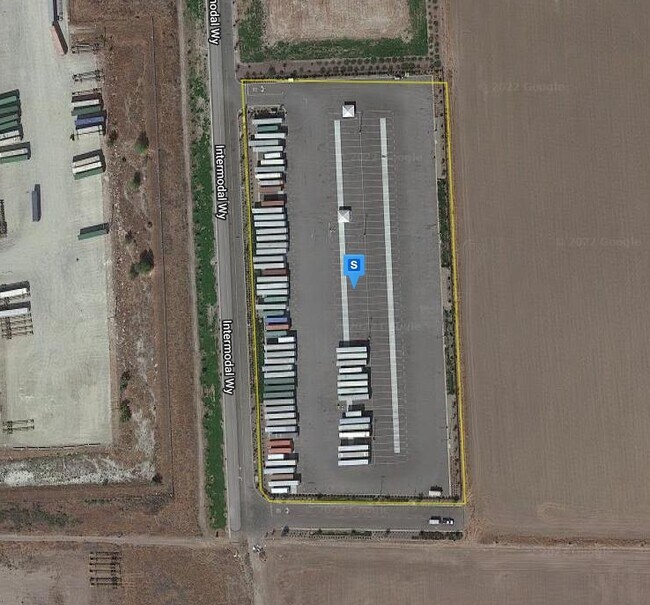
2880 Intermodal Way, Manteca, CA 95336


Property Detail
2880 Intermodal Way
198-200-22
SAN JOAQUIN
Parkinglot
California
C and X Area of minimal flood hazard, usually depicted on FIRMs as above the 500-year flood level.
6.04 AC
2025
Tracy/Manteca
2025
Stockton/Modesto
005141
Stockton-Lodi, CA
NEARBY LISTINGS FOR SALE OR LEASE
-
-
View all Manteca listings for sale on LoopNet.com
DEMOGRAPHICS near 2880 Intermodal Way
1 mile
3 mile
5 mile
2025 Total Population
1,765
52,511
129,803
2030 Population
1,843
54,979
137,207
Pop Growth 2025-2030
+ 4.42%
+ 4.70%
+ 5.70%
Average Age
64
40
38
2025 Total Households
901
16,603
39,132
HH Growth 2025-2030
+ 4.55%
+ 4.75%
+ 5.82%
Median Household Inc
$85,658
$95,302
$97,034
Avg Household Size
1.90
3.10
3.20
2025 Avg HH Vehicles
2.00
2.00
2.00
Median Home Value
$719,738
$636,437
$648,679
Median Year Built
2010
1991
1995
Nearby Places
Map Layers
Map Styles
 Street
 Aerial
Layers
 Traffic
 Biking
Places
Listings with unknown addresses are not visible on the map
- Restaurants
- Banks
- Shops
- Fitness
- Groceries
PUBLIC TRANSPORTATION
COMMUTER RAIL
Lathrop Station (ACE Train - Altamont Corridor Express)
Drive
Walk
Distance
Lathrop Station (ACE Train - Altamont Corridor Express)
12 min
4.9 mi
Stockton (San Joaquins - Amtrak)
Drive
Walk
Distance
Stockton (San Joaquins - Amtrak)
18 min
9.8 mi
AIRPORT
Stockton Metro
Drive
Walk
Distance
Stockton Metro
11 min
4.5 mi
Freight Ports
Port of Stockton
Drive
Walk
Distance
Port of Stockton
20 min
11.7 mi
Nearby Properties
Address
Land Use
TOTAL SIZE
Lot Size
Zoning
Address
Land Use
TOTAL SIZE
Lot Size
Zoning
730,300 SF
41.44 AC
Address
Land Use
TOTAL SIZE
Lot Size
Zoning
832,994 SF
106.05 AC
Address
Land Use
TOTAL SIZE
Lot Size
Zoning
870,294 SF
48.64 AC
Address
Land Use
TOTAL SIZE
Lot Size
Zoning
622,959 SF
31.75 AC
IW
Address
Land Use
TOTAL SIZE
Lot Size
Zoning
600 SF
19.12 AC
Address
Land Use
TOTAL SIZE
Lot Size
Zoning
649,693 SF
35.59 AC
Address
Land Use
TOTAL SIZE
Lot Size
Zoning
81.08 AC
Address
Land Use
TOTAL SIZE
Lot Size
Zoning
746,790 SF
39.23 AC
M2
Address
Land Use
TOTAL SIZE
Lot Size
Zoning
830,175 SF
46.57 AC
IG
Address
Land Use
TOTAL SIZE
Lot Size
Zoning
Address
Land Use
TOTAL SIZE
Lot Size
Zoning
745,640 SF
41.63 AC
Address
Land Use
TOTAL SIZE
Lot Size
Zoning
565,580 SF
56.99 AC
Address
Land Use
TOTAL SIZE
Lot Size
Zoning
16.02 AC
Address
Land Use
TOTAL SIZE
Lot Size
Zoning
346,860 SF
18.70 AC
Address
Land Use
TOTAL SIZE
Lot Size
Zoning
374,976 SF
15.18 AC
Address
Land Use
TOTAL SIZE
Lot Size
Zoning
343,732 SF
13.90 AC
Address
Land Use
TOTAL SIZE
Lot Size
Zoning
436,800 SF
21.71 AC
Address
Land Use
TOTAL SIZE
Lot Size
Zoning
19,912 SF
6.49 AC
C1
Address
Land Use
TOTAL SIZE
Lot Size
Zoning
82,329 SF
5.96 AC
Address
Land Use
TOTAL SIZE
Lot Size
Zoning
404,657 SF
24.89 AC
AG40
Address
Land Use
TOTAL SIZE
Lot Size
Zoning
101,695 SF
23.07 AC
Address
Land Use
TOTAL SIZE
Lot Size
Zoning
406,580 SF
18.65 AC
Address
Land Use
TOTAL SIZE
Lot Size
Zoning
15,476 SF
7.83 AC
CO
Address
Land Use
TOTAL SIZE
Lot Size
Zoning
231,840 SF
11.78 AC
Address
Land Use
TOTAL SIZE
Lot Size
Zoning
161,474 SF
10.03 AC
Address
Land Use
TOTAL SIZE
Lot Size
Zoning
110,000 SF
15.10 AC
Address
Land Use
TOTAL SIZE
Lot Size
Zoning
322,560 SF
12.85 AC
Address
Land Use
TOTAL SIZE
Lot Size
Zoning
4,800 SF
32.64 AC
Address
Land Use
TOTAL SIZE
Lot Size
Zoning
Address
Land Use
TOTAL SIZE
Lot Size
Zoning
6,000 SF
3.96 AC
The World's #1 Commercial Real Estate Marketplace
Connect with us
© 2026 CoStar Group
The information above has been obtained from sources believed reliable. While we do not doubt its accuracy we have not verified it and make no guarantee, warranty or representation about it. It is your responsibility to independently confirm its accuracy and completeness. Any projections, opinions, assumptions, or estimates used are for example only and do not represent the current or future performance of the property. The value of this transaction to you depends on tax and other factors which should be evaluated by your tax, financial, and legal advisors. You and your advisors should conduct a careful, independent investigation of the property to determine to your satisfaction the suitability of the property for your needs.