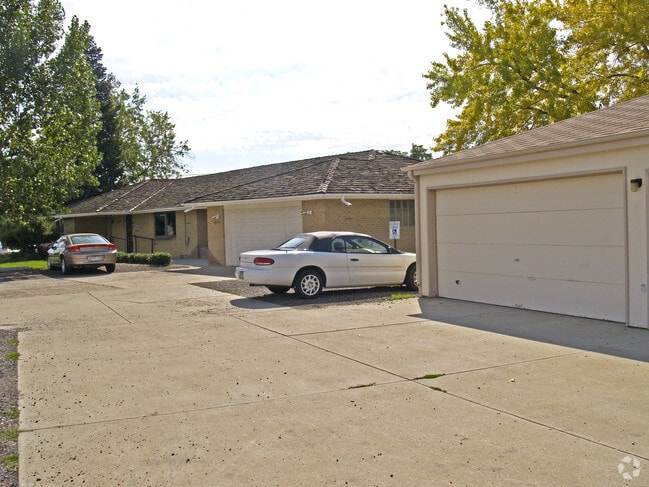
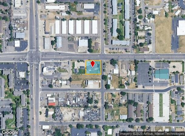
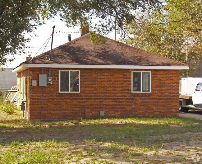
Property Record
2880 W 92Nd Ave, Denver, CO 80260
NEARBY LISTINGS FOR SALE OR LEASE
Property Detail
2880 W 92Nd Ave
Denver-Aurora-Centennial, CO
North Federal Heights
1719-20-4-01-006
SUB:NORTH FEDERAL HEIGHTS DESC: PARC NO 1 BEG 22 FT W OF NE COR TRACT 17 TH S 131/45 FT M/L TO S LN SD TRACT TH W 150 FT TH N 130/06 FT M/L TO N LN SD TRACT TH E 150 FT TO POB TRACT 17
Officebuilding
Adams
X
Colorado
08059C0207F
17
2024
0.45 AC
2025
North Denver
009319
Denver
2,935 SF
DEMOGRAPHICS near 2880 W 92Nd Ave
1 Mile
3 Mile
5 Mile
2024 Total Population
23,088
159,292
343,428
2029 Population
24,022
164,230
353,147
Pop Growth 2024-2029
+ 4.05%
+ 3.10%
+ 2.83%
Average Age
37
38
38
2024 Total Households
8,106
58,689
129,063
HH Growth 2024-2029
+ 4.07%
+ 3.15%
+ 2.82%
Median Household Inc
$57,389
$69,495
$76,485
Avg Household Size
2.80
2.60
2.60
2024 Avg HH Vehicles
2.00
2.00
2.00
Median Home Value
$180,153
$388,497
$413,483
Median Year Built
1981
1978
1981
Nearby Places
Map Layers
Map Styles
 Street
 Aerial
- Restaurants
- Banks
- Shops
- Fitness
- Groceries
PUBLIC TRANSPORTATION
COMMUTER RAIL
Westminster Station S-Bound (Union Station to Westminster Station - Regional Transportation District)
DRIVE
WALK
Distance
Westminster Station S-Bound (Union Station to Westminster Station - Regional Transportation District)
6 min
3.2 mi
Westminster Station N-Bound (Union Station to Westminster Station - Regional Transportation District)
DRIVE
WALK
Distance
Westminster Station N-Bound (Union Station to Westminster Station - Regional Transportation District)
8 min
3.6 mi
AIRPORT
Denver International
DRIVE
WALK
Distance
Denver International
37 min
27.8 mi
Freight Ports
Tulsa Port Of Catoosa
DRIVE
WALK
Distance
Tulsa Port Of Catoosa
734 min
713.3 mi
Nearby Properties
Address
Land Use
TOTAL SIZE
Lot Size
Zoning
Address
Land Use
TOTAL SIZE
Lot Size
Zoning
21,306 SF
2.43 AC
Address
Land Use
TOTAL SIZE
Lot Size
Zoning
271,631 SF
12.84 AC
Address
Land Use
TOTAL SIZE
Lot Size
Zoning
216,285 SF
6 AC
Address
Land Use
TOTAL SIZE
Lot Size
Zoning
208,500 SF
8.42 AC
Address
Land Use
TOTAL SIZE
Lot Size
Zoning
140,430 SF
8.39 AC
Address
Land Use
TOTAL SIZE
Lot Size
Zoning
138,912 SF
8.71 AC
Address
Land Use
TOTAL SIZE
Lot Size
Zoning
261,540 SF
19.23 AC
Address
Land Use
TOTAL SIZE
Lot Size
Zoning
170,210 SF
9 AC
Address
Land Use
TOTAL SIZE
Lot Size
Zoning
113,385 SF
6.77 AC
Address
Land Use
TOTAL SIZE
Lot Size
Zoning
398,180 SF
33.31 AC
R1C
Address
Land Use
TOTAL SIZE
Lot Size
Zoning
58,750 SF
1.52 AC
Address
Land Use
TOTAL SIZE
Lot Size
Zoning
86,816 SF
4.95 AC
Address
Land Use
TOTAL SIZE
Lot Size
Zoning
79,636 SF
4.91 AC
Address
Land Use
TOTAL SIZE
Lot Size
Zoning
305,110 SF
16.87 AC
Address
Land Use
TOTAL SIZE
Lot Size
Zoning
110,878 SF
4.65 AC
Address
Land Use
TOTAL SIZE
Lot Size
Zoning
105,600 SF
1.31 AC
Address
Land Use
TOTAL SIZE
Lot Size
Zoning
406,811 SF
50.96 AC
Address
Land Use
TOTAL SIZE
Lot Size
Zoning
65,336 SF
2.86 AC
Address
Land Use
TOTAL SIZE
Lot Size
Zoning
64,106 SF
4.10 AC
Address
Land Use
TOTAL SIZE
Lot Size
Zoning
74,432 SF
4.47 AC
Address
Land Use
TOTAL SIZE
Lot Size
Zoning
1,440 SF
41.30 AC
Address
Land Use
TOTAL SIZE
Lot Size
Zoning
309,126 SF
5.75 AC
Address
Land Use
TOTAL SIZE
Lot Size
Zoning
69,537 SF
4.49 AC
Address
Land Use
TOTAL SIZE
Lot Size
Zoning
141,124 SF
22.35 AC
Address
Land Use
TOTAL SIZE
Lot Size
Zoning
10,883 SF
4.54 AC
Address
Land Use
TOTAL SIZE
Lot Size
Zoning
51,312 SF
2.17 AC
PUD
Address
Land Use
TOTAL SIZE
Lot Size
Zoning
53,602 SF
2.37 AC
Address
Land Use
TOTAL SIZE
Lot Size
Zoning
674,481 SF
21.06 AC
Address
Land Use
TOTAL SIZE
Lot Size
Zoning
616,346 SF
30.04 AC
Address
Land Use
TOTAL SIZE
Lot Size
Zoning
317,619 SF
32.28 AC
The World's #1 Commercial Real Estate Marketplace
Connect with us
© 2026 CoStar Group
The information above has been obtained from sources believed reliable. While we do not doubt its accuracy we have not verified it and make no guarantee, warranty or representation about it. It is your responsibility to independently confirm its accuracy and completeness. Any projections, opinions, assumptions, or estimates used are for example only and do not represent the current or future performance of the property. The value of this transaction to you depends on tax and other factors which should be evaluated by your tax, financial, and legal advisors. You and your advisors should conduct a careful, independent investigation of the property to determine to your satisfaction the suitability of the property for your needs.