Property Record
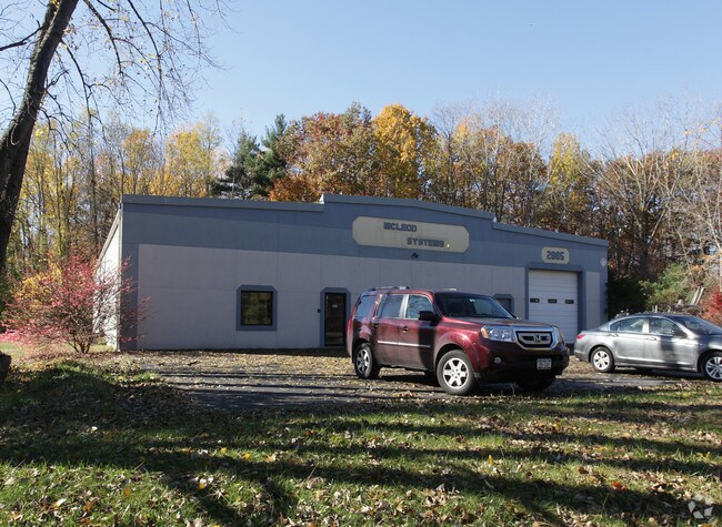
2885 Curry Rd, Schenectady, NY 12303


NEARBY LISTINGS FOR SALE OR LEASE
Property Detail
2885 Curry Rd
012689-016-003-0001-018-000-0000
LOT N-CURRY RD E-2899 S-51-79
Warehouse
Albany
X
New York
36001C0156D
18.000
2025
1.40 AC
2024
W Outer Albany County
013804
Albany/Schenectady/Troy
8,000 SF
Albany-Schenectady-Troy, NY
DEMOGRAPHICS near 2885 Curry Rd
1 Mile
3 Mile
5 Mile
2024 Total Population
1,162
41,851
143,417
2029 Population
1,147
42,710
147,861
Pop Growth 2024-2029
(1.29%)
+ 2.05%
+ 3.10%
Average Age
43
43
41
2024 Total Households
454
17,431
58,288
HH Growth 2024-2029
(1.32%)
+ 2.23%
+ 3.23%
Median Household Inc
$125,362
$87,281
$78,080
Avg Household Size
2.50
2.30
2.40
2024 Avg HH Vehicles
2.00
2.00
2.00
Median Home Value
$310,965
$234,860
$219,948
Median Year Built
1978
1968
1958
Nearby Places
- Restaurants
- Banks
- Shops
- Fitness
- Groceries
PUBLIC TRANSPORTATION
COMMUTER RAIL
Schenectady (Adirondack - VIA Rail, Empire Service - VIA Rail, Ethan Allen Express - VIA Rail, Lake Shore Limited - VIA Rail, Maple Leaf - VIA Rail, Toronto - New York - VIA Rail)
DRIVE
WALK
Distance
Schenectady (Adirondack - VIA Rail, Empire Service - VIA Rail, Ethan Allen Express - VIA Rail, Lake Shore Limited - VIA Rail, Maple Leaf - VIA Rail, Toronto - New York - VIA Rail)
12 min
6.6 mi
AIRPORT
Albany International
DRIVE
WALK
Distance
Albany International
20 min
8.9 mi
Freight Ports
Albany, NY Port
DRIVE
WALK
Distance
Albany, NY Port
28 min
17.7 mi
Nearby Properties
Address
Land Use
TOTAL SIZE
Lot Size
Zoning
Address
Land Use
TOTAL SIZE
Lot Size
Zoning
11,700 SF
43.80 AC
R2
Address
Land Use
TOTAL SIZE
Lot Size
Zoning
102,862 SF
32.45 AC
CS
Address
Land Use
TOTAL SIZE
Lot Size
Zoning
120,755 SF
33.88 AC
R1
Address
Land Use
TOTAL SIZE
Lot Size
Zoning
382,858 SF
70.33 AC
R-1
Address
Land Use
TOTAL SIZE
Lot Size
Zoning
98.20 AC
LC
Address
Land Use
TOTAL SIZE
Lot Size
Zoning
9,000 SF
10.32 AC
GB
Address
Land Use
TOTAL SIZE
Lot Size
Zoning
103.30 AC
LC
Address
Land Use
TOTAL SIZE
Lot Size
Zoning
4,680 SF
11.39 AC
CH
Address
Land Use
TOTAL SIZE
Lot Size
Zoning
19,968 SF
12 AC
MR
Address
Land Use
TOTAL SIZE
Lot Size
Zoning
78,326 SF
27.47 AC
R40
Address
Land Use
TOTAL SIZE
Lot Size
Zoning
45 AC
LC
Address
Land Use
TOTAL SIZE
Lot Size
Zoning
Address
Land Use
TOTAL SIZE
Lot Size
Zoning
86,049 SF
17.10 AC
RO30
Address
Land Use
TOTAL SIZE
Lot Size
Zoning
45,896 SF
10.20 AC
03 - MULTI
Address
Land Use
TOTAL SIZE
Lot Size
Zoning
79,041 SF
13.20 AC
CN
Address
Land Use
TOTAL SIZE
Lot Size
Zoning
120,373 SF
9.68 AC
CS
Address
Land Use
TOTAL SIZE
Lot Size
Zoning
20,630 SF
12.99 AC
MR*
Address
Land Use
TOTAL SIZE
Lot Size
Zoning
97,440 SF
8.15 AC
B-2
Address
Land Use
TOTAL SIZE
Lot Size
Zoning
99,620 SF
15 AC
45
Address
Land Use
TOTAL SIZE
Lot Size
Zoning
111,915 SF
15.04 AC
05 - COMME
Address
Land Use
TOTAL SIZE
Lot Size
Zoning
117 AC
06 - INDUS
Address
Land Use
TOTAL SIZE
Lot Size
Zoning
68,080 SF
6.22 AC
CS
Address
Land Use
TOTAL SIZE
Lot Size
Zoning
30.20 AC
LC
Address
Land Use
TOTAL SIZE
Lot Size
Zoning
68,000 SF
11.20 AC
TH
Address
Land Use
TOTAL SIZE
Lot Size
Zoning
6,889 SF
284.30 AC
F
Address
Land Use
TOTAL SIZE
Lot Size
Zoning
134,624 SF
26.23 AC
CON
Address
Land Use
TOTAL SIZE
Lot Size
Zoning
102,028 SF
11.65 AC
CS
Address
Land Use
TOTAL SIZE
Lot Size
Zoning
32,830 SF
17.85 AC
12
Address
Land Use
TOTAL SIZE
Lot Size
Zoning
47,951 SF
8.10 AC
GB
Address
Land Use
TOTAL SIZE
Lot Size
Zoning
92,244 SF
21.51 AC
04 - FARM
The World's #1 Commercial Real Estate Marketplace
Connect with us
© 2025 CoStar Group
The information above has been obtained from sources believed reliable. While we do not doubt its accuracy we have not verified it and make no guarantee, warranty or representation about it. It is your responsibility to independently confirm its accuracy and completeness. Any projections, opinions, assumptions, or estimates used are for example only and do not represent the current or future performance of the property. The value of this transaction to you depends on tax and other factors which should be evaluated by your tax, financial, and legal advisors. You and your advisors should conduct a careful, independent investigation of the property to determine to your satisfaction the suitability of the property for your needs.