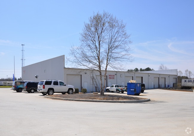
Property Record
2887 Highway 78, Loganville, GA 30052


NEARBY LISTINGS FOR SALE OR LEASE
-
-
View all Loganville listings for sale on LoopNet.com
Property Detail
2887 Highway 78
C044000000035000
09094-Hwy 78 Major
Storesoffices
7.06AC
X
Walton
13297C0105E
Georgia
2024
7.06 AC
2025
North Walton County
110504
Atlanta
16,450 SF
Atlanta-Sandy Springs-Roswell, GA
DEMOGRAPHICS near 2887 Highway 78
1 Mile
3 Mile
5 Mile
2024 Total Population
1,093
21,342
57,270
2029 Population
1,252
24,443
64,197
Pop Growth 2024-2029
+ 14.55%
+ 14.53%
+ 12.10%
Average Age
40
40
39
2024 Total Households
358
7,147
18,701
HH Growth 2024-2029
+ 15.08%
+ 14.83%
+ 12.52%
Median Household Inc
$80,500
$82,925
$86,001
Avg Household Size
3.00
2.90
3.00
2024 Avg HH Vehicles
2.00
2.00
2.00
Median Home Value
$279,770
$269,788
$289,718
Median Year Built
1999
1997
2000
Nearby Places
Map Layers
Map Styles
 Street
 Aerial
- Restaurants
- Banks
- Shops
- Fitness
- Groceries
PUBLIC TRANSPORTATION
AIRPORT
Hartsfield - Jackson Atlanta International
DRIVE
WALK
Distance
Hartsfield - Jackson Atlanta International
66 min
43.4 mi
Nearby Properties
Address
Land Use
TOTAL SIZE
Lot Size
Zoning
Address
Land Use
TOTAL SIZE
Lot Size
Zoning
3,480 SF
57.72 AC
RM8
Address
Land Use
TOTAL SIZE
Lot Size
Zoning
197,044 SF
95.31 AC
A1
Address
Land Use
TOTAL SIZE
Lot Size
Zoning
3,261 SF
30 AC
RM8
Address
Land Use
TOTAL SIZE
Lot Size
Zoning
111,277 SF
17.36 AC
CH
Address
Land Use
TOTAL SIZE
Lot Size
Zoning
154,281 SF
45.25 AC
R44
Address
Land Use
TOTAL SIZE
Lot Size
Zoning
118,235 SF
31.54 AC
CH
Address
Land Use
TOTAL SIZE
Lot Size
Zoning
34,128 SF
61.26 AC
A1 B2 M1
Address
Land Use
TOTAL SIZE
Lot Size
Zoning
62,352 SF
22.67 AC
CH
Address
Land Use
TOTAL SIZE
Lot Size
Zoning
29,084 SF
19.19 AC
CH
Address
Land Use
TOTAL SIZE
Lot Size
Zoning
49,022 SF
23.15 AC
R22
Address
Land Use
TOTAL SIZE
Lot Size
Zoning
33,685 SF
17.71 AC
CH
Address
Land Use
TOTAL SIZE
Lot Size
Zoning
28,284 SF
6.45 AC
CN
Address
Land Use
TOTAL SIZE
Lot Size
Zoning
3,218 SF
12.46 AC
RM8
Address
Land Use
TOTAL SIZE
Lot Size
Zoning
21.78 AC
CH
Address
Land Use
TOTAL SIZE
Lot Size
Zoning
2,560 SF
37.15 AC
MHP
Address
Land Use
TOTAL SIZE
Lot Size
Zoning
2,100 SF
25 AC
R44
Address
Land Use
TOTAL SIZE
Lot Size
Zoning
52,004 SF
5.89 AC
CH
Address
Land Use
TOTAL SIZE
Lot Size
Zoning
17.82 AC
OI
Address
Land Use
TOTAL SIZE
Lot Size
Zoning
69,363 SF
10.65 AC
R44
Address
Land Use
TOTAL SIZE
Lot Size
Zoning
4,000 SF
2.36 AC
CH
Address
Land Use
TOTAL SIZE
Lot Size
Zoning
18,697 SF
8.68 AC
CH
Address
Land Use
TOTAL SIZE
Lot Size
Zoning
57,164 SF
9.37 AC
CH
Address
Land Use
TOTAL SIZE
Lot Size
Zoning
15,015 SF
8.80 AC
CH
Address
Land Use
TOTAL SIZE
Lot Size
Zoning
9,030 SF
63.75 AC
R44
Address
Land Use
TOTAL SIZE
Lot Size
Zoning
6,000 SF
25 AC
R44
Address
Land Use
TOTAL SIZE
Lot Size
Zoning
6,322 SF
1.85 AC
CH
Address
Land Use
TOTAL SIZE
Lot Size
Zoning
25,039 SF
3.05 AC
OI
Address
Land Use
TOTAL SIZE
Lot Size
Zoning
20.13 AC
CH
Address
Land Use
TOTAL SIZE
Lot Size
Zoning
2,894 SF
5.14 AC
RM8
Address
Land Use
TOTAL SIZE
Lot Size
Zoning
14,490 SF
2.23 AC
CH
The World's #1 Commercial Real Estate Marketplace
Connect with us
© 2025 CoStar Group
The information above has been obtained from sources believed reliable. While we do not doubt its accuracy we have not verified it and make no guarantee, warranty or representation about it. It is your responsibility to independently confirm its accuracy and completeness. Any projections, opinions, assumptions, or estimates used are for example only and do not represent the current or future performance of the property. The value of this transaction to you depends on tax and other factors which should be evaluated by your tax, financial, and legal advisors. You and your advisors should conduct a careful, independent investigation of the property to determine to your satisfaction the suitability of the property for your needs.