Property Record
2888 Hamilton Rd, Lagrange, GA 30241
NEARBY LISTINGS FOR SALE OR LEASE
Property Detail
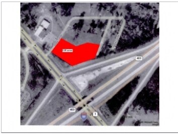
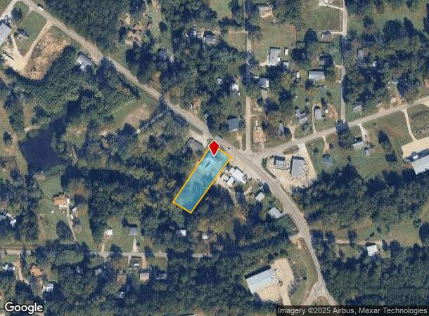
2888 Hamilton Rd
LaGrange, GA-AL
Pat Cohen
052-1-000-106
2888 HAMILTON RD/PT LOT 6 PAT COHEN SD
Commercialnec
Troup
X
Georgia
13285C0255E
6
2024
0.70 AC
2025
Troup County
960700
Columbus GA
DEMOGRAPHICS near 2888 Hamilton Rd
1 mile
3 mile
5 mile
2024 Total Population
1,009
4,992
23,294
2029 Population
1,018
5,099
24,041
Pop Growth 2024-2029
+ 0.89%
+ 2.14%
+ 3.21%
Average Age
39
39
38
2024 Total Households
297
1,652
8,599
HH Growth 2024-2029
+ 1.35%
+ 2.42%
+ 3.36%
Median Household Inc
$44,374
$48,789
$44,926
Avg Household Size
2.80
2.70
2.60
2024 Avg HH Vehicles
2.00
2.00
2.00
Median Home Value
$109,756
$154,248
$135,753
Median Year Built
1979
1981
1977
Nearby Places
Map Layers
Map Styles
 Street
 Aerial
Transit
 Traffic
 Biking
Places
Listings with unknown addresses are not visible on the map
- Restaurants
- Banks
- Shops
- Fitness
- Groceries
PUBLIC TRANSPORTATION
AIRPORT
Columbus
Drive
Walk
Distance
Columbus
44 min
37.7 mi
Nearby Properties
Address
Land Use
TOTAL SIZE
Lot Size
Zoning
Address
Land Use
TOTAL SIZE
Lot Size
Zoning
375,609 SF
44.39 AC
16- AC-MX
Address
Land Use
TOTAL SIZE
Lot Size
Zoning
28,575 SF
45.67 AC
16- CR-MX
Address
Land Use
TOTAL SIZE
Lot Size
Zoning
20,096 SF
36.59 AC
16- AC-MX
Address
Land Use
TOTAL SIZE
Lot Size
Zoning
1,652 SF
43.40 AC
16- CP-GI
Address
Land Use
TOTAL SIZE
Lot Size
Zoning
211,264 SF
57.40 AC
16- AC-MX
Address
Land Use
TOTAL SIZE
Lot Size
Zoning
275,130 SF
66.99 AC
16- CP-GI
Address
Land Use
TOTAL SIZE
Lot Size
Zoning
92,907 SF
41.61 AC
16- CP-GI
Address
Land Use
TOTAL SIZE
Lot Size
Zoning
484,700 SF
54.09 AC
16- CP-GI
Address
Land Use
TOTAL SIZE
Lot Size
Zoning
29,978 SF
1 AC
16- AC-MX
Address
Land Use
TOTAL SIZE
Lot Size
Zoning
192,428 SF
10.80 AC
16- CP-GI
Address
Land Use
TOTAL SIZE
Lot Size
Zoning
3,009 SF
21.15 AC
01-AGR
Address
Land Use
TOTAL SIZE
Lot Size
Zoning
24,412 SF
147.20 AC
16- CP-GI
Address
Land Use
TOTAL SIZE
Lot Size
Zoning
1,152 SF
42 AC
16 -CR-MX
Address
Land Use
TOTAL SIZE
Lot Size
Zoning
2,334 SF
62.01 AC
16- AC-MX
Address
Land Use
TOTAL SIZE
Lot Size
Zoning
53,940 SF
1.70 AC
16- AC-MX
Address
Land Use
TOTAL SIZE
Lot Size
Zoning
11,000 SF
49.57 AC
01-SFMD
Address
Land Use
TOTAL SIZE
Lot Size
Zoning
308.73 AC
16- CP-GI
Address
Land Use
TOTAL SIZE
Lot Size
Zoning
113.43 AC
16- CP-GI
Address
Land Use
TOTAL SIZE
Lot Size
Zoning
4,945 SF
1.42 AC
16- AC-MX
Address
Land Use
TOTAL SIZE
Lot Size
Zoning
52,870 SF
4.75 AC
16- CP-GI
Address
Land Use
TOTAL SIZE
Lot Size
Zoning
40,625 SF
20.40 AC
01-GC
Address
Land Use
TOTAL SIZE
Lot Size
Zoning
5,000 SF
1.80 AC
16- CR-MX
Address
Land Use
TOTAL SIZE
Lot Size
Zoning
42.65 AC
16- CP-GI
Address
Land Use
TOTAL SIZE
Lot Size
Zoning
9,856 SF
90 AC
16- CR-MX
Address
Land Use
TOTAL SIZE
Lot Size
Zoning
43,604 SF
9.88 AC
16- CP-GI
Address
Land Use
TOTAL SIZE
Lot Size
Zoning
17,538 SF
44.08 AC
01-GC
Address
Land Use
TOTAL SIZE
Lot Size
Zoning
72.65 AC
16- CP-GI
Address
Land Use
TOTAL SIZE
Lot Size
Zoning
40,362 SF
2.62 AC
16- AC-MX
Address
Land Use
TOTAL SIZE
Lot Size
Zoning
39,745 SF
11.33 AC
01-AGR
Address
Land Use
TOTAL SIZE
Lot Size
Zoning
109,040 SF
30.08 AC
16- CP-GI
The World's #1 Commercial Real Estate Marketplace
Connect with us
© 2026 CoStar Group
The information above has been obtained from sources believed reliable. While we do not doubt its accuracy we have not verified it and make no guarantee, warranty or representation about it. It is your responsibility to independently confirm its accuracy and completeness. Any projections, opinions, assumptions, or estimates used are for example only and do not represent the current or future performance of the property. The value of this transaction to you depends on tax and other factors which should be evaluated by your tax, financial, and legal advisors. You and your advisors should conduct a careful, independent investigation of the property to determine to your satisfaction the suitability of the property for your needs.