Property Record
289 Beaverbrook Rd, Lincoln Park, NJ 07035


NEARBY LISTINGS FOR SALE OR LEASE
Property Detail
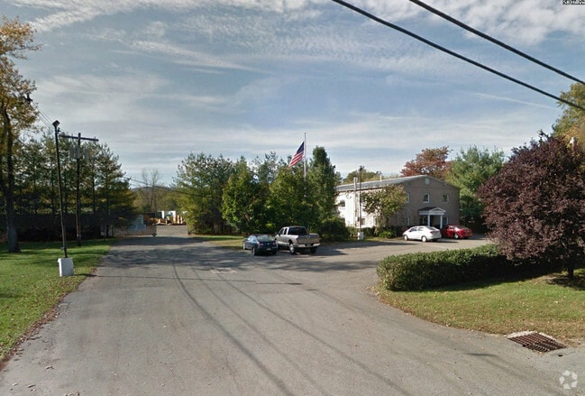
289 Beaverbrook Rd
Newark, NJ
ADDITIONAL LOTS: B3 L20-A
16-00003-0000-00020-1
Morris
Industrialgeneral
New Jersey
2024
1
2025
17.46 AC
040101
Eastern Morris
5,880 SF
Northern New Jersey
DEMOGRAPHICS near 289 Beaverbrook Rd
1 Mile
3 Mile
5 Mile
2024 Total Population
4,314
42,987
133,645
2029 Population
4,314
43,013
132,984
Pop Growth 2024-2029
0.00%
+ 0.06%
(0.49%)
Average Age
43
44
43
2024 Total Households
1,525
15,425
49,287
HH Growth 2024-2029
+ 0.07%
+ 0.01%
(0.64%)
Median Household Inc
$148,838
$129,180
$122,325
Avg Household Size
2.80
2.70
2.60
2024 Avg HH Vehicles
2.00
2.00
2.00
Median Home Value
$484,301
$496,674
$498,570
Median Year Built
1963
1966
1967
Nearby Places
Map Layers
Map Styles
 Street
 Aerial
- Restaurants
- Banks
- Shops
- Fitness
- Groceries
PUBLIC TRANSPORTATION
COMMUTER RAIL
Lincoln Park (Montclair-Boonton Line - NJ Transit Commuter Rail (NJ Transit))
DRIVE
WALK
Distance
Lincoln Park (Montclair-Boonton Line - NJ Transit Commuter Rail (NJ Transit))
4 min
1.9 mi
Towaco (Montclair-Boonton Line - NJ Transit Commuter Rail (NJ Transit))
DRIVE
WALK
Distance
Towaco (Montclair-Boonton Line - NJ Transit Commuter Rail (NJ Transit))
7 min
3.6 mi
AIRPORT
Newark Liberty International
DRIVE
WALK
Distance
Newark Liberty International
33 min
26.5 mi
LaGuardia
DRIVE
WALK
Distance
LaGuardia
50 min
34.5 mi
Freight Ports
Port Newark Container Terminal
DRIVE
WALK
Distance
Port Newark Container Terminal
39 min
25.8 mi
SALE & LEASE HISTORY
LISTING DATE
SALE/LEASE

Oct 10, 2016
For Lease
Nearby Properties
Address
Land Use
TOTAL SIZE
Lot Size
Zoning
Address
Land Use
TOTAL SIZE
Lot Size
Zoning
21.99 AC
H
Address
Land Use
TOTAL SIZE
Lot Size
Zoning
49,701 SF
29.34 AC
GAR
Address
Land Use
TOTAL SIZE
Lot Size
Zoning
18.76 AC
C-3
Address
Land Use
TOTAL SIZE
Lot Size
Zoning
32.21 AC
R-15
Address
Land Use
TOTAL SIZE
Lot Size
Zoning
192,206 SF
7.73 AC
R-20
Address
Land Use
TOTAL SIZE
Lot Size
Zoning
41.71 AC
C-4
Address
Land Use
TOTAL SIZE
Lot Size
Zoning
97,631 SF
10.01 AC
B-2
Address
Land Use
TOTAL SIZE
Lot Size
Zoning
9.08 AC
H-C
Address
Land Use
TOTAL SIZE
Lot Size
Zoning
9.28 AC
R-11
Address
Land Use
TOTAL SIZE
Lot Size
Zoning
10.07 AC
R-15
Address
Land Use
TOTAL SIZE
Lot Size
Zoning
143,500 SF
14.73 AC
I
Address
Land Use
TOTAL SIZE
Lot Size
Zoning
12.24 AC
H-C
Address
Land Use
TOTAL SIZE
Lot Size
Zoning
6.30 AC
I-2
Address
Land Use
TOTAL SIZE
Lot Size
Zoning
82,061 SF
12.39 AC
R-15
Address
Land Use
TOTAL SIZE
Lot Size
Zoning
634 SF
14.76 AC
H
Address
Land Use
TOTAL SIZE
Lot Size
Zoning
6.95 AC
I-2
Address
Land Use
TOTAL SIZE
Lot Size
Zoning
47,312 SF
12.34 AC
R-20
Address
Land Use
TOTAL SIZE
Lot Size
Zoning
101,685 SF
9.64 AC
I
Address
Land Use
TOTAL SIZE
Lot Size
Zoning
57,880 SF
9.25 AC
B-2
Address
Land Use
TOTAL SIZE
Lot Size
Zoning
34.77 AC
R-15
Address
Land Use
TOTAL SIZE
Lot Size
Zoning
5.89 AC
R-9
Address
Land Use
TOTAL SIZE
Lot Size
Zoning
10.97 AC
R-15
Address
Land Use
TOTAL SIZE
Lot Size
Zoning
6.34 AC
C-3
Address
Land Use
TOTAL SIZE
Lot Size
Zoning
7.54 AC
R-15
Address
Land Use
TOTAL SIZE
Lot Size
Zoning
8.98 AC
R-11
Address
Land Use
TOTAL SIZE
Lot Size
Zoning
69,765 SF
23.74 AC
R-20
Address
Land Use
TOTAL SIZE
Lot Size
Zoning
4,320 SF
11.59 AC
PRD
Address
Land Use
TOTAL SIZE
Lot Size
Zoning
2.44 AC
C-1
Address
Land Use
TOTAL SIZE
Lot Size
Zoning
11.51 AC
R
The World's #1 Commercial Real Estate Marketplace
Connect with us
© 2026 CoStar Group
The information above has been obtained from sources believed reliable. While we do not doubt its accuracy we have not verified it and make no guarantee, warranty or representation about it. It is your responsibility to independently confirm its accuracy and completeness. Any projections, opinions, assumptions, or estimates used are for example only and do not represent the current or future performance of the property. The value of this transaction to you depends on tax and other factors which should be evaluated by your tax, financial, and legal advisors. You and your advisors should conduct a careful, independent investigation of the property to determine to your satisfaction the suitability of the property for your needs.