No Photo
Property Record
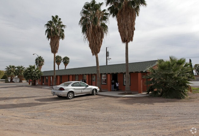
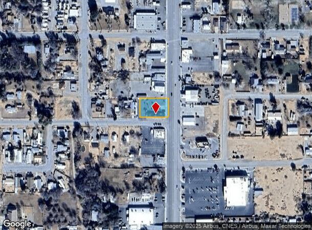
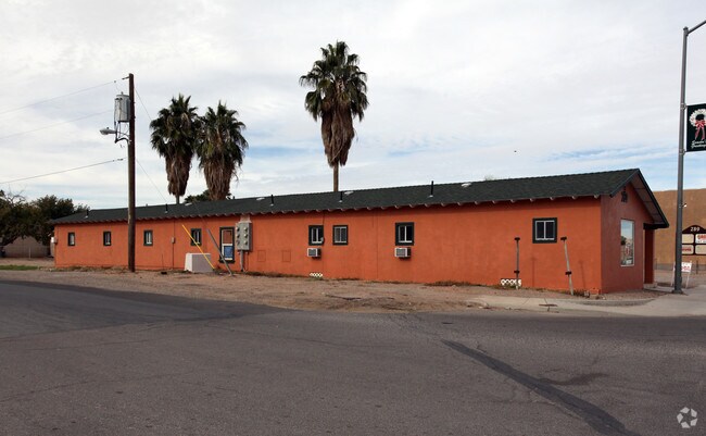
289 S Moapa Valley Blvd, Overton, NV 89040

NEARBY LISTINGS FOR SALE OR LEASE
-
-
View all Overton listings for sale on LoopNet.com
Property Detail
289 S Moapa Valley Blvd
Las Vegas-Henderson-Paradise, NV
Overton Town Survey Amd
070-13-710-068
OVERTON TOWN SURVEY AMD PLAT BOOK 3 PAGE 5 PT LOT 1 BLOCK 1 (PARCEL MAP 50-58 LOT 1)
Commercialnec
Clark
X
Nevada
32003C1115E
1
2025
0.47 AC
2025
Outlying NE Clark Cnty
005612
Las Vegas
1,802 SF
DEMOGRAPHICS near 289 S Moapa Valley Blvd
1 Mile
3 Mile
5 Mile
2024 Total Population
1,473
2,496
3,925
2029 Population
1,524
2,558
3,984
Pop Growth 2024-2029
+ 3.46%
+ 2.48%
+ 1.50%
Average Age
44
43
41
2024 Total Households
611
983
1,446
HH Growth 2024-2029
+ 3.44%
+ 2.64%
+ 1.73%
Median Household Inc
$53,721
$67,013
$70,460
Avg Household Size
2.40
2.50
2.70
2024 Avg HH Vehicles
2.00
2.00
2.00
Median Home Value
$214,151
$327,358
$387,022
Median Year Built
1984
1985
1988
Nearby Places
Map Layers
Map Styles
 Street
 Aerial
- Restaurants
- Banks
- Shops
- Fitness
- Groceries
Nearby Properties
Address
Land Use
TOTAL SIZE
Lot Size
Zoning
Address
Land Use
TOTAL SIZE
Lot Size
Zoning
17.62 AC
M1
Address
Land Use
TOTAL SIZE
Lot Size
Zoning
20.77 AC
PF
Address
Land Use
TOTAL SIZE
Lot Size
Zoning
29,437 SF
21.10 AC
M1
Address
Land Use
TOTAL SIZE
Lot Size
Zoning
9,835 SF
2.37 AC
PF
Address
Land Use
TOTAL SIZE
Lot Size
Zoning
25,836 SF
5.51 AC
C2
Address
Land Use
TOTAL SIZE
Lot Size
Zoning
23,164 SF
3.07 AC
C2
Address
Land Use
TOTAL SIZE
Lot Size
Zoning
792 SF
2.20 AC
R3
Address
Land Use
TOTAL SIZE
Lot Size
Zoning
16,401 SF
2.40 AC
R3
Address
Land Use
TOTAL SIZE
Lot Size
Zoning
15,992 SF
4.12 AC
RU
Address
Land Use
TOTAL SIZE
Lot Size
Zoning
7,248 SF
1.42 AC
C2
Address
Land Use
TOTAL SIZE
Lot Size
Zoning
8,369 SF
11.75 AC
C2
Address
Land Use
TOTAL SIZE
Lot Size
Zoning
6,512 SF
2.03 AC
CP
Address
Land Use
TOTAL SIZE
Lot Size
Zoning
13,471 SF
3.09 AC
M1
Address
Land Use
TOTAL SIZE
Lot Size
Zoning
8,000 SF
0.65 AC
C2
Address
Land Use
TOTAL SIZE
Lot Size
Zoning
17,344 SF
1.68 AC
R1
Address
Land Use
TOTAL SIZE
Lot Size
Zoning
9,912 SF
0.40 AC
R4
Address
Land Use
TOTAL SIZE
Lot Size
Zoning
20,358 SF
1.96 AC
M1
Address
Land Use
TOTAL SIZE
Lot Size
Zoning
30,000 SF
38.89 AC
PF
Address
Land Use
TOTAL SIZE
Lot Size
Zoning
17,625 SF
1.38 AC
C2
Address
Land Use
TOTAL SIZE
Lot Size
Zoning
70 AC
PF
Address
Land Use
TOTAL SIZE
Lot Size
Zoning
4,004 SF
2.04 AC
CP
Address
Land Use
TOTAL SIZE
Lot Size
Zoning
2,436 SF
0.81 AC
C2
Address
Land Use
TOTAL SIZE
Lot Size
Zoning
16,000 SF
7.96 AC
M1
Address
Land Use
TOTAL SIZE
Lot Size
Zoning
2,372 SF
0.74 AC
C2
Address
Land Use
TOTAL SIZE
Lot Size
Zoning
4,519 SF
0.99 AC
C2
Address
Land Use
TOTAL SIZE
Lot Size
Zoning
9,254 SF
0.88 AC
PF
Address
Land Use
TOTAL SIZE
Lot Size
Zoning
4,596 SF
1.99 AC
RU
Address
Land Use
TOTAL SIZE
Lot Size
Zoning
4,640 SF
1.84 AC
PF
Address
Land Use
TOTAL SIZE
Lot Size
Zoning
4,500 SF
0.18 AC
C2
Address
Land Use
TOTAL SIZE
Lot Size
Zoning
3,485 SF
0.75 AC
C2
The World's #1 Commercial Real Estate Marketplace
Connect with us
© 2025 CoStar Group
The information above has been obtained from sources believed reliable. While we do not doubt its accuracy we have not verified it and make no guarantee, warranty or representation about it. It is your responsibility to independently confirm its accuracy and completeness. Any projections, opinions, assumptions, or estimates used are for example only and do not represent the current or future performance of the property. The value of this transaction to you depends on tax and other factors which should be evaluated by your tax, financial, and legal advisors. You and your advisors should conduct a careful, independent investigation of the property to determine to your satisfaction the suitability of the property for your needs.