Property Record
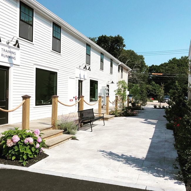
289 Saint George St, Duxbury, MA 02332


NEARBY LISTINGS FOR SALE OR LEASE
Property Detail
289 Saint George St
DUXB-000106-000742-000006
Plymouth
Commercialofficeresidentialmixeduse
Massachusetts
X
6
25023C0241L
2.33 AC
2025
Route 3 South
2025
Boston
507104
Boston-Cambridge-Newton, MA-NH
DEMOGRAPHICS near 289 Saint George St
1 Mile
3 Mile
5 Mile
2024 Total Population
1,821
16,565
43,588
2029 Population
1,842
16,566
43,844
Pop Growth 2024-2029
+ 1.15%
+ 0.01%
+ 0.59%
Average Age
42
43
44
2024 Total Households
632
6,053
16,826
HH Growth 2024-2029
+ 0.95%
(0.12%)
+ 0.59%
Median Household Inc
$149,184
$140,944
$119,411
Avg Household Size
2.90
2.70
2.60
2024 Avg HH Vehicles
2.00
2.00
2.00
Median Home Value
$798,630
$735,943
$614,738
Median Year Built
1970
1970
1970
Nearby Places
Map Layers
Map Styles
 Street
 Aerial
- Restaurants
- Banks
- Shops
- Fitness
- Groceries
PUBLIC TRANSPORTATION
COMMUTER RAIL
Kingston/Route 3 (Kingston/Plymouth Line - Massachusetts Bay Transportation Authority Commuter Rail (Purple Line))
DRIVE
WALK
Distance
Kingston/Route 3 (Kingston/Plymouth Line - Massachusetts Bay Transportation Authority Commuter Rail (Purple Line))
14 min
7.1 mi
Halifax (Kingston/Plymouth Line - Massachusetts Bay Transportation Authority Commuter Rail (Purple Line))
DRIVE
WALK
Distance
Halifax (Kingston/Plymouth Line - Massachusetts Bay Transportation Authority Commuter Rail (Purple Line))
18 min
9.9 mi
AIRPORT
General Edward Lawrence Logan International
DRIVE
WALK
Distance
General Edward Lawrence Logan International
50 min
35.0 mi
Freight Ports
Port of Boston
DRIVE
WALK
Distance
Port of Boston
47 min
32.8 mi
SALE & LEASE HISTORY
LISTING DATE
SALE/LEASE

Nov 20, 2018
For Lease
Nearby Properties
Address
Land Use
TOTAL SIZE
Lot Size
Zoning
Address
Land Use
TOTAL SIZE
Lot Size
Zoning
119,308 SF
63.51 AC
PD
Address
Land Use
TOTAL SIZE
Lot Size
Zoning
28.68 AC
OS
Address
Land Use
TOTAL SIZE
Lot Size
Zoning
7.40 AC
NB
Address
Land Use
TOTAL SIZE
Lot Size
Zoning
37.88 AC
RC
Address
Land Use
TOTAL SIZE
Lot Size
Zoning
8.71 AC
RC
Address
Land Use
TOTAL SIZE
Lot Size
Zoning
4.87 AC
NB
Address
Land Use
TOTAL SIZE
Lot Size
Zoning
46,674 SF
9.26 AC
Address
Land Use
TOTAL SIZE
Lot Size
Zoning
4.71 AC
RC
Address
Land Use
TOTAL SIZE
Lot Size
Zoning
18.91 AC
RC
Address
Land Use
TOTAL SIZE
Lot Size
Zoning
112,405 SF
6.67 AC
NB
Address
Land Use
TOTAL SIZE
Lot Size
Zoning
66,308 SF
21.10 AC
Address
Land Use
TOTAL SIZE
Lot Size
Zoning
2.41 AC
NB
Address
Land Use
TOTAL SIZE
Lot Size
Zoning
43,557 SF
3.96 AC
NB
Address
Land Use
TOTAL SIZE
Lot Size
Zoning
6,344 SF
332.81 AC
OS
Address
Land Use
TOTAL SIZE
Lot Size
Zoning
24,003 SF
5.38 AC
R-2
Address
Land Use
TOTAL SIZE
Lot Size
Zoning
9.07 AC
RC
Address
Land Use
TOTAL SIZE
Lot Size
Zoning
24,000 SF
2.55 AC
C
Address
Land Use
TOTAL SIZE
Lot Size
Zoning
50,893 SF
4.33 AC
NB
Address
Land Use
TOTAL SIZE
Lot Size
Zoning
1.01 AC
RC
Address
Land Use
TOTAL SIZE
Lot Size
Zoning
91.98 AC
O
Address
Land Use
TOTAL SIZE
Lot Size
Zoning
1.60 AC
RC
Address
Land Use
TOTAL SIZE
Lot Size
Zoning
12.23 AC
PD
Address
Land Use
TOTAL SIZE
Lot Size
Zoning
600 SF
12.64 AC
RC
Address
Land Use
TOTAL SIZE
Lot Size
Zoning
3.23 AC
RC
Address
Land Use
TOTAL SIZE
Lot Size
Zoning
24.85 AC
PD
Address
Land Use
TOTAL SIZE
Lot Size
Zoning
21,448 SF
2.11 AC
RC
Address
Land Use
TOTAL SIZE
Lot Size
Zoning
18,464 SF
3.50 AC
RC
Address
Land Use
TOTAL SIZE
Lot Size
Zoning
19,077 SF
96.50 AC
Address
Land Use
TOTAL SIZE
Lot Size
Zoning
5.70 AC
OS
The World's #1 Commercial Real Estate Marketplace
Connect with us
© 2026 CoStar Group
The information above has been obtained from sources believed reliable. While we do not doubt its accuracy we have not verified it and make no guarantee, warranty or representation about it. It is your responsibility to independently confirm its accuracy and completeness. Any projections, opinions, assumptions, or estimates used are for example only and do not represent the current or future performance of the property. The value of this transaction to you depends on tax and other factors which should be evaluated by your tax, financial, and legal advisors. You and your advisors should conduct a careful, independent investigation of the property to determine to your satisfaction the suitability of the property for your needs.