Property Record
28850 Us Highway 281 N, Bulverde, TX 78163

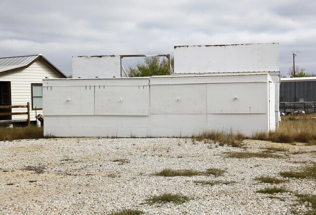
Property Detail
28850 Us Highway 281 N
14-0325-0001-00
A-174 SUR-194 A GAYTAN, ACRES 1.76
Commercialnec
COMAL
C and X Area of minimal flood hazard, usually depicted on FIRMs as above the 500-year flood level.
Texas
2024
1.76 AC
2025
Comal County
310703
San Antonio
5,081 SF
San Antonio-New Braunfels, TX
NEARBY LISTINGS FOR SALE OR LEASE
DEMOGRAPHICS near 28850 Us Highway 281 N
1 mile
3 mile
5 mile
2025 Total Population
1,864
22,199
75,917
2030 Population
2,205
24,532
82,767
Pop Growth 2025-2030
+ 18.29%
+ 10.51%
+ 9.02%
Average Age
39
39
38
2025 Total Households
631
7,391
25,590
HH Growth 2025-2030
+ 18.54%
+ 10.85%
+ 9.28%
Median Household Inc
$154,301
$139,012
$137,128
Avg Household Size
3.00
3.00
2.90
2025 Avg HH Vehicles
2.00
2.00
2.00
Median Home Value
$476,367
$461,607
$472,429
Median Year Built
2011
2010
2009
Nearby Places
Map Layers
Map Styles
 Street
 Aerial
Layers
 Traffic
 Biking
Places
Listings with unknown addresses are not visible on the map
- Restaurants
- Banks
- Shops
- Fitness
- Groceries
PUBLIC TRANSPORTATION
AIRPORT
San Antonio International
Drive
Walk
Distance
San Antonio International
19 min
15.4 mi
Freight Ports
Calhoun Port
Drive
Walk
Distance
Calhoun Port
196 min
164.2 mi
Nearby Properties
Address
Land Use
TOTAL SIZE
Lot Size
Zoning
Address
Land Use
TOTAL SIZE
Lot Size
Zoning
310,384 SF
14.25 AC
Address
Land Use
TOTAL SIZE
Lot Size
Zoning
137,704 SF
26.31 AC
Address
Land Use
TOTAL SIZE
Lot Size
Zoning
66,166 SF
85.74 AC
Address
Land Use
TOTAL SIZE
Lot Size
Zoning
28.60 AC
Address
Land Use
TOTAL SIZE
Lot Size
Zoning
20.13 AC
Address
Land Use
TOTAL SIZE
Lot Size
Zoning
74,320 SF
4.55 AC
Address
Land Use
TOTAL SIZE
Lot Size
Zoning
63,236 SF
15.29 AC
Address
Land Use
TOTAL SIZE
Lot Size
Zoning
76,120 SF
3.90 AC
Address
Land Use
TOTAL SIZE
Lot Size
Zoning
264.41 AC
Address
Land Use
TOTAL SIZE
Lot Size
Zoning
5,508 SF
3.50 AC
Address
Land Use
TOTAL SIZE
Lot Size
Zoning
183.24 AC
Address
Land Use
TOTAL SIZE
Lot Size
Zoning
19.32 AC
Address
Land Use
TOTAL SIZE
Lot Size
Zoning
5,400 SF
3.24 AC
Address
Land Use
TOTAL SIZE
Lot Size
Zoning
57,226 SF
6.95 AC
Address
Land Use
TOTAL SIZE
Lot Size
Zoning
134.81 AC
Address
Land Use
TOTAL SIZE
Lot Size
Zoning
71,743 SF
6.87 AC
Address
Land Use
TOTAL SIZE
Lot Size
Zoning
13,969 SF
10.03 AC
Address
Land Use
TOTAL SIZE
Lot Size
Zoning
6,590 SF
211.63 AC
Address
Land Use
TOTAL SIZE
Lot Size
Zoning
9,280 SF
3.93 AC
Address
Land Use
TOTAL SIZE
Lot Size
Zoning
2,021 SF
18.28 AC
Address
Land Use
TOTAL SIZE
Lot Size
Zoning
19,554 SF
3.19 AC
Address
Land Use
TOTAL SIZE
Lot Size
Zoning
1,070 SF
303.68 AC
Address
Land Use
TOTAL SIZE
Lot Size
Zoning
13,172 SF
1.98 AC
Address
Land Use
TOTAL SIZE
Lot Size
Zoning
13,552 SF
4.48 AC
Address
Land Use
TOTAL SIZE
Lot Size
Zoning
11.30 AC
Address
Land Use
TOTAL SIZE
Lot Size
Zoning
13,557 SF
2.31 AC
Address
Land Use
TOTAL SIZE
Lot Size
Zoning
4,180 SF
1.57 AC
Address
Land Use
TOTAL SIZE
Lot Size
Zoning
214.93 AC
Address
Land Use
TOTAL SIZE
Lot Size
Zoning
13,520 SF
1.58 AC
Address
Land Use
TOTAL SIZE
Lot Size
Zoning
12,248 SF
26.73 AC
The World's #1 Commercial Real Estate Marketplace
Connect with us
© 2026 CoStar Group
The information above has been obtained from sources believed reliable. While we do not doubt its accuracy we have not verified it and make no guarantee, warranty or representation about it. It is your responsibility to independently confirm its accuracy and completeness. Any projections, opinions, assumptions, or estimates used are for example only and do not represent the current or future performance of the property. The value of this transaction to you depends on tax and other factors which should be evaluated by your tax, financial, and legal advisors. You and your advisors should conduct a careful, independent investigation of the property to determine to your satisfaction the suitability of the property for your needs.