Property Record
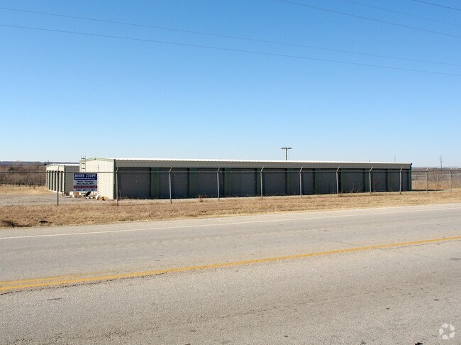
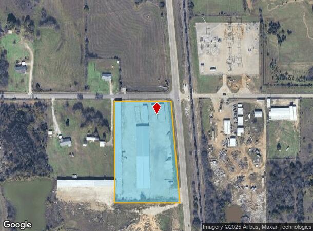
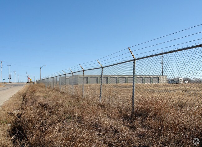
2897 Us Highway 77, Ardmore, OK 73401
NEARBY LISTINGS FOR SALE OR LEASE
-
-
View all Ardmore listings for sale on LoopNet.com
Property Detail
2897 Us Highway 77
0000-24-05S-01E-1-003-00
Unplatted
Publicstorage
E/2 NE NE NE-E/2 W/2 NE NE NE LESS 1.33 AC.FOR HWY AND RR ROW 24 05S 01E
X
Carter
40019C0600C
Oklahoma
2024
6.17 AC
2025
Oklahoma East Area
892700
Other Market Areas
3,000 SF
Ardmore, OK
DEMOGRAPHICS near 2897 Us Highway 77
1 Mile
3 Mile
5 Mile
2024 Total Population
259
2,644
20,357
2029 Population
265
2,695
20,970
Pop Growth 2024-2029
+ 2.32%
+ 1.93%
+ 3.01%
Average Age
40
40
40
2024 Total Households
96
977
7,968
HH Growth 2024-2029
+ 2.08%
+ 2.05%
+ 3.01%
Median Household Inc
$63,214
$65,862
$47,278
Avg Household Size
2.60
2.60
2.40
2024 Avg HH Vehicles
2.00
2.00
2.00
Median Home Value
$199,999
$198,935
$146,322
Median Year Built
1980
1979
1968
Nearby Places
Map Layers
Map Styles
 Street
 Aerial
- Restaurants
- Banks
- Shops
- Fitness
- Groceries
PUBLIC TRANSPORTATION
COMMUTER RAIL
Ardmore Amtrak Station (Heartland Flyer - Amtrak)
DRIVE
WALK
Distance
Ardmore Amtrak Station (Heartland Flyer - Amtrak)
9 min
5.2 mi
Freight Ports
Tulsa Port of Inola
DRIVE
WALK
Distance
Tulsa Port of Inola
243 min
209.3 mi
Nearby Properties
Address
Land Use
TOTAL SIZE
Lot Size
Zoning
Address
Land Use
TOTAL SIZE
Lot Size
Zoning
1,020 SF
34.64 AC
C1
Address
Land Use
TOTAL SIZE
Lot Size
Zoning
828 SF
12.24 AC
C1
Address
Land Use
TOTAL SIZE
Lot Size
Zoning
408 SF
78.62 AC
C1
Address
Land Use
TOTAL SIZE
Lot Size
Zoning
3,125 SF
10 AC
C1
Address
Land Use
TOTAL SIZE
Lot Size
Zoning
2,500 SF
10 AC
C1
Address
Land Use
TOTAL SIZE
Lot Size
Zoning
3,985 SF
10 AC
C1
Address
Land Use
TOTAL SIZE
Lot Size
Zoning
55,440 SF
10.01 AC
C1
Address
Land Use
TOTAL SIZE
Lot Size
Zoning
2,282 SF
5 AC
R1
Address
Land Use
TOTAL SIZE
Lot Size
Zoning
980 SF
23.12 AC
C1
Address
Land Use
TOTAL SIZE
Lot Size
Zoning
5,246 SF
1.10 AC
Address
Land Use
TOTAL SIZE
Lot Size
Zoning
5,571 SF
37.97 AC
C1
Address
Land Use
TOTAL SIZE
Lot Size
Zoning
9,301 SF
2.12 AC
Address
Land Use
TOTAL SIZE
Lot Size
Zoning
2,000 SF
9.47 AC
C1
Address
Land Use
TOTAL SIZE
Lot Size
Zoning
4,496 SF
1.25 AC
R1
Address
Land Use
TOTAL SIZE
Lot Size
Zoning
11,211 SF
24.66 AC
C1
Address
Land Use
TOTAL SIZE
Lot Size
Zoning
4,390 SF
2.33 AC
C1
Address
Land Use
TOTAL SIZE
Lot Size
Zoning
1,066 SF
3.33 AC
C1
Address
Land Use
TOTAL SIZE
Lot Size
Zoning
1,524 SF
14.73 AC
C1
Address
Land Use
TOTAL SIZE
Lot Size
Zoning
3,080 SF
5.17 AC
Address
Land Use
TOTAL SIZE
Lot Size
Zoning
640 SF
3.54 AC
C1
Address
Land Use
TOTAL SIZE
Lot Size
Zoning
10,816 SF
12.67 AC
Address
Land Use
TOTAL SIZE
Lot Size
Zoning
2,561 SF
2.75 AC
C1
Address
Land Use
TOTAL SIZE
Lot Size
Zoning
4,240 SF
2.90 AC
C1
Address
Land Use
TOTAL SIZE
Lot Size
Zoning
14,760 SF
1.15 AC
C1
Address
Land Use
TOTAL SIZE
Lot Size
Zoning
640 SF
2.91 AC
C1
Address
Land Use
TOTAL SIZE
Lot Size
Zoning
130 SF
7 AC
C1
Address
Land Use
TOTAL SIZE
Lot Size
Zoning
356 SF
4.98 AC
C1
Address
Land Use
TOTAL SIZE
Lot Size
Zoning
3,117 SF
1.02 AC
R1
Address
Land Use
TOTAL SIZE
Lot Size
Zoning
10,000 SF
2.47 AC
C1
Address
Land Use
TOTAL SIZE
Lot Size
Zoning
2,400 SF
6.19 AC
C1
The World's #1 Commercial Real Estate Marketplace
Connect with us
© 2026 CoStar Group
The information above has been obtained from sources believed reliable. While we do not doubt its accuracy we have not verified it and make no guarantee, warranty or representation about it. It is your responsibility to independently confirm its accuracy and completeness. Any projections, opinions, assumptions, or estimates used are for example only and do not represent the current or future performance of the property. The value of this transaction to you depends on tax and other factors which should be evaluated by your tax, financial, and legal advisors. You and your advisors should conduct a careful, independent investigation of the property to determine to your satisfaction the suitability of the property for your needs.