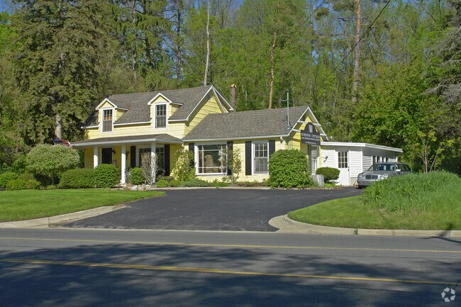
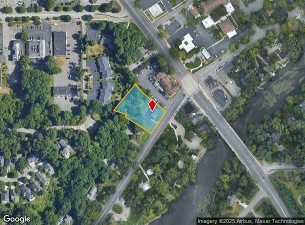
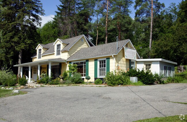
Property Record
2899 Thornapple River Dr Se, Grand Rapids, MI 49546
NEARBY LISTINGS FOR SALE OR LEASE
Property Detail
2899 Thornapple River Dr Se
Grand Rapids-Wyoming, MI
Cascade Township
41-19-16-201-029
411916201029 PART OF GOVT LOT 8 COM 505.0 FT S 0D 08M 36S W ALONG N&S 1/4 LINE & 142.62 FT S 71D 02M 43S E FROM N 1/4 COR TH
Commercialnec
Kent
X
Michigan
26081C0461D
8
2024
45,302 AC
2025
SE Grand Rapids/Cascade
012203
West Michigan
1,796 SF
DEMOGRAPHICS near 2899 Thornapple River Dr Se
1 Mile
3 Mile
5 Mile
2024 Total Population
5,777
21,894
61,209
2029 Population
5,815
22,159
61,922
Pop Growth 2024-2029
+ 0.66%
+ 1.21%
+ 1.16%
Average Age
42
41
40
2024 Total Households
2,192
7,957
23,024
HH Growth 2024-2029
+ 0.59%
+ 1.18%
+ 1.16%
Median Household Inc
$113,662
$122,389
$94,095
Avg Household Size
2.60
2.70
2.50
2024 Avg HH Vehicles
2.00
2.00
2.00
Median Home Value
$375,696
$392,114
$356,983
Median Year Built
1981
1984
1986
Nearby Places
Map Layers
Map Styles
 Street
 Aerial
- Restaurants
- Banks
- Shops
- Fitness
- Groceries
PUBLIC TRANSPORTATION
AIRPORT
Gerald R Ford International
DRIVE
WALK
Distance
Gerald R Ford International
15 min
7.4 mi
Nearby Properties
Address
Land Use
TOTAL SIZE
Lot Size
Zoning
Address
Land Use
TOTAL SIZE
Lot Size
Zoning
23.99 AC
PUD
Address
Land Use
TOTAL SIZE
Lot Size
Zoning
285,875 SF
37.86 AC
TI
Address
Land Use
TOTAL SIZE
Lot Size
Zoning
184,186 SF
19.24 AC
R4
Address
Land Use
TOTAL SIZE
Lot Size
Zoning
236,061 SF
11.09 AC
PUD
Address
Land Use
TOTAL SIZE
Lot Size
Zoning
529,904 SF
20.04 AC
I1
Address
Land Use
TOTAL SIZE
Lot Size
Zoning
362,686 SF
20.99 AC
TI
Address
Land Use
TOTAL SIZE
Lot Size
Zoning
117,572 SF
14.89 AC
B2
Address
Land Use
TOTAL SIZE
Lot Size
Zoning
317,875 SF
24.04 AC
I
Address
Land Use
TOTAL SIZE
Lot Size
Zoning
57,495 SF
R1
Address
Land Use
TOTAL SIZE
Lot Size
Zoning
Address
Land Use
TOTAL SIZE
Lot Size
Zoning
247,984 SF
21.68 AC
B2
Address
Land Use
TOTAL SIZE
Lot Size
Zoning
11,200 SF
9.92 AC
PUD
Address
Land Use
TOTAL SIZE
Lot Size
Zoning
197,812 SF
14.78 AC
I
Address
Land Use
TOTAL SIZE
Lot Size
Zoning
Address
Land Use
TOTAL SIZE
Lot Size
Zoning
1,144 SF
4.15 AC
PUD
Address
Land Use
TOTAL SIZE
Lot Size
Zoning
255,790 SF
16.21 AC
I1
Address
Land Use
TOTAL SIZE
Lot Size
Zoning
159,722 SF
12.25 AC
I
Address
Land Use
TOTAL SIZE
Lot Size
Zoning
108,278 SF
3.80 AC
I
Address
Land Use
TOTAL SIZE
Lot Size
Zoning
216,000 SF
11.40 AC
TI
Address
Land Use
TOTAL SIZE
Lot Size
Zoning
183,463 SF
12.27 AC
TI
Address
Land Use
TOTAL SIZE
Lot Size
Zoning
135,803 SF
24.25 AC
C2
Address
Land Use
TOTAL SIZE
Lot Size
Zoning
209,610 SF
7.86 AC
TI
Address
Land Use
TOTAL SIZE
Lot Size
Zoning
200,000 SF
12.70 AC
TI
Address
Land Use
TOTAL SIZE
Lot Size
Zoning
200,000 SF
11.23 AC
TI
Address
Land Use
TOTAL SIZE
Lot Size
Zoning
119,613 SF
2.49 AC
I
Address
Land Use
TOTAL SIZE
Lot Size
Zoning
41,472 SF
8.39 AC
Address
Land Use
TOTAL SIZE
Lot Size
Zoning
193,483 SF
16.92 AC
TI
Address
Land Use
TOTAL SIZE
Lot Size
Zoning
135,696 SF
6.61 AC
C2
Address
Land Use
TOTAL SIZE
Lot Size
Zoning
159,893 SF
14.96 AC
B2
Address
Land Use
TOTAL SIZE
Lot Size
Zoning
74,529 SF
6.53 AC
PUD
The World's #1 Commercial Real Estate Marketplace
Connect with us
© 2025 CoStar Group
The information above has been obtained from sources believed reliable. While we do not doubt its accuracy we have not verified it and make no guarantee, warranty or representation about it. It is your responsibility to independently confirm its accuracy and completeness. Any projections, opinions, assumptions, or estimates used are for example only and do not represent the current or future performance of the property. The value of this transaction to you depends on tax and other factors which should be evaluated by your tax, financial, and legal advisors. You and your advisors should conduct a careful, independent investigation of the property to determine to your satisfaction the suitability of the property for your needs.