Property Record
29 33 S Frank Blvd S, , OH
Property Detail
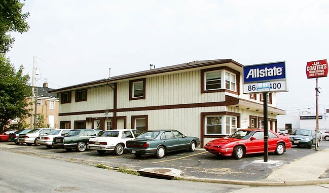
29 33 S Frank Blvd S
Akron, OH
FAIRLAWN PK LOT 131 ALL FRANK BLVD
68-11301
SUMMIT
Parkingstructure
Ohio
B and X Area of moderate flood hazard, usually the area between the limits of the 100-year and 500-year floods.
131
2023
0.06 AC
2025
Akron
507101
Cleveland
NEARBY LISTINGS FOR SALE OR LEASE
DEMOGRAPHICS near 29 33 S Frank Blvd S
1 mile
3 mile
5 mile
2024 Total Population
9,783
65,466
156,269
2029 Population
9,705
65,477
156,582
Pop Growth 2024-2029
(0.80%)
+ 0.02%
+ 0.20%
Average Age
42
43
41
2024 Total Households
4,695
30,440
67,890
HH Growth 2024-2029
(0.77%)
+ 0.03%
+ 0.19%
Median Household Inc
$75,036
$65,812
$59,203
Avg Household Size
2.10
2.10
2.20
2024 Avg HH Vehicles
2.00
2.00
2.00
Median Home Value
$194,063
$199,815
$184,909
Median Year Built
1954
1958
1958
Nearby Places
Map Layers
Map Styles
 Street
 Aerial
Transit
 Traffic
 Biking
Places
Listings with unknown addresses are not visible on the map
- Restaurants
- Banks
- Shops
- Fitness
- Groceries
PUBLIC TRANSPORTATION
COMMUTER RAIL
Drive
Walk
Distance
10 min
4.0 mi
Drive
Walk
Distance
9 min
4.2 mi
AIRPORT
Akron-Canton Regional
Drive
Walk
Distance
Akron-Canton Regional
27 min
19.3 mi
Cleveland-Hopkins International
Drive
Walk
Distance
Cleveland-Hopkins International
50 min
33.6 mi
SALE & LEASE HISTORY
LISTING DATE
SALE/LEASE

Aug 29, 2018
For Sale
Nearby Properties
Address
Land Use
TOTAL SIZE
Lot Size
Zoning
Address
Land Use
TOTAL SIZE
Lot Size
Zoning
Address
Land Use
TOTAL SIZE
Lot Size
Zoning
282,490 SF
20.76 AC
Address
Land Use
TOTAL SIZE
Lot Size
Zoning
676,403 SF
39.06 AC
Address
Land Use
TOTAL SIZE
Lot Size
Zoning
194,508 SF
30.87 AC
Address
Land Use
TOTAL SIZE
Lot Size
Zoning
91,104 SF
17.30 AC
Address
Land Use
TOTAL SIZE
Lot Size
Zoning
311,093 SF
32.53 AC
Address
Land Use
TOTAL SIZE
Lot Size
Zoning
479,446 SF
6.07 AC
Address
Land Use
TOTAL SIZE
Lot Size
Zoning
192,658 SF
15.34 AC
Address
Land Use
TOTAL SIZE
Lot Size
Zoning
246,312 SF
17.50 AC
Address
Land Use
TOTAL SIZE
Lot Size
Zoning
231,968 SF
29.14 AC
Address
Land Use
TOTAL SIZE
Lot Size
Zoning
10 AC
Address
Land Use
TOTAL SIZE
Lot Size
Zoning
10.78 AC
Address
Land Use
TOTAL SIZE
Lot Size
Zoning
12.46 AC
Address
Land Use
TOTAL SIZE
Lot Size
Zoning
313,167 SF
18.50 AC
Address
Land Use
TOTAL SIZE
Lot Size
Zoning
43,574 SF
3.67 AC
Address
Land Use
TOTAL SIZE
Lot Size
Zoning
76,560 SF
6.07 AC
Address
Land Use
TOTAL SIZE
Lot Size
Zoning
10.26 AC
Address
Land Use
TOTAL SIZE
Lot Size
Zoning
113,059 SF
7.46 AC
Address
Land Use
TOTAL SIZE
Lot Size
Zoning
327,798 SF
116.80 AC
Address
Land Use
TOTAL SIZE
Lot Size
Zoning
123,800 SF
76.50 AC
Address
Land Use
TOTAL SIZE
Lot Size
Zoning
54,398 SF
8.10 AC
Address
Land Use
TOTAL SIZE
Lot Size
Zoning
58,639 SF
2.29 AC
Address
Land Use
TOTAL SIZE
Lot Size
Zoning
Address
Land Use
TOTAL SIZE
Lot Size
Zoning
Address
Land Use
TOTAL SIZE
Lot Size
Zoning
209,183 SF
36.34 AC
Address
Land Use
TOTAL SIZE
Lot Size
Zoning
121,170 SF
1 AC
Address
Land Use
TOTAL SIZE
Lot Size
Zoning
123,367 SF
8.81 AC
Address
Land Use
TOTAL SIZE
Lot Size
Zoning
105,770 SF
16.40 AC
Address
Land Use
TOTAL SIZE
Lot Size
Zoning
136,381 SF
6.51 AC
Address
Land Use
TOTAL SIZE
Lot Size
Zoning
104,861 SF
2.07 AC
The World's #1 Commercial Real Estate Marketplace
Connect with us
© 2026 CoStar Group
The information above has been obtained from sources believed reliable. While we do not doubt its accuracy we have not verified it and make no guarantee, warranty or representation about it. It is your responsibility to independently confirm its accuracy and completeness. Any projections, opinions, assumptions, or estimates used are for example only and do not represent the current or future performance of the property. The value of this transaction to you depends on tax and other factors which should be evaluated by your tax, financial, and legal advisors. You and your advisors should conduct a careful, independent investigation of the property to determine to your satisfaction the suitability of the property for your needs.