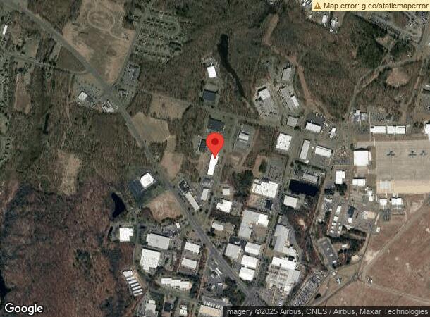
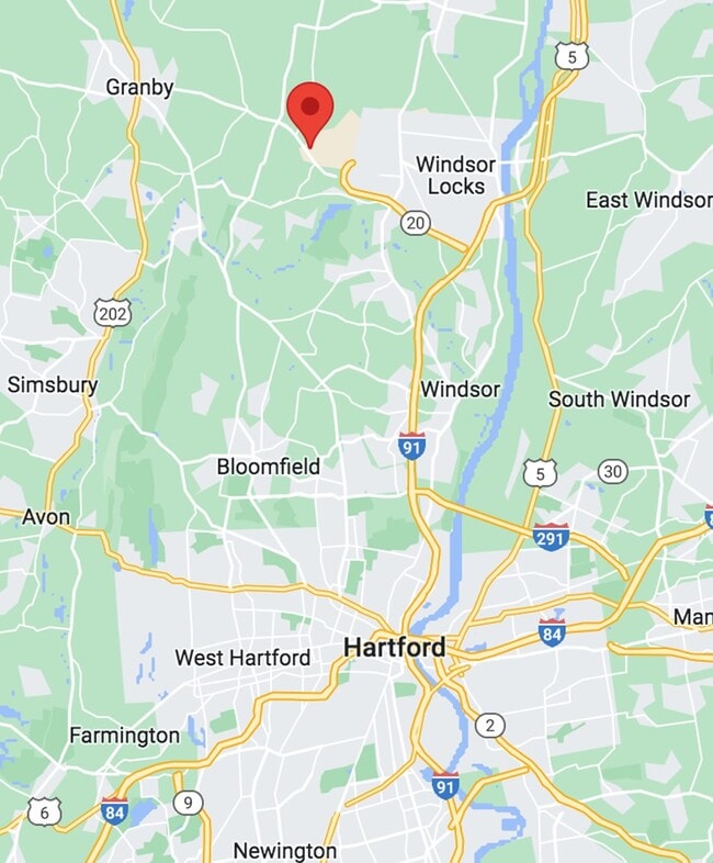
Property Record
29 Kripes Rd, East Granby, CT 06026

NEARBY LISTINGS FOR SALE OR LEASE
-
-
View all East Granby listings for lease on LoopNet.com
Property Detail
29 Kripes Rd
EGRA-000017-000000-000017
Hartford
Industrialgeneral
Connecticut
X
8.42 AC
09003C0212F
East Granby
2024
Hartford
2025
Hartford-West Hartford-East Hartford, CT
470100
DEMOGRAPHICS near 29 Kripes Rd
1 Mile
3 Mile
5 Mile
2024 Total Population
663
9,989
41,287
2029 Population
660
9,940
41,115
Pop Growth 2024-2029
(0.45%)
(0.49%)
(0.42%)
Average Age
43
43
44
2024 Total Households
260
4,072
17,039
HH Growth 2024-2029
(0.38%)
(0.52%)
(0.50%)
Median Household Inc
$97,674
$94,316
$96,319
Avg Household Size
2.50
2.40
2.30
2024 Avg HH Vehicles
2.00
2.00
2.00
Median Home Value
$275,390
$274,556
$283,816
Median Year Built
1992
1970
1972
Nearby Places
Map Layers
Map Styles
 Street
 Aerial
- Restaurants
- Banks
- Shops
- Fitness
- Groceries
PUBLIC TRANSPORTATION
COMMUTER RAIL
Windsor Locks (Hartford Line - CT Rail (CTRail))
DRIVE
WALK
Distance
Windsor Locks (Hartford Line - CT Rail (CTRail))
10 min
6.1 mi
DRIVE
WALK
Distance
15 min
9.7 mi
AIRPORT
Bradley International
DRIVE
WALK
Distance
Bradley International
14 min
2.9 mi
SALE & LEASE HISTORY
LISTING DATE
SALE/LEASE

Sep 25, 2016
For Lease
May 02, 2023
For Lease
Mar 01, 2021
For Lease
Jul 13, 2018
For Lease
Apr 07, 2020
For Lease
Apr 04, 2024
For Lease
Nearby Properties
Address
Land Use
TOTAL SIZE
Lot Size
Zoning
Address
Land Use
TOTAL SIZE
Lot Size
Zoning
723,830 SF
160.79 AC
IND1
Address
Land Use
TOTAL SIZE
Lot Size
Zoning
100,414 SF
93.10 AC
Address
Land Use
TOTAL SIZE
Lot Size
Zoning
130.99 AC
Address
Land Use
TOTAL SIZE
Lot Size
Zoning
6,000 SF
62.78 AC
IND1
Address
Land Use
TOTAL SIZE
Lot Size
Zoning
64.41 AC
IND3
Address
Land Use
TOTAL SIZE
Lot Size
Zoning
64,798 SF
1 AC
Address
Land Use
TOTAL SIZE
Lot Size
Zoning
269,325 SF
32.33 AC
IND3
Address
Land Use
TOTAL SIZE
Lot Size
Zoning
304,200 SF
58.46 AC
Address
Land Use
TOTAL SIZE
Lot Size
Zoning
52,811 SF
4.79 AC
BUS1
Address
Land Use
TOTAL SIZE
Lot Size
Zoning
234,000 SF
16.50 AC
Address
Land Use
TOTAL SIZE
Lot Size
Zoning
242,000 SF
20.30 AC
Address
Land Use
TOTAL SIZE
Lot Size
Zoning
451,937 SF
25.93 AC
IND3
Address
Land Use
TOTAL SIZE
Lot Size
Zoning
52.32 AC
R20
Address
Land Use
TOTAL SIZE
Lot Size
Zoning
50,287 SF
1.74 AC
Address
Land Use
TOTAL SIZE
Lot Size
Zoning
46,206 SF
2.70 AC
BUS1
Address
Land Use
TOTAL SIZE
Lot Size
Zoning
80,408 SF
2.59 AC
BUS1
Address
Land Use
TOTAL SIZE
Lot Size
Zoning
260,002 SF
9.89 AC
IND3
Address
Land Use
TOTAL SIZE
Lot Size
Zoning
38,884 SF
3.04 AC
B1
Address
Land Use
TOTAL SIZE
Lot Size
Zoning
40 AC
IND3
Address
Land Use
TOTAL SIZE
Lot Size
Zoning
4,212 SF
183.61 AC
Address
Land Use
TOTAL SIZE
Lot Size
Zoning
Address
Land Use
TOTAL SIZE
Lot Size
Zoning
62,241 SF
3.21 AC
BUS1
Address
Land Use
TOTAL SIZE
Lot Size
Zoning
148,884 SF
15.40 AC
Address
Land Use
TOTAL SIZE
Lot Size
Zoning
4 AC
BUS1
Address
Land Use
TOTAL SIZE
Lot Size
Zoning
20.30 AC
CP
Address
Land Use
TOTAL SIZE
Lot Size
Zoning
138,891 SF
16.46 AC
Address
Land Use
TOTAL SIZE
Lot Size
Zoning
138,891 SF
15.39 AC
Address
Land Use
TOTAL SIZE
Lot Size
Zoning
44,656 SF
3.34 AC
BUS1
Address
Land Use
TOTAL SIZE
Lot Size
Zoning
33.12 AC
BUS1
Address
Land Use
TOTAL SIZE
Lot Size
Zoning
136,500 SF
12.20 AC
The World's #1 Commercial Real Estate Marketplace
Connect with us
© 2025 CoStar Group
The information above has been obtained from sources believed reliable. While we do not doubt its accuracy we have not verified it and make no guarantee, warranty or representation about it. It is your responsibility to independently confirm its accuracy and completeness. Any projections, opinions, assumptions, or estimates used are for example only and do not represent the current or future performance of the property. The value of this transaction to you depends on tax and other factors which should be evaluated by your tax, financial, and legal advisors. You and your advisors should conduct a careful, independent investigation of the property to determine to your satisfaction the suitability of the property for your needs.