Property Record
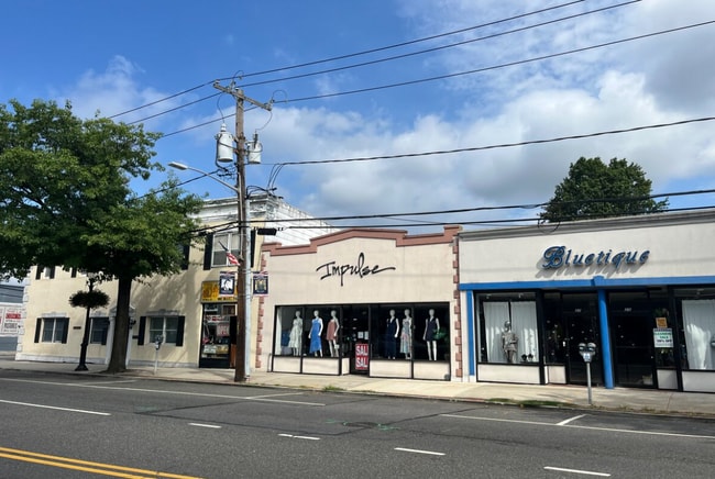
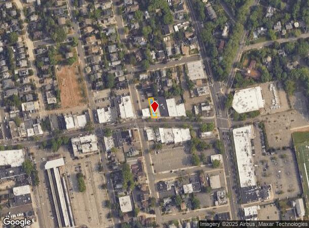
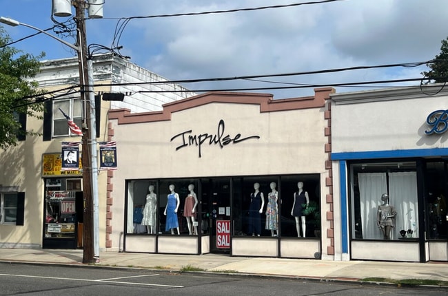
29 Main St, Port Washington, NY 11050
Current Lease Availabilities
NEARBY LISTINGS FOR SALE OR LEASE
Property Detail
29 Main St
Nassau County-Suffolk County, NY
Nassau
2289-05-026-00-0162-0
New York
Townhouserowhouse
0.07 AC
X
Western Nassau
36059C0108G
Long Island (New York)
3,226 SF
DEMOGRAPHICS near 29 Main St
1 Mile
3 Mile
5 Mile
2024 Total Population
14,435
67,762
183,292
2029 Population
14,175
66,696
181,166
Pop Growth 2024-2029
(1.80%)
(1.57%)
(1.16%)
Average Age
42
42
43
2024 Total Households
5,106
23,429
63,726
HH Growth 2024-2029
(1.88%)
(1.63%)
(1.19%)
Median Household Inc
$163,384
$154,109
$132,535
Avg Household Size
2.70
2.80
2.80
2024 Avg HH Vehicles
2.00
2.00
2.00
Median Home Value
$880,820
$986,442
$916,546
Median Year Built
1951
1955
1957
Nearby Places
- Restaurants
- Banks
- Shops
- Fitness
- Groceries
PUBLIC TRANSPORTATION
COMMUTER RAIL
Port Washington Station (Port Washington Branch - Long Island Rail Road)
DRIVE
WALK
Distance
Port Washington Station (Port Washington Branch - Long Island Rail Road)
1 min
4 min
0.2 mi
Plandome Station (Port Washington Branch - Long Island Rail Road)
DRIVE
WALK
Distance
Plandome Station (Port Washington Branch - Long Island Rail Road)
5 min
2.4 mi
AIRPORT
LaGuardia
DRIVE
WALK
Distance
LaGuardia
29 min
17.7 mi
John F Kennedy International
DRIVE
WALK
Distance
John F Kennedy International
32 min
20.5 mi
Westchester County
DRIVE
WALK
Distance
Westchester County
59 min
36.6 mi
Freight Ports
NY - Red Hook Container Terminal
DRIVE
WALK
Distance
NY - Red Hook Container Terminal
40 min
25.8 mi
Nearby Properties
Address
Land Use
TOTAL SIZE
Lot Size
Zoning
Address
Land Use
TOTAL SIZE
Lot Size
Zoning
375,331 SF
14.83 AC
Address
Land Use
TOTAL SIZE
Lot Size
Zoning
251,828 SF
31.03 AC
Address
Land Use
TOTAL SIZE
Lot Size
Zoning
26,200 SF
186 AC
Address
Land Use
TOTAL SIZE
Lot Size
Zoning
196,507 SF
133.37 AC
Address
Land Use
TOTAL SIZE
Lot Size
Zoning
148,942 SF
34.17 AC
Address
Land Use
TOTAL SIZE
Lot Size
Zoning
50,252 SF
143.04 AC
Address
Land Use
TOTAL SIZE
Lot Size
Zoning
84,302 SF
3.49 AC
Address
Land Use
TOTAL SIZE
Lot Size
Zoning
171,770 SF
5.95 AC
Address
Land Use
TOTAL SIZE
Lot Size
Zoning
179,365 SF
6.05 AC
Address
Land Use
TOTAL SIZE
Lot Size
Zoning
45,898 SF
85.13 AC
Address
Land Use
TOTAL SIZE
Lot Size
Zoning
98,439 SF
8.94 AC
Address
Land Use
TOTAL SIZE
Lot Size
Zoning
155,256 SF
25 AC
Address
Land Use
TOTAL SIZE
Lot Size
Zoning
56,663 SF
388.75 AC
Address
Land Use
TOTAL SIZE
Lot Size
Zoning
102,595 SF
21.45 AC
Address
Land Use
TOTAL SIZE
Lot Size
Zoning
161,595 SF
29.91 AC
Address
Land Use
TOTAL SIZE
Lot Size
Zoning
140,916 SF
3.14 AC
Address
Land Use
TOTAL SIZE
Lot Size
Zoning
114,248 SF
80.99 AC
Address
Land Use
TOTAL SIZE
Lot Size
Zoning
130,665 SF
9.91 AC
Address
Land Use
TOTAL SIZE
Lot Size
Zoning
52,275 SF
27.63 AC
Address
Land Use
TOTAL SIZE
Lot Size
Zoning
246,555 SF
1.93 AC
Address
Land Use
TOTAL SIZE
Lot Size
Zoning
133,941 SF
10.02 AC
Address
Land Use
TOTAL SIZE
Lot Size
Zoning
95,147 SF
207.90 AC
Address
Land Use
TOTAL SIZE
Lot Size
Zoning
123,240 SF
13.67 AC
Address
Land Use
TOTAL SIZE
Lot Size
Zoning
125,611 SF
11.23 AC
Address
Land Use
TOTAL SIZE
Lot Size
Zoning
215,166 SF
4.06 AC
Address
Land Use
TOTAL SIZE
Lot Size
Zoning
1,500 SF
24.12 AC
Address
Land Use
TOTAL SIZE
Lot Size
Zoning
19,259 SF
12.22 AC
Address
Land Use
TOTAL SIZE
Lot Size
Zoning
2,860 SF
20.37 AC
Address
Land Use
TOTAL SIZE
Lot Size
Zoning
215,694 SF
7.42 AC
Address
Land Use
TOTAL SIZE
Lot Size
Zoning
70,230 SF
15.20 AC
The World's #1 Commercial Real Estate Marketplace
Connect with us
© 2025 CoStar Group
The information above has been obtained from sources believed reliable. While we do not doubt its accuracy we have not verified it and make no guarantee, warranty or representation about it. It is your responsibility to independently confirm its accuracy and completeness. Any projections, opinions, assumptions, or estimates used are for example only and do not represent the current or future performance of the property. The value of this transaction to you depends on tax and other factors which should be evaluated by your tax, financial, and legal advisors. You and your advisors should conduct a careful, independent investigation of the property to determine to your satisfaction the suitability of the property for your needs.