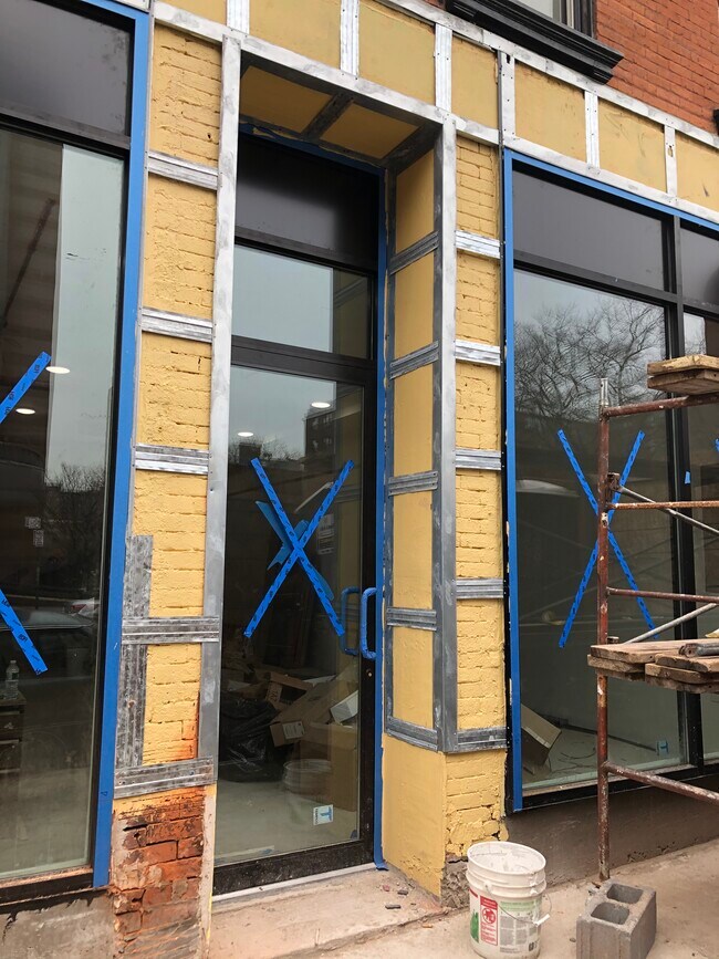
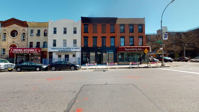
Property Record
29 Marcus Garvey Blvd, Brooklyn, NY 11206
NEARBY LISTINGS FOR SALE OR LEASE
Property Detail
29 Marcus Garvey Blvd
01579-0002
Kings
Commercialofficeresidentialmixeduse
New York
X
2
3604970204F
0.05 AC
2024
Stuyvesant Heights
2025
Long Island (New York)
028501
New York-Jersey City-White Plains, NY-NJ
5,526 SF
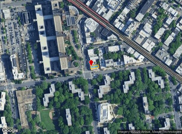
DEMOGRAPHICS near 29 Marcus Garvey Blvd
1 mile
3 mile
5 mile
2024 Total Population
204,840
1,201,717
3,059,849
2029 Population
195,105
1,134,645
2,869,832
Pop Growth 2024-2029
(4.75%)
(5.58%)
(6.21%)
Average Age
34
37
39
2024 Total Households
71,993
481,582
1,253,079
HH Growth 2024-2029
(5.37%)
(5.99%)
(6.49%)
Median Household Inc
$60,419
$75,013
$81,429
Avg Household Size
2.70
2.40
2.30
2024 Avg HH Vehicles
.00
.00
.00
Median Home Value
$950,125
$937,776
$841,690
Median Year Built
1956
1948
1949
Nearby Places
Map Layers
Map Styles
 Street
 Aerial
Transit
 Traffic
 Biking
Places
Listings with unknown addresses are not visible on the map
- Restaurants
- Banks
- Shops
- Fitness
- Groceries
PUBLIC TRANSPORTATION
TRANSIT/SUBWAY
Flushing Avenue (J,M Line) (J - New York MTA Subway (The Subway), M - New York MTA Subway (The Subway))
Drive
Walk
Distance
Flushing Avenue (J,M Line) (J - New York MTA Subway (The Subway), M - New York MTA Subway (The Subway))
2 min
2 min
0.1 mi
Myrtle Avenue (J - New York MTA Subway (The Subway), M - New York MTA Subway (The Subway), Z - New York MTA Subway (The Subway))
Drive
Walk
Distance
Myrtle Avenue (J - New York MTA Subway (The Subway), M - New York MTA Subway (The Subway), Z - New York MTA Subway (The Subway))
1 min
7 min
0.3 mi
Lorimer Street (J,M Line) (J - New York MTA Subway (The Subway), M - New York MTA Subway (The Subway))
Drive
Walk
Distance
Lorimer Street (J,M Line) (J - New York MTA Subway (The Subway), M - New York MTA Subway (The Subway))
3 min
10 min
0.5 mi
Flushing Avenue (G Line) (G - New York MTA Subway (The Subway))
Drive
Walk
Distance
Flushing Avenue (G Line) (G - New York MTA Subway (The Subway))
2 min
13 min
0.7 mi
Myrtle-Willoughby Avenues (G - New York MTA Subway (The Subway))
Drive
Walk
Distance
Myrtle-Willoughby Avenues (G - New York MTA Subway (The Subway))
2 min
13 min
0.7 mi
COMMUTER RAIL
Nostrand Avenue Station (Far Rockaway Branch - Long Island Rail Road, Hempstead Branch - Long Island Rail Road, Long Beach Branch - Long Island Rail Road, West Hempstead Branch - Long Island Rail Road)
Drive
Walk
Distance
Nostrand Avenue Station (Far Rockaway Branch - Long Island Rail Road, Hempstead Branch - Long Island Rail Road, Long Beach Branch - Long Island Rail Road, West Hempstead Branch - Long Island Rail Road)
7 min
2.0 mi
East New York Station (Far Rockaway Branch - Long Island Rail Road, Long Beach Branch - Long Island Rail Road, West Hempstead Branch - Long Island Rail Road)
Drive
Walk
Distance
East New York Station (Far Rockaway Branch - Long Island Rail Road, Long Beach Branch - Long Island Rail Road, West Hempstead Branch - Long Island Rail Road)
7 min
2.8 mi
AIRPORT
LaGuardia
Drive
Walk
Distance
LaGuardia
18 min
8.4 mi
John F Kennedy International
Drive
Walk
Distance
John F Kennedy International
24 min
10.8 mi
Newark Liberty International
Drive
Walk
Distance
Newark Liberty International
30 min
15.8 mi
Freight Ports
NY - Red Hook Container Terminal
Drive
Walk
Distance
NY - Red Hook Container Terminal
11 min
4.6 mi
Nearby Properties
Address
Land Use
TOTAL SIZE
Lot Size
Zoning
Address
Land Use
TOTAL SIZE
Lot Size
Zoning
2,812,739 SF
2.10 AC
C5-3
Address
Land Use
TOTAL SIZE
Lot Size
Zoning
1,104,505 SF
2.32 AC
C4-7
Address
Land Use
TOTAL SIZE
Lot Size
Zoning
7,058,736 SF
147.61 AC
M3-1
Address
Land Use
TOTAL SIZE
Lot Size
Zoning
869,038 SF
1.53 AC
M1-1
Address
Land Use
TOTAL SIZE
Lot Size
Zoning
986,641 SF
6.74 AC
R8
Address
Land Use
TOTAL SIZE
Lot Size
Zoning
986,641 SF
6.74 AC
R8
Address
Land Use
TOTAL SIZE
Lot Size
Zoning
986,641 SF
6.74 AC
R8
Address
Land Use
TOTAL SIZE
Lot Size
Zoning
986,641 SF
6.74 AC
R8
Address
Land Use
TOTAL SIZE
Lot Size
Zoning
986,641 SF
6.74 AC
R8
Address
Land Use
TOTAL SIZE
Lot Size
Zoning
986,641 SF
6.74 AC
R8
Address
Land Use
TOTAL SIZE
Lot Size
Zoning
986,641 SF
6.74 AC
R8
Address
Land Use
TOTAL SIZE
Lot Size
Zoning
986,641 SF
6.74 AC
R8
Address
Land Use
TOTAL SIZE
Lot Size
Zoning
986,641 SF
6.74 AC
R8
Address
Land Use
TOTAL SIZE
Lot Size
Zoning
986,641 SF
6.74 AC
R8
Address
Land Use
TOTAL SIZE
Lot Size
Zoning
986,641 SF
6.74 AC
R8
Address
Land Use
TOTAL SIZE
Lot Size
Zoning
986,641 SF
6.74 AC
R8
Address
Land Use
TOTAL SIZE
Lot Size
Zoning
986,641 SF
6.74 AC
R8
Address
Land Use
TOTAL SIZE
Lot Size
Zoning
986,641 SF
6.74 AC
R8
Address
Land Use
TOTAL SIZE
Lot Size
Zoning
986,641 SF
6.74 AC
R8
Address
Land Use
TOTAL SIZE
Lot Size
Zoning
986,641 SF
6.74 AC
R8
Address
Land Use
TOTAL SIZE
Lot Size
Zoning
986,641 SF
6.74 AC
R8
Address
Land Use
TOTAL SIZE
Lot Size
Zoning
986,641 SF
6.74 AC
R8
Address
Land Use
TOTAL SIZE
Lot Size
Zoning
986,641 SF
6.74 AC
R8
Address
Land Use
TOTAL SIZE
Lot Size
Zoning
986,641 SF
6.74 AC
R8
Address
Land Use
TOTAL SIZE
Lot Size
Zoning
986,641 SF
6.74 AC
R8
Address
Land Use
TOTAL SIZE
Lot Size
Zoning
986,641 SF
6.74 AC
R8
Address
Land Use
TOTAL SIZE
Lot Size
Zoning
986,641 SF
6.74 AC
R8
Address
Land Use
TOTAL SIZE
Lot Size
Zoning
986,641 SF
6.74 AC
R8
Address
Land Use
TOTAL SIZE
Lot Size
Zoning
986,641 SF
6.74 AC
R8
Address
Land Use
TOTAL SIZE
Lot Size
Zoning
986,641 SF
6.74 AC
R8
The World's #1 Commercial Real Estate Marketplace
Connect with us
© 2026 CoStar Group
The information above has been obtained from sources believed reliable. While we do not doubt its accuracy we have not verified it and make no guarantee, warranty or representation about it. It is your responsibility to independently confirm its accuracy and completeness. Any projections, opinions, assumptions, or estimates used are for example only and do not represent the current or future performance of the property. The value of this transaction to you depends on tax and other factors which should be evaluated by your tax, financial, and legal advisors. You and your advisors should conduct a careful, independent investigation of the property to determine to your satisfaction the suitability of the property for your needs.