Property Record
29 New St, Newburgh, NY 12550

Save to a Folder
{{folder.Name}}
{{folder.ListingIds.length}} Properties
{{folder.ListingIds.length}} Property
Create a New Folder
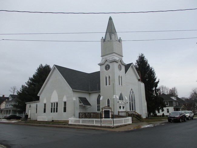
Property Detail
29 New St
Kiryas Joel-Poughkeepsie-Newburgh, NY
LT B CHURCH SUB MAP 5278
332600-004-000-0002-011.200-0000
ORANGE
Religious
New York
B and X Area of moderate flood hazard, usually the area between the limits of the 100-year and 500-year floods.
11.20
2024
0.33 AC
2025
Middletown
010400
Northern New Jersey
NEARBY LISTINGS FOR SALE OR LEASE
-
-
View all Newburgh listings for sale on LoopNet.com
DEMOGRAPHICS near 29 New St
1 mile
3 mile
5 mile
2025 Total Population
2,362
7,652
16,140
2030 Population
2,365
7,622
16,085
Pop Growth 2025-2030
+ 0.13%
(0.39%)
(0.34%)
Average Age
43
42
42
2025 Total Households
818
2,380
5,267
HH Growth 2025-2030
0.00%
(0.67%)
(0.47%)
Median Household Inc
$109,408
$118,141
$124,342
Avg Household Size
2.40
2.60
2.70
2025 Avg HH Vehicles
2.00
2.00
2.00
Median Home Value
$335,366
$368,023
$390,120
Median Year Built
1958
1972
1974
Nearby Places
Map Layers
Map Styles
 Street
 Aerial
Layers
 Traffic
 Biking
Places
Listings with unknown addresses are not visible on the map
- Restaurants
- Banks
- Shops
- Fitness
- Groceries
PUBLIC TRANSPORTATION
AIRPORT
New York Stewart International
Drive
Walk
Distance
New York Stewart International
29 min
17.6 mi
SALE & LEASE HISTORY
LISTING DATE
SALE/LEASE

Apr 19, 2019
For Sale
Nearby Properties
Address
Land Use
TOTAL SIZE
Lot Size
Zoning
Address
Land Use
TOTAL SIZE
Lot Size
Zoning
1,944 SF
1,141 AC
RAG-4
Address
Land Use
TOTAL SIZE
Lot Size
Zoning
52.20 AC
Address
Land Use
TOTAL SIZE
Lot Size
Zoning
12.60 AC
Address
Land Use
TOTAL SIZE
Lot Size
Zoning
48,875 SF
5.50 AC
B
Address
Land Use
TOTAL SIZE
Lot Size
Zoning
6.20 AC
Address
Land Use
TOTAL SIZE
Lot Size
Zoning
1,862 SF
1.80 AC
07
Address
Land Use
TOTAL SIZE
Lot Size
Zoning
6.60 AC
Address
Land Use
TOTAL SIZE
Lot Size
Zoning
5,773 SF
118.50 AC
07
Address
Land Use
TOTAL SIZE
Lot Size
Zoning
8.50 AC
B
Address
Land Use
TOTAL SIZE
Lot Size
Zoning
20,160 SF
1.10 AC
B
Address
Land Use
TOTAL SIZE
Lot Size
Zoning
Address
Land Use
TOTAL SIZE
Lot Size
Zoning
11.90 AC
Address
Land Use
TOTAL SIZE
Lot Size
Zoning
37,250 SF
5 AC
Address
Land Use
TOTAL SIZE
Lot Size
Zoning
6.60 AC
05 - COMME
Address
Land Use
TOTAL SIZE
Lot Size
Zoning
20,829 SF
3.40 AC
Address
Land Use
TOTAL SIZE
Lot Size
Zoning
12,597 SF
87.10 AC
RS2
Address
Land Use
TOTAL SIZE
Lot Size
Zoning
3.40 AC
Address
Land Use
TOTAL SIZE
Lot Size
Zoning
Address
Land Use
TOTAL SIZE
Lot Size
Zoning
14.90 AC
RA07
Address
Land Use
TOTAL SIZE
Lot Size
Zoning
1,911 SF
79 AC
RA07
Address
Land Use
TOTAL SIZE
Lot Size
Zoning
12,824 SF
1.30 AC
B
Address
Land Use
TOTAL SIZE
Lot Size
Zoning
4,940 SF
132.20 AC
07
Address
Land Use
TOTAL SIZE
Lot Size
Zoning
9,941 SF
1.20 AC
Address
Land Use
TOTAL SIZE
Lot Size
Zoning
9,941 SF
1.20 AC
Address
Land Use
TOTAL SIZE
Lot Size
Zoning
9,941 SF
1.20 AC
Address
Land Use
TOTAL SIZE
Lot Size
Zoning
12,000 SF
2 AC
Address
Land Use
TOTAL SIZE
Lot Size
Zoning
9,449 SF
2 AC
Address
Land Use
TOTAL SIZE
Lot Size
Zoning
11,730 SF
4.30 AC
B
Address
Land Use
TOTAL SIZE
Lot Size
Zoning
9,147 SF
83.80 AC
07
Address
Land Use
TOTAL SIZE
Lot Size
Zoning
6,974 SF
0.81 AC
The World's #1 Commercial Real Estate Marketplace
Connect with us
© 2026 CoStar Group
The information above has been obtained from sources believed reliable. While we do not doubt its accuracy we have not verified it and make no guarantee, warranty or representation about it. It is your responsibility to independently confirm its accuracy and completeness. Any projections, opinions, assumptions, or estimates used are for example only and do not represent the current or future performance of the property. The value of this transaction to you depends on tax and other factors which should be evaluated by your tax, financial, and legal advisors. You and your advisors should conduct a careful, independent investigation of the property to determine to your satisfaction the suitability of the property for your needs.