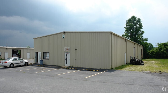
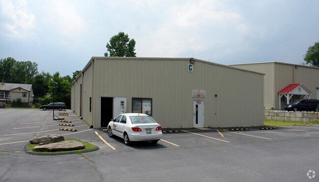
Property Record
29 P E M Dr, Hendersonville, NC 28792

NEARBY LISTINGS FOR SALE OR LEASE
Property Detail
29 P E M Dr
Asheville, NC
Dana
0111283
LOT # SR1734 ON SUGARLOAF RD
Industrialgeneral
Henderson
X
North Carolina
3700957900J
329
2025
4.19 AC
2025
Henderson County
931000
Asheville
5,400 SF
DEMOGRAPHICS near 29 P E M Dr
1 Mile
3 Mile
5 Mile
2024 Total Population
3,886
25,159
61,182
2029 Population
4,080
26,396
64,065
Pop Growth 2024-2029
+ 4.99%
+ 4.92%
+ 4.71%
Average Age
44
45
46
2024 Total Households
1,731
10,920
26,350
HH Growth 2024-2029
+ 5.03%
+ 5.03%
+ 4.81%
Median Household Inc
$40,636
$46,500
$53,282
Avg Household Size
2.20
2.20
2.20
2024 Avg HH Vehicles
2.00
2.00
2.00
Median Home Value
$213,218
$222,306
$267,955
Median Year Built
1994
1984
1983
Nearby Places
Map Layers
Map Styles
 Street
 Aerial
- Restaurants
- Banks
- Shops
- Fitness
- Groceries
PUBLIC TRANSPORTATION
AIRPORT
Asheville Regional
DRIVE
WALK
Distance
Asheville Regional
14 min
10.6 mi
Freight Ports
North Charleston Terminal
DRIVE
WALK
Distance
North Charleston Terminal
264 min
236.5 mi
Nearby Properties
Address
Land Use
TOTAL SIZE
Lot Size
Zoning
Address
Land Use
TOTAL SIZE
Lot Size
Zoning
8,728 SF
8.84 AC
9970930~PC
Address
Land Use
TOTAL SIZE
Lot Size
Zoning
60,582 SF
9.54 AC
10010646~R
Address
Land Use
TOTAL SIZE
Lot Size
Zoning
60,582 SF
9.53 AC
9948805~R-
Address
Land Use
TOTAL SIZE
Lot Size
Zoning
96,084 SF
13.96 AC
1013416~PI
Address
Land Use
TOTAL SIZE
Lot Size
Zoning
4,800 SF
29.70 AC
1007531~PR
Address
Land Use
TOTAL SIZE
Lot Size
Zoning
97,776 SF
0.92 AC
1009121~MI
Address
Land Use
TOTAL SIZE
Lot Size
Zoning
170,797 SF
55.91 AC
1013176~R1
Address
Land Use
TOTAL SIZE
Lot Size
Zoning
2,888 SF
26.93 AC
10006080~I
Address
Land Use
TOTAL SIZE
Lot Size
Zoning
5,625 SF
15.53 AC
10007593~P
Address
Land Use
TOTAL SIZE
Lot Size
Zoning
29,233 SF
83.09 AC
10005104~O
Address
Land Use
TOTAL SIZE
Lot Size
Zoning
172,244 SF
18.87 AC
9968664~R-
Address
Land Use
TOTAL SIZE
Lot Size
Zoning
223,395 SF
29.32 AC
9968634~PC
Address
Land Use
TOTAL SIZE
Lot Size
Zoning
12,309 SF
6.52 AC
10005105~O
Address
Land Use
TOTAL SIZE
Lot Size
Zoning
105,179 SF
5.20 AC
1008855~PC
Address
Land Use
TOTAL SIZE
Lot Size
Zoning
44,485 SF
38.89 AC
9906409~OI
Address
Land Use
TOTAL SIZE
Lot Size
Zoning
90,000 SF
19.59 AC
1004354~R2
Address
Land Use
TOTAL SIZE
Lot Size
Zoning
3,314 SF
14.75 AC
9969886~PR
Address
Land Use
TOTAL SIZE
Lot Size
Zoning
70,136 SF
3.33 AC
10000154~O
Address
Land Use
TOTAL SIZE
Lot Size
Zoning
94,826 SF
8.85 AC
300593~HMU
Address
Land Use
TOTAL SIZE
Lot Size
Zoning
102,649 SF
7.08 AC
9904585~PI
Address
Land Use
TOTAL SIZE
Lot Size
Zoning
88,754 SF
4 AC
1003459~OI
Address
Land Use
TOTAL SIZE
Lot Size
Zoning
97,368 SF
6.66 AC
1000569~PI
Address
Land Use
TOTAL SIZE
Lot Size
Zoning
106,374 SF
32.85 AC
1013177~R1
Address
Land Use
TOTAL SIZE
Lot Size
Zoning
84,486 SF
36.02 AC
9964983~R2
Address
Land Use
TOTAL SIZE
Lot Size
Zoning
92,512 SF
3.38 AC
9968665~PR
Address
Land Use
TOTAL SIZE
Lot Size
Zoning
135,809 SF
13.87 AC
9967831~PC
Address
Land Use
TOTAL SIZE
Lot Size
Zoning
94,066 SF
15.21 AC
9970994~PC
Address
Land Use
TOTAL SIZE
Lot Size
Zoning
40,975 SF
1.15 AC
9904361~C-
Address
Land Use
TOTAL SIZE
Lot Size
Zoning
72,560 SF
7.23 AC
10000067~P
Address
Land Use
TOTAL SIZE
Lot Size
Zoning
59,072 SF
6.62 AC
10008042~R
The World's #1 Commercial Real Estate Marketplace
Connect with us
© 2026 CoStar Group
The information above has been obtained from sources believed reliable. While we do not doubt its accuracy we have not verified it and make no guarantee, warranty or representation about it. It is your responsibility to independently confirm its accuracy and completeness. Any projections, opinions, assumptions, or estimates used are for example only and do not represent the current or future performance of the property. The value of this transaction to you depends on tax and other factors which should be evaluated by your tax, financial, and legal advisors. You and your advisors should conduct a careful, independent investigation of the property to determine to your satisfaction the suitability of the property for your needs.