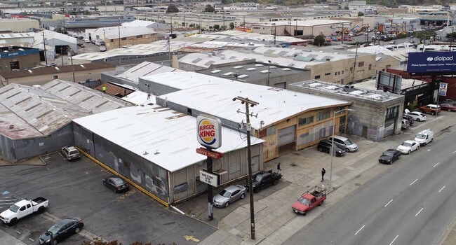
Property Record
29 Patterson St, San Francisco, CA 94124

NEARBY LISTINGS FOR SALE OR LEASE
Property Detail
29 Patterson St
San Francisco-San Mateo-Redwood City, CA
Parcel Map Of A Portion Of Assessors Blo
5560-107
San Francisco
Industrialgeneral
California
2024
98
2025
0.11 AC
980900
Mission/Potrero
4,875 SF
San Francisco
DEMOGRAPHICS near 29 Patterson St
1 mile
3 mile
5 mile
2024 Total Population
51,000
398,303
775,434
2029 Population
47,063
368,111
717,558
Pop Growth 2024-2029
(7.72%)
(7.58%)
(7.46%)
Average Age
41
42
42
2024 Total Households
17,537
162,948
326,528
HH Growth 2024-2029
(8.14%)
(7.90%)
(7.80%)
Median Household Inc
$129,930
$123,538
$125,597
Avg Household Size
2.70
2.30
2.20
2024 Avg HH Vehicles
1.00
1.00
1.00
Median Home Value
$1,081,955
$1,083,873
$1,091,635
Median Year Built
1947
1954
1949
Nearby Places
Map Layers
Map Styles
 Street
 Aerial
Transit
 Traffic
 Biking
Places
Listings with unknown addresses are not visible on the map
- Restaurants
- Banks
- Shops
- Fitness
- Groceries
PUBLIC TRANSPORTATION
COMMUTER RAIL
Drive
Walk
Distance
6 min
2.6 mi
Drive
Walk
Distance
5 min
2.7 mi
AIRPORT
San Francisco International
Drive
Walk
Distance
San Francisco International
17 min
10.5 mi
Metro Oakland International
Drive
Walk
Distance
Metro Oakland International
33 min
21.6 mi
Norman Y Mineta San Jose International
Drive
Walk
Distance
Norman Y Mineta San Jose International
53 min
42.1 mi
Freight Ports
Port of San Francisco
Drive
Walk
Distance
Port of San Francisco
10 min
5.1 mi
SALE & LEASE HISTORY
LISTING DATE
SALE/LEASE

Sep 01, 2020
For Lease
Nearby Properties
Address
Land Use
TOTAL SIZE
Lot Size
Zoning
Address
Land Use
TOTAL SIZE
Lot Size
Zoning
750,370 SF
3.25 AC
MBR3
Address
Land Use
TOTAL SIZE
Lot Size
Zoning
248,303 SF
4.35 AC
Address
Land Use
TOTAL SIZE
Lot Size
Zoning
717,234 SF
3.47 AC
UMU
Address
Land Use
TOTAL SIZE
Lot Size
Zoning
475,791 SF
0.55 AC
C3OSD
Address
Land Use
TOTAL SIZE
Lot Size
Zoning
10.92 AC
Address
Land Use
TOTAL SIZE
Lot Size
Zoning
266,143 SF
4 AC
C-3-R
Address
Land Use
TOTAL SIZE
Lot Size
Zoning
885,581 SF
5.20 AC
M2
Address
Land Use
TOTAL SIZE
Lot Size
Zoning
696,431 SF
0.97 AC
C3G
Address
Land Use
TOTAL SIZE
Lot Size
Zoning
1.52 AC
C3G
Address
Land Use
TOTAL SIZE
Lot Size
Zoning
1,424,230 SF
2.60 AC
C3G
Address
Land Use
TOTAL SIZE
Lot Size
Zoning
2.74 AC
Address
Land Use
TOTAL SIZE
Lot Size
Zoning
313,306 SF
1.23 AC
WMUG
Address
Land Use
TOTAL SIZE
Lot Size
Zoning
314,826 SF
1.85 AC
MB-RA
Address
Land Use
TOTAL SIZE
Lot Size
Zoning
10.92 AC
Address
Land Use
TOTAL SIZE
Lot Size
Zoning
393,918 SF
3.36 AC
WMUG
Address
Land Use
TOTAL SIZE
Lot Size
Zoning
471,334 SF
0.34 AC
RC4
Address
Land Use
TOTAL SIZE
Lot Size
Zoning
24.37 AC
Address
Land Use
TOTAL SIZE
Lot Size
Zoning
241,659 SF
3.76 AC
Address
Land Use
TOTAL SIZE
Lot Size
Zoning
230,853 SF
3.76 AC
Address
Land Use
TOTAL SIZE
Lot Size
Zoning
342,574 SF
0.54 AC
C3O
Address
Land Use
TOTAL SIZE
Lot Size
Zoning
302,084 SF
0.88 AC
MBO
Address
Land Use
TOTAL SIZE
Lot Size
Zoning
674,317 SF
3.36 AC
UMU
Address
Land Use
TOTAL SIZE
Lot Size
Zoning
319,119 SF
0.76 AC
Address
Land Use
TOTAL SIZE
Lot Size
Zoning
649,376 SF
0.93 AC
C3S
Address
Land Use
TOTAL SIZE
Lot Size
Zoning
222,000 SF
1 AC
MB-RA
Address
Land Use
TOTAL SIZE
Lot Size
Zoning
10.92 AC
Address
Land Use
TOTAL SIZE
Lot Size
Zoning
2.93 AC
Address
Land Use
TOTAL SIZE
Lot Size
Zoning
1.75 AC
C-3-O
Address
Land Use
TOTAL SIZE
Lot Size
Zoning
809,986 SF
3.13 AC
SSO
Address
Land Use
TOTAL SIZE
Lot Size
Zoning
342,727 SF
1.36 AC
C3G
The World's #1 Commercial Real Estate Marketplace
Connect with us
© 2026 CoStar Group
The information above has been obtained from sources believed reliable. While we do not doubt its accuracy we have not verified it and make no guarantee, warranty or representation about it. It is your responsibility to independently confirm its accuracy and completeness. Any projections, opinions, assumptions, or estimates used are for example only and do not represent the current or future performance of the property. The value of this transaction to you depends on tax and other factors which should be evaluated by your tax, financial, and legal advisors. You and your advisors should conduct a careful, independent investigation of the property to determine to your satisfaction the suitability of the property for your needs.