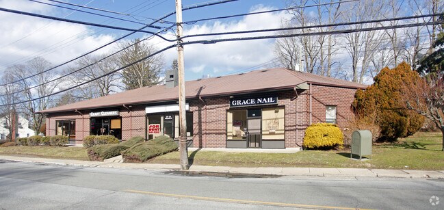
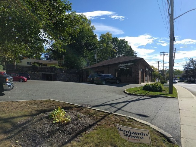
Property Record
29 Pleasantville Rd, Ossining, NY 10562

NEARBY LISTINGS FOR SALE OR LEASE
Property Detail
29 Pleasantville Rd
4203-089-016-00000-000-0072-000-0-6
Westchester
Storesoffices
New York
X
72.000
36119C0136F
0.41 AC
2025
Northwest
2024
Westchester/So Connecticut
013402
New York-Jersey City-White Plains, NY-NJ
DEMOGRAPHICS near 29 Pleasantville Rd
1 Mile
3 Mile
5 Mile
2024 Total Population
16,467
43,743
87,111
2029 Population
15,789
42,598
85,171
Pop Growth 2024-2029
(4.12%)
(2.62%)
(2.23%)
Average Age
40
42
42
2024 Total Households
5,556
15,623
30,123
HH Growth 2024-2029
(4.25%)
(2.80%)
(2.43%)
Median Household Inc
$101,699
$121,033
$143,659
Avg Household Size
2.80
2.70
2.70
2024 Avg HH Vehicles
2.00
2.00
2.00
Median Home Value
$455,624
$558,235
$668,383
Median Year Built
1953
1963
1961
Nearby Places
- Restaurants
- Banks
- Shops
- Fitness
- Groceries
PUBLIC TRANSPORTATION
COMMUTER RAIL
Ossining Station (Hudson Line - Metro-North Commuter Railroad Company (Metro-North))
DRIVE
WALK
Distance
Ossining Station (Hudson Line - Metro-North Commuter Railroad Company (Metro-North))
3 min
1.6 mi
Scarborough Station (Hudson Line - Metro-North Commuter Railroad Company (Metro-North))
DRIVE
WALK
Distance
Scarborough Station (Hudson Line - Metro-North Commuter Railroad Company (Metro-North))
8 min
3.0 mi
AIRPORT
Westchester County
DRIVE
WALK
Distance
Westchester County
26 min
15.5 mi
LaGuardia
DRIVE
WALK
Distance
LaGuardia
50 min
34.3 mi
New York Stewart International
DRIVE
WALK
Distance
New York Stewart International
59 min
35.0 mi
Freight Ports
NY - Red Hook Container Terminal
DRIVE
WALK
Distance
NY - Red Hook Container Terminal
63 min
42.5 mi
SALE & LEASE HISTORY
LISTING DATE
SALE/LEASE

Oct 18, 2016
For Sale
Jan 09, 2017
For Lease
Nearby Properties
Address
Land Use
TOTAL SIZE
Lot Size
Zoning
Address
Land Use
TOTAL SIZE
Lot Size
Zoning
Address
Land Use
TOTAL SIZE
Lot Size
Zoning
Address
Land Use
TOTAL SIZE
Lot Size
Zoning
Address
Land Use
TOTAL SIZE
Lot Size
Zoning
15.18 AC
Address
Land Use
TOTAL SIZE
Lot Size
Zoning
2.67 AC
Address
Land Use
TOTAL SIZE
Lot Size
Zoning
13 AC
Address
Land Use
TOTAL SIZE
Lot Size
Zoning
16.69 AC
Address
Land Use
TOTAL SIZE
Lot Size
Zoning
20.80 AC
Address
Land Use
TOTAL SIZE
Lot Size
Zoning
26.16 AC
Address
Land Use
TOTAL SIZE
Lot Size
Zoning
14.75 AC
Address
Land Use
TOTAL SIZE
Lot Size
Zoning
32.20 AC
Address
Land Use
TOTAL SIZE
Lot Size
Zoning
Address
Land Use
TOTAL SIZE
Lot Size
Zoning
56.91 AC
Address
Land Use
TOTAL SIZE
Lot Size
Zoning
11.66 AC
Address
Land Use
TOTAL SIZE
Lot Size
Zoning
Address
Land Use
TOTAL SIZE
Lot Size
Zoning
10.33 AC
Address
Land Use
TOTAL SIZE
Lot Size
Zoning
Address
Land Use
TOTAL SIZE
Lot Size
Zoning
0.50 AC
Address
Land Use
TOTAL SIZE
Lot Size
Zoning
5.88 AC
Address
Land Use
TOTAL SIZE
Lot Size
Zoning
19.20 AC
Address
Land Use
TOTAL SIZE
Lot Size
Zoning
7.10 AC
Address
Land Use
TOTAL SIZE
Lot Size
Zoning
1.01 AC
Address
Land Use
TOTAL SIZE
Lot Size
Zoning
21 AC
Address
Land Use
TOTAL SIZE
Lot Size
Zoning
11.11 AC
Address
Land Use
TOTAL SIZE
Lot Size
Zoning
5.54 AC
Address
Land Use
TOTAL SIZE
Lot Size
Zoning
1.87 AC
Address
Land Use
TOTAL SIZE
Lot Size
Zoning
Address
Land Use
TOTAL SIZE
Lot Size
Zoning
7.81 AC
Address
Land Use
TOTAL SIZE
Lot Size
Zoning
Address
Land Use
TOTAL SIZE
Lot Size
Zoning
16.70 AC
The World's #1 Commercial Real Estate Marketplace
Connect with us
© 2025 CoStar Group
The information above has been obtained from sources believed reliable. While we do not doubt its accuracy we have not verified it and make no guarantee, warranty or representation about it. It is your responsibility to independently confirm its accuracy and completeness. Any projections, opinions, assumptions, or estimates used are for example only and do not represent the current or future performance of the property. The value of this transaction to you depends on tax and other factors which should be evaluated by your tax, financial, and legal advisors. You and your advisors should conduct a careful, independent investigation of the property to determine to your satisfaction the suitability of the property for your needs.