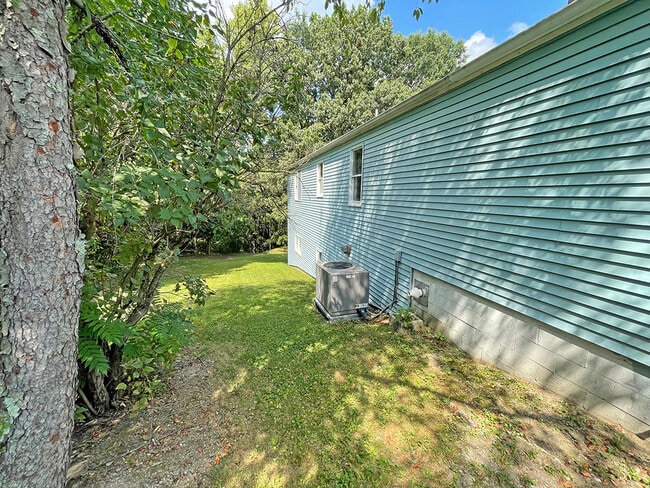
Property Record
29 Radam St, Enola, PA 17025


Current Lease Availabilities
NEARBY LISTINGS FOR SALE OR LEASE
Property Detail
29 Radam St
Harrisburg-Carlisle, PA
GEORGE MOORE PLAN LOT 17 & PO 18 PO-19 TR 1,2
09-12-2995-094
Cumberland
Officebuilding
Pennsylvania
X
17
42041C0116F
0.45 AC
2025
Harrisburg Area West
2025
Philadelphia
010201
DEMOGRAPHICS near 29 Radam St
1 Mile
3 Mile
5 Mile
2024 Total Population
4,773
46,794
140,346
2029 Population
5,136
49,200
146,853
Pop Growth 2024-2029
+ 7.61%
+ 5.14%
+ 4.64%
Average Age
41
40
40
2024 Total Households
2,090
19,731
59,249
HH Growth 2024-2029
+ 7.85%
+ 5.30%
+ 4.77%
Median Household Inc
$68,026
$73,599
$70,983
Avg Household Size
2.20
2.30
2.30
2024 Avg HH Vehicles
2.00
2.00
2.00
Median Home Value
$161,156
$186,251
$209,175
Median Year Built
1975
1967
1966
Nearby Places
Map Layers
Map Styles
 Street
 Aerial
- Restaurants
- Banks
- Shops
- Fitness
- Groceries
PUBLIC TRANSPORTATION
COMMUTER RAIL
Harrisburg (Keystone Service - Amtrak, Pennsylvanian - Amtrak)
DRIVE
WALK
Distance
Harrisburg (Keystone Service - Amtrak, Pennsylvanian - Amtrak)
12 min
6.0 mi
AIRPORT
Harrisburg International
DRIVE
WALK
Distance
Harrisburg International
25 min
16.5 mi
Freight Ports
Port of Baltimore
DRIVE
WALK
Distance
Port of Baltimore
118 min
84.3 mi
Nearby Properties
Address
Land Use
TOTAL SIZE
Lot Size
Zoning
Address
Land Use
TOTAL SIZE
Lot Size
Zoning
615,797 SF
59.70 AC
Address
Land Use
TOTAL SIZE
Lot Size
Zoning
3,025 SF
274.13 AC
Address
Land Use
TOTAL SIZE
Lot Size
Zoning
Address
Land Use
TOTAL SIZE
Lot Size
Zoning
35.15 AC
Address
Land Use
TOTAL SIZE
Lot Size
Zoning
577,075 SF
39.55 AC
Address
Land Use
TOTAL SIZE
Lot Size
Zoning
1,155,340 SF
3.94 AC
Address
Land Use
TOTAL SIZE
Lot Size
Zoning
638,721 SF
47.78 AC
Address
Land Use
TOTAL SIZE
Lot Size
Zoning
Address
Land Use
TOTAL SIZE
Lot Size
Zoning
28.13 AC
Address
Land Use
TOTAL SIZE
Lot Size
Zoning
30.87 AC
Address
Land Use
TOTAL SIZE
Lot Size
Zoning
21.68 AC
Address
Land Use
TOTAL SIZE
Lot Size
Zoning
79.43 AC
Address
Land Use
TOTAL SIZE
Lot Size
Zoning
13.57 AC
Address
Land Use
TOTAL SIZE
Lot Size
Zoning
13.05 AC
Address
Land Use
TOTAL SIZE
Lot Size
Zoning
228,141 SF
42.50 AC
Address
Land Use
TOTAL SIZE
Lot Size
Zoning
665,098 SF
14 AC
Address
Land Use
TOTAL SIZE
Lot Size
Zoning
Address
Land Use
TOTAL SIZE
Lot Size
Zoning
51,300 SF
11.36 AC
Address
Land Use
TOTAL SIZE
Lot Size
Zoning
16.61 AC
Address
Land Use
TOTAL SIZE
Lot Size
Zoning
14.76 AC
Address
Land Use
TOTAL SIZE
Lot Size
Zoning
15.58 AC
Address
Land Use
TOTAL SIZE
Lot Size
Zoning
1,702 SF
3.44 AC
Address
Land Use
TOTAL SIZE
Lot Size
Zoning
14.46 AC
Address
Land Use
TOTAL SIZE
Lot Size
Zoning
39,066 SF
6.42 AC
Address
Land Use
TOTAL SIZE
Lot Size
Zoning
19,558 SF
12.50 AC
Address
Land Use
TOTAL SIZE
Lot Size
Zoning
17.35 AC
Address
Land Use
TOTAL SIZE
Lot Size
Zoning
59,748 SF
3.17 AC
Address
Land Use
TOTAL SIZE
Lot Size
Zoning
119,902 SF
1.17 AC
Address
Land Use
TOTAL SIZE
Lot Size
Zoning
73,101 SF
13.39 AC
Address
Land Use
TOTAL SIZE
Lot Size
Zoning
3,100 SF
24.70 AC
The World's #1 Commercial Real Estate Marketplace
Connect with us
© 2026 CoStar Group
The information above has been obtained from sources believed reliable. While we do not doubt its accuracy we have not verified it and make no guarantee, warranty or representation about it. It is your responsibility to independently confirm its accuracy and completeness. Any projections, opinions, assumptions, or estimates used are for example only and do not represent the current or future performance of the property. The value of this transaction to you depends on tax and other factors which should be evaluated by your tax, financial, and legal advisors. You and your advisors should conduct a careful, independent investigation of the property to determine to your satisfaction the suitability of the property for your needs.