Property Record
29 Superior St, Hillsdale, MI 49242

Save to a Folder
{{folder.Name}}
{{folder.ListingIds.length}} Properties
{{folder.ListingIds.length}} Property
Create a New Folder
Property Detail
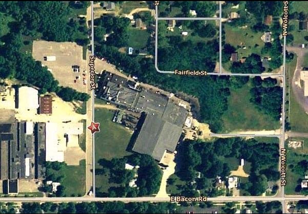
29 Superior St
006-126-253-10
COM CEN SEC 26 TH E ALG E-W LN 337 FT TH N0034'10E 33 FT FOR POB TH N0034'10E 847.3 FT ALG E LN SUPERIOR ST TO CEN LN VAC FAI
Industrialgeneral
Hillsdale
PRD
Michigan
B and X Area of moderate flood hazard, usually the area between the limits of the 100-year and 500-year floods.
157
2025
10.15 AC
2025
Other Market Areas
050700
Hillsdale, MI
130,979 SF
NEARBY LISTINGS FOR SALE OR LEASE
-
-
View all Hillsdale listings for sale on LoopNet.com
DEMOGRAPHICS near 29 Superior St
1 mile
3 mile
5 mile
2025 Total Population
4,508
9,781
15,880
2030 Population
4,443
9,624
15,733
Pop Growth 2025-2030
(1.44%)
(1.61%)
(0.93%)
Average Age
37
39
40
2025 Total Households
1,756
3,745
6,213
HH Growth 2025-2030
(1.65%)
(1.92%)
(1.09%)
Median Household Inc
$49,054
$55,269
$57,603
Avg Household Size
2.30
2.30
2.30
2025 Avg HH Vehicles
1.00
2.00
2.00
Median Home Value
$166,666
$189,450
$193,788
Median Year Built
1949
1962
1966
Nearby Places
Map Layers
Map Styles
 Street
 Aerial
Layers
 Traffic
 Biking
Places
Listings with unknown addresses are not visible on the map
- Restaurants
- Banks
- Shops
- Fitness
- Groceries
Nearby Properties
Address
Land Use
TOTAL SIZE
Lot Size
Zoning
Address
Land Use
TOTAL SIZE
Lot Size
Zoning
77,528 SF
26.75 AC
C1
Address
Land Use
TOTAL SIZE
Lot Size
Zoning
171,597 SF
55.32 AC
C1
Address
Land Use
TOTAL SIZE
Lot Size
Zoning
Address
Land Use
TOTAL SIZE
Lot Size
Zoning
135,240 SF
10 AC
RM1
Address
Land Use
TOTAL SIZE
Lot Size
Zoning
77,009 SF
6.03 AC
C1
Address
Land Use
TOTAL SIZE
Lot Size
Zoning
22,719 SF
1.90 AC
B2
Address
Land Use
TOTAL SIZE
Lot Size
Zoning
47,074 SF
6.62 AC
RM1
Address
Land Use
TOTAL SIZE
Lot Size
Zoning
128,464 SF
23.66 AC
PRF
Address
Land Use
TOTAL SIZE
Lot Size
Zoning
31,104 SF
6.36 AC
C1
Address
Land Use
TOTAL SIZE
Lot Size
Zoning
107,352 SF
2.67 AC
RM1
Address
Land Use
TOTAL SIZE
Lot Size
Zoning
20,696 SF
1.73 AC
C1
Address
Land Use
TOTAL SIZE
Lot Size
Zoning
31,500 SF
25 AC
C1
Address
Land Use
TOTAL SIZE
Lot Size
Zoning
100,000 SF
3.91 AC
RM1
Address
Land Use
TOTAL SIZE
Lot Size
Zoning
4,510 SF
B3
Address
Land Use
TOTAL SIZE
Lot Size
Zoning
17,856 SF
0.70 AC
C1
Address
Land Use
TOTAL SIZE
Lot Size
Zoning
114,879 SF
12.47 AC
B3
Address
Land Use
TOTAL SIZE
Lot Size
Zoning
1,212 SF
144 AC
PRF
Address
Land Use
TOTAL SIZE
Lot Size
Zoning
2,128 SF
7.02 AC
R1
Address
Land Use
TOTAL SIZE
Lot Size
Zoning
19,118 SF
8.85 AC
B1
Address
Land Use
TOTAL SIZE
Lot Size
Zoning
35,457 SF
3.35 AC
C1
Address
Land Use
TOTAL SIZE
Lot Size
Zoning
54,016 SF
4.84 AC
RM1
Address
Land Use
TOTAL SIZE
Lot Size
Zoning
81,225 SF
49.49 AC
I1
Address
Land Use
TOTAL SIZE
Lot Size
Zoning
133,532 SF
22.67 AC
I1
Address
Land Use
TOTAL SIZE
Lot Size
Zoning
8,865 SF
1.43 AC
C1
Address
Land Use
TOTAL SIZE
Lot Size
Zoning
12,400 SF
12.04 AC
B1
Address
Land Use
TOTAL SIZE
Lot Size
Zoning
0.93 AC
Address
Land Use
TOTAL SIZE
Lot Size
Zoning
Address
Land Use
TOTAL SIZE
Lot Size
Zoning
75,380 SF
5.53 AC
I1
Address
Land Use
TOTAL SIZE
Lot Size
Zoning
35,000 SF
4.73 AC
R1
Address
Land Use
TOTAL SIZE
Lot Size
Zoning
73,521 SF
7.33 AC
RM1
The World's #1 Commercial Real Estate Marketplace
Connect with us
© 2026 CoStar Group
The information above has been obtained from sources believed reliable. While we do not doubt its accuracy we have not verified it and make no guarantee, warranty or representation about it. It is your responsibility to independently confirm its accuracy and completeness. Any projections, opinions, assumptions, or estimates used are for example only and do not represent the current or future performance of the property. The value of this transaction to you depends on tax and other factors which should be evaluated by your tax, financial, and legal advisors. You and your advisors should conduct a careful, independent investigation of the property to determine to your satisfaction the suitability of the property for your needs.