Property Record
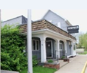
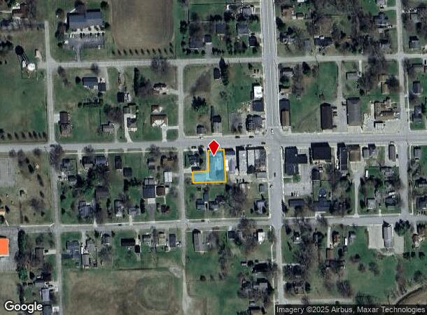
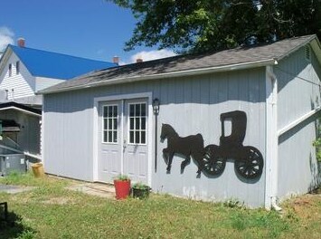
29 W Lapeer St, Peck, MI 48466
NEARBY LISTINGS FOR SALE OR LEASE
Property Detail
29 W Lapeer St
Other Market Areas
Dawsons Addition
071-060-001-004-00
T10N R14E SEC 34 LOT 4 & S 46 FT OF LOT 5 BLK 1 DAWSON'S ADDN TO VILLAGE OF PECK
Commercialnec
Sanilac
2024
Michigan
2025
4-5
971200
0.30 AC
DEMOGRAPHICS near 29 W Lapeer St
1 Mile
3 Mile
5 Mile
2024 Total Population
712
1,179
2,552
2029 Population
690
1,141
2,456
Pop Growth 2024-2029
(3.09%)
(3.22%)
(3.76%)
Average Age
41
41
41
2024 Total Households
268
447
969
HH Growth 2024-2029
(3.73%)
(4.03%)
(4.54%)
Median Household Inc
$53,695
$54,000
$54,354
Avg Household Size
2.50
2.50
2.50
2024 Avg HH Vehicles
2.00
2.00
2.00
Median Home Value
$109,589
$118,421
$136,111
Median Year Built
1969
1970
1972
Nearby Places
Map Layers
Map Styles
 Street
 Aerial
- Restaurants
- Banks
- Shops
- Fitness
- Groceries
SALE & LEASE HISTORY
LISTING DATE
SALE/LEASE

Sep 24, 2016
For Sale
Oct 31, 2017
For Lease
Nearby Properties
Address
Land Use
TOTAL SIZE
Lot Size
Zoning
Address
Land Use
TOTAL SIZE
Lot Size
Zoning
155.50 AC
Address
Land Use
TOTAL SIZE
Lot Size
Zoning
200 AC
Address
Land Use
TOTAL SIZE
Lot Size
Zoning
157.30 AC
Address
Land Use
TOTAL SIZE
Lot Size
Zoning
153 AC
Address
Land Use
TOTAL SIZE
Lot Size
Zoning
158 AC
Address
Land Use
TOTAL SIZE
Lot Size
Zoning
Address
Land Use
TOTAL SIZE
Lot Size
Zoning
157.72 AC
Address
Land Use
TOTAL SIZE
Lot Size
Zoning
157.75 AC
Address
Land Use
TOTAL SIZE
Lot Size
Zoning
98 AC
Address
Land Use
TOTAL SIZE
Lot Size
Zoning
Address
Land Use
TOTAL SIZE
Lot Size
Zoning
150.69 AC
Address
Land Use
TOTAL SIZE
Lot Size
Zoning
85.54 AC
Address
Land Use
TOTAL SIZE
Lot Size
Zoning
158 AC
Address
Land Use
TOTAL SIZE
Lot Size
Zoning
146.90 AC
Address
Land Use
TOTAL SIZE
Lot Size
Zoning
170 AC
Address
Land Use
TOTAL SIZE
Lot Size
Zoning
38 AC
Address
Land Use
TOTAL SIZE
Lot Size
Zoning
120 AC
Address
Land Use
TOTAL SIZE
Lot Size
Zoning
160 AC
Address
Land Use
TOTAL SIZE
Lot Size
Zoning
117 AC
Address
Land Use
TOTAL SIZE
Lot Size
Zoning
120 AC
Address
Land Use
TOTAL SIZE
Lot Size
Zoning
117.05 AC
Address
Land Use
TOTAL SIZE
Lot Size
Zoning
120 AC
Address
Land Use
TOTAL SIZE
Lot Size
Zoning
124.66 AC
Address
Land Use
TOTAL SIZE
Lot Size
Zoning
192.90 AC
Address
Land Use
TOTAL SIZE
Lot Size
Zoning
71.76 AC
Address
Land Use
TOTAL SIZE
Lot Size
Zoning
110 AC
Address
Land Use
TOTAL SIZE
Lot Size
Zoning
119 AC
Address
Land Use
TOTAL SIZE
Lot Size
Zoning
78 AC
Address
Land Use
TOTAL SIZE
Lot Size
Zoning
1.46 AC
Address
Land Use
TOTAL SIZE
Lot Size
Zoning
78 AC
The World's #1 Commercial Real Estate Marketplace
Connect with us
© 2025 CoStar Group
The information above has been obtained from sources believed reliable. While we do not doubt its accuracy we have not verified it and make no guarantee, warranty or representation about it. It is your responsibility to independently confirm its accuracy and completeness. Any projections, opinions, assumptions, or estimates used are for example only and do not represent the current or future performance of the property. The value of this transaction to you depends on tax and other factors which should be evaluated by your tax, financial, and legal advisors. You and your advisors should conduct a careful, independent investigation of the property to determine to your satisfaction the suitability of the property for your needs.