Property Record
290 Turnpike Rd, Westborough, MA 01581


Property Detail
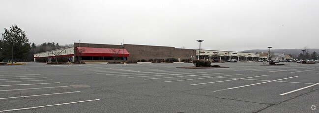
290 Turnpike Rd
Commercialnec
WORCESTER
BA
Massachusetts
A Areas with a 1% annual chance of flooding and a 26% chance of flooding over the life of a 30-year mortgage.
34.34 AC
2025
The Boroughs
2025
Boston
742402
Worcester, MA
184,523 SF
WBOR-000026-000027
NEARBY LISTINGS FOR SALE OR LEASE
DEMOGRAPHICS near 290 Turnpike Rd
1 mile
3 mile
5 mile
2024 Total Population
4,970
37,483
84,051
2029 Population
5,143
38,575
86,640
Pop Growth 2024-2029
+ 3.48%
+ 2.91%
+ 3.08%
Average Age
36
41
41
2024 Total Households
1,803
13,963
31,018
HH Growth 2024-2029
+ 3.66%
+ 3.08%
+ 3.28%
Median Household Inc
$136,345
$140,368
$145,306
Avg Household Size
2.70
2.60
2.70
2024 Avg HH Vehicles
2.00
2.00
2.00
Median Home Value
$720,530
$682,242
$669,924
Median Year Built
1990
1979
1980
Nearby Places
Map Layers
Map Styles
 Street
 Aerial
Transit
 Traffic
 Biking
Places
Listings with unknown addresses are not visible on the map
- Restaurants
- Banks
- Shops
- Fitness
- Groceries
SALE & LEASE HISTORY
LISTING DATE
SALE/LEASE

Sep 25, 2016
For Lease
Nearby Properties
Address
Land Use
TOTAL SIZE
Lot Size
Zoning
Address
Land Use
TOTAL SIZE
Lot Size
Zoning
42.01 AC
I
Address
Land Use
TOTAL SIZE
Lot Size
Zoning
274,000 SF
32 AC
M-1
Address
Land Use
TOTAL SIZE
Lot Size
Zoning
68.85 AC
OFF-RE
Address
Land Use
TOTAL SIZE
Lot Size
Zoning
22.40 AC
COM BU
Address
Land Use
TOTAL SIZE
Lot Size
Zoning
67.29 AC
IB
Address
Land Use
TOTAL SIZE
Lot Size
Zoning
23.65 AC
RUR A
Address
Land Use
TOTAL SIZE
Lot Size
Zoning
19.69 AC
BA
Address
Land Use
TOTAL SIZE
Lot Size
Zoning
375.66 AC
OLI
Address
Land Use
TOTAL SIZE
Lot Size
Zoning
205,712 SF
3.95 AC
BA
Address
Land Use
TOTAL SIZE
Lot Size
Zoning
201,818 SF
5.55 AC
BA
Address
Land Use
TOTAL SIZE
Lot Size
Zoning
205,712 SF
5.76 AC
BA
Address
Land Use
TOTAL SIZE
Lot Size
Zoning
107,308 SF
45.40 AC
M-1
Address
Land Use
TOTAL SIZE
Lot Size
Zoning
15.20 AC
BA
Address
Land Use
TOTAL SIZE
Lot Size
Zoning
412,272 SF
42.44 AC
OFF-RE
Address
Land Use
TOTAL SIZE
Lot Size
Zoning
43.90 AC
M-1
Address
Land Use
TOTAL SIZE
Lot Size
Zoning
21.04 AC
APT 99
Address
Land Use
TOTAL SIZE
Lot Size
Zoning
10.28 AC
R
Address
Land Use
TOTAL SIZE
Lot Size
Zoning
9.70 AC
COM BU
Address
Land Use
TOTAL SIZE
Lot Size
Zoning
134,896 SF
15.10 AC
LIM IN
Address
Land Use
TOTAL SIZE
Lot Size
Zoning
167,438 SF
23.82 AC
I
Address
Land Use
TOTAL SIZE
Lot Size
Zoning
170,000 SF
27.66 AC
BA
Address
Land Use
TOTAL SIZE
Lot Size
Zoning
102,181 SF
38.62 AC
RES B-
Address
Land Use
TOTAL SIZE
Lot Size
Zoning
108,038 SF
19.68 AC
M-1
Address
Land Use
TOTAL SIZE
Lot Size
Zoning
12.96 AC
MF-1
Address
Land Use
TOTAL SIZE
Lot Size
Zoning
10.34 AC
APT 91
Address
Land Use
TOTAL SIZE
Lot Size
Zoning
125,914 SF
111.02 AC
Address
Land Use
TOTAL SIZE
Lot Size
Zoning
19.05 AC
I
Address
Land Use
TOTAL SIZE
Lot Size
Zoning
40.46 AC
R4
Address
Land Use
TOTAL SIZE
Lot Size
Zoning
22.06 AC
COM BU
Address
Land Use
TOTAL SIZE
Lot Size
Zoning
216,518 SF
6.64 AC
R
The World's #1 Commercial Real Estate Marketplace
Connect with us
© 2026 CoStar Group
The information above has been obtained from sources believed reliable. While we do not doubt its accuracy we have not verified it and make no guarantee, warranty or representation about it. It is your responsibility to independently confirm its accuracy and completeness. Any projections, opinions, assumptions, or estimates used are for example only and do not represent the current or future performance of the property. The value of this transaction to you depends on tax and other factors which should be evaluated by your tax, financial, and legal advisors. You and your advisors should conduct a careful, independent investigation of the property to determine to your satisfaction the suitability of the property for your needs.