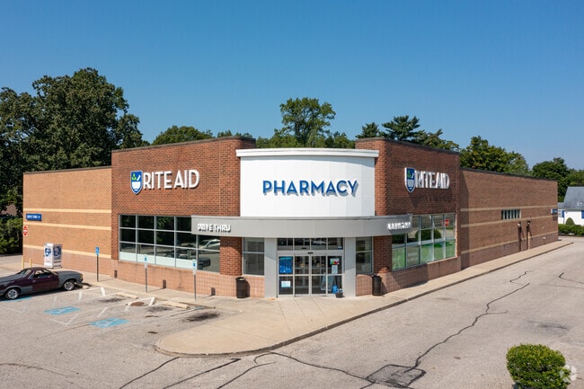
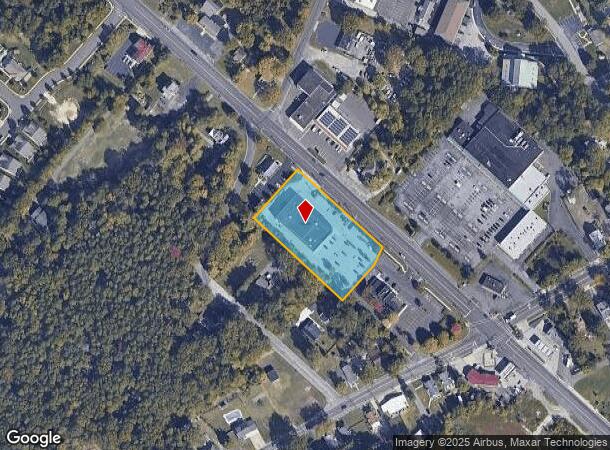
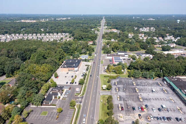
Property Record
290 Front St, Atco, NJ 08004
Current Lease Availabilities
NEARBY LISTINGS FOR SALE OR LEASE
Property Detail
290 Front St
Philadelphia-Camden-Wilmington, PA-NJ-DE-MD
Plan/Lots-Giberson Tr Sec 01
35-00403-0000-00002
ADDITIONAL LOTS: RITE AID/FACILITY NAME: STORE RITE AID
Commercialnec
Camden
X
New Jersey
34007C0145E
2
2024
1.67 AC
2025
South Camden County
606000
Philadelphia
14,594 SF
DEMOGRAPHICS near 290 Front St
1 Mile
3 Mile
5 Mile
2024 Total Population
7,088
24,420
65,559
2029 Population
7,132
24,716
65,794
Pop Growth 2024-2029
+ 0.62%
+ 1.21%
+ 0.36%
Average Age
42
43
41
2024 Total Households
2,785
9,284
24,052
HH Growth 2024-2029
+ 0.72%
+ 1.32%
+ 0.44%
Median Household Inc
$91,006
$94,016
$94,409
Avg Household Size
2.50
2.60
2.70
2024 Avg HH Vehicles
2.00
2.00
2.00
Median Home Value
$249,459
$262,386
$267,801
Median Year Built
1984
1977
1979
Nearby Places
Map Layers
Map Styles
 Street
 Aerial
- Restaurants
- Banks
- Shops
- Fitness
- Groceries
PUBLIC TRANSPORTATION
COMMUTER RAIL
Atco (Atlantic City Line - NJ Transit Commuter Rail (NJ Transit))
DRIVE
WALK
Distance
Atco (Atlantic City Line - NJ Transit Commuter Rail (NJ Transit))
3 min
1.6 mi
Lindenwold (NJT) (Atlantic City Line - NJ Transit Commuter Rail (NJ Transit))
DRIVE
WALK
Distance
Lindenwold (NJT) (Atlantic City Line - NJ Transit Commuter Rail (NJ Transit))
11 min
7.7 mi
AIRPORT
Philadelphia International
DRIVE
WALK
Distance
Philadelphia International
40 min
26.4 mi
Atlantic City International
DRIVE
WALK
Distance
Atlantic City International
60 min
31.5 mi
Nearby Properties
Address
Land Use
TOTAL SIZE
Lot Size
Zoning
Address
Land Use
TOTAL SIZE
Lot Size
Zoning
6,208 SF
30.73 AC
PARC
Address
Land Use
TOTAL SIZE
Lot Size
Zoning
137.33 AC
PR3
Address
Land Use
TOTAL SIZE
Lot Size
Zoning
88.36 AC
PR4
Address
Land Use
TOTAL SIZE
Lot Size
Zoning
73.95 AC
PI3
Address
Land Use
TOTAL SIZE
Lot Size
Zoning
27.18 AC
PR4
Address
Land Use
TOTAL SIZE
Lot Size
Zoning
155 AC
PI
Address
Land Use
TOTAL SIZE
Lot Size
Zoning
69,324 SF
20.26 AC
Address
Land Use
TOTAL SIZE
Lot Size
Zoning
59,361 SF
19.21 AC
INST
Address
Land Use
TOTAL SIZE
Lot Size
Zoning
22.93 AC
PC-2
Address
Land Use
TOTAL SIZE
Lot Size
Zoning
14.10 AC
RD-1
Address
Land Use
TOTAL SIZE
Lot Size
Zoning
8.16 AC
I1
Address
Land Use
TOTAL SIZE
Lot Size
Zoning
8.56 AC
PARC
Address
Land Use
TOTAL SIZE
Lot Size
Zoning
0.42 AC
E-1
Address
Land Use
TOTAL SIZE
Lot Size
Zoning
15,950 SF
12.73 AC
C
Address
Land Use
TOTAL SIZE
Lot Size
Zoning
29,300 SF
3.36 AC
C2
Address
Land Use
TOTAL SIZE
Lot Size
Zoning
5.06 AC
PF
Address
Land Use
TOTAL SIZE
Lot Size
Zoning
15.84 AC
RPF
Address
Land Use
TOTAL SIZE
Lot Size
Zoning
7.07 AC
PF
Address
Land Use
TOTAL SIZE
Lot Size
Zoning
116.11 AC
E-1
Address
Land Use
TOTAL SIZE
Lot Size
Zoning
20.99 AC
C-2
Address
Land Use
TOTAL SIZE
Lot Size
Zoning
4.57 AC
C-3
Address
Land Use
TOTAL SIZE
Lot Size
Zoning
6.20 AC
Address
Land Use
TOTAL SIZE
Lot Size
Zoning
73.95 AC
PI3
Address
Land Use
TOTAL SIZE
Lot Size
Zoning
0.47 AC
C-2
Address
Land Use
TOTAL SIZE
Lot Size
Zoning
5,702 SF
3.28 AC
C-3
Address
Land Use
TOTAL SIZE
Lot Size
Zoning
1,341 SF
1.98 AC
PHB
Address
Land Use
TOTAL SIZE
Lot Size
Zoning
4,746 SF
2.01 AC
C-2
Address
Land Use
TOTAL SIZE
Lot Size
Zoning
Address
Land Use
TOTAL SIZE
Lot Size
Zoning
38.85 AC
PHB
Address
Land Use
TOTAL SIZE
Lot Size
Zoning
2.26 AC
C-2
The World's #1 Commercial Real Estate Marketplace
Connect with us
© 2026 CoStar Group
The information above has been obtained from sources believed reliable. While we do not doubt its accuracy we have not verified it and make no guarantee, warranty or representation about it. It is your responsibility to independently confirm its accuracy and completeness. Any projections, opinions, assumptions, or estimates used are for example only and do not represent the current or future performance of the property. The value of this transaction to you depends on tax and other factors which should be evaluated by your tax, financial, and legal advisors. You and your advisors should conduct a careful, independent investigation of the property to determine to your satisfaction the suitability of the property for your needs.