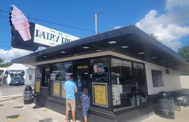
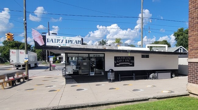
Property Record
290 N Main St, Dunkirk, OH 45836

Property Detail
290 N Main St
03-100020.0000
ORIGINAL 12 PT 13
Restaurantdrivein
Hardin
B and X Area of moderate flood hazard, usually the area between the limits of the 100-year and 500-year floods.
Ohio
2025
0.13 AC
2025
Lima/Findlay
000300
Other Market Areas
568 SF
NEARBY LISTINGS FOR SALE OR LEASE
-
-
View all Dunkirk listings for sale on LoopNet.com
DEMOGRAPHICS near 290 N Main St
1 mile
3 mile
5 mile
2025 Total Population
875
1,551
2,738
2030 Population
854
1,511
2,673
Pop Growth 2025-2030
(2.40%)
(2.58%)
(2.37%)
Average Age
43
43
43
2025 Total Households
362
621
1,070
HH Growth 2025-2030
(2.76%)
(2.90%)
(2.62%)
Median Household Inc
$59,053
$65,763
$70,216
Avg Household Size
2.40
2.50
2.60
2025 Avg HH Vehicles
2.00
2.00
2.00
Median Home Value
$130,219
$148,466
$164,333
Median Year Built
1948
1960
1968
Nearby Places
Map Layers
Map Styles
 Street
 Aerial
Layers
 Traffic
 Biking
Places
Listings with unknown addresses are not visible on the map
- Restaurants
- Banks
- Shops
- Fitness
- Groceries
SALE & LEASE HISTORY
LISTING DATE
SALE/LEASE

May 10, 2023
For Sale
Jan 14, 2025
For Sale
Jan 07, 2019
For Sale
Aug 11, 2025
For Sale
Nearby Properties
Address
Land Use
TOTAL SIZE
Lot Size
Zoning
Address
Land Use
TOTAL SIZE
Lot Size
Zoning
48,274 SF
19.95 AC
Address
Land Use
TOTAL SIZE
Lot Size
Zoning
12.95 AC
Address
Land Use
TOTAL SIZE
Lot Size
Zoning
80 SF
39.39 AC
Address
Land Use
TOTAL SIZE
Lot Size
Zoning
2,084 SF
157.07 AC
Address
Land Use
TOTAL SIZE
Lot Size
Zoning
35.85 AC
Address
Land Use
TOTAL SIZE
Lot Size
Zoning
19,734 SF
1.72 AC
Address
Land Use
TOTAL SIZE
Lot Size
Zoning
5,928 SF
172.26 AC
Address
Land Use
TOTAL SIZE
Lot Size
Zoning
56,651 SF
4.61 AC
Address
Land Use
TOTAL SIZE
Lot Size
Zoning
1.98 AC
Address
Land Use
TOTAL SIZE
Lot Size
Zoning
158.61 AC
Address
Land Use
TOTAL SIZE
Lot Size
Zoning
6,000 SF
1.53 AC
Address
Land Use
TOTAL SIZE
Lot Size
Zoning
23.98 AC
Address
Land Use
TOTAL SIZE
Lot Size
Zoning
117.58 AC
Address
Land Use
TOTAL SIZE
Lot Size
Zoning
140.88 AC
Address
Land Use
TOTAL SIZE
Lot Size
Zoning
40 SF
118.73 AC
Address
Land Use
TOTAL SIZE
Lot Size
Zoning
156 AC
Address
Land Use
TOTAL SIZE
Lot Size
Zoning
7,200 SF
98.35 AC
Address
Land Use
TOTAL SIZE
Lot Size
Zoning
142.19 AC
Address
Land Use
TOTAL SIZE
Lot Size
Zoning
2,100 SF
98.79 AC
Address
Land Use
TOTAL SIZE
Lot Size
Zoning
155.50 AC
Address
Land Use
TOTAL SIZE
Lot Size
Zoning
6,300 SF
0.23 AC
Address
Land Use
TOTAL SIZE
Lot Size
Zoning
126.83 AC
Address
Land Use
TOTAL SIZE
Lot Size
Zoning
144.91 AC
Address
Land Use
TOTAL SIZE
Lot Size
Zoning
8,000 SF
4 AC
Address
Land Use
TOTAL SIZE
Lot Size
Zoning
1,352 SF
118 AC
Address
Land Use
TOTAL SIZE
Lot Size
Zoning
109 AC
Address
Land Use
TOTAL SIZE
Lot Size
Zoning
105.35 AC
Address
Land Use
TOTAL SIZE
Lot Size
Zoning
4,880 SF
0.92 AC
Address
Land Use
TOTAL SIZE
Lot Size
Zoning
2,560 SF
80.71 AC
Address
Land Use
TOTAL SIZE
Lot Size
Zoning
720 SF
100 AC
The World's #1 Commercial Real Estate Marketplace
Connect with us
© 2026 CoStar Group
The information above has been obtained from sources believed reliable. While we do not doubt its accuracy we have not verified it and make no guarantee, warranty or representation about it. It is your responsibility to independently confirm its accuracy and completeness. Any projections, opinions, assumptions, or estimates used are for example only and do not represent the current or future performance of the property. The value of this transaction to you depends on tax and other factors which should be evaluated by your tax, financial, and legal advisors. You and your advisors should conduct a careful, independent investigation of the property to determine to your satisfaction the suitability of the property for your needs.