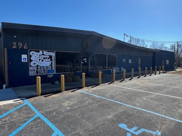
Property Record
290 Richey Rd, Pelzer, SC 29669


Current Lease Availabilities
Property Detail
290 Richey Rd
Greenville-Anderson-Greer, SC
GREENVILLE
0595.02-01-004.09
South Carolina
Storebuilding
1.15 AC
2025
I-85 South/Donaldson
2025
Greenville/Spartanburg
003203
NEARBY LISTINGS FOR SALE OR LEASE
-
-
View all Pelzer listings for lease on LoopNet.com
DEMOGRAPHICS near 290 Richey Rd
1 mile
3 mile
5 mile
2025 Total Population
1,267
7,955
28,288
2030 Population
1,384
8,711
31,122
Pop Growth 2025-2030
+ 9.23%
+ 9.50%
+ 10.02%
Average Age
44
43
40
2025 Total Households
402
2,796
10,400
HH Growth 2025-2030
+ 9.95%
+ 9.98%
+ 10.30%
Median Household Inc
$79,109
$72,798
$68,971
Avg Household Size
2.60
2.60
2.60
2025 Avg HH Vehicles
2.00
2.00
2.00
Median Home Value
$380,611
$321,606
$266,431
Median Year Built
1995
1995
1996
Nearby Places
Map Layers
Map Styles
 Street
 Aerial
Layers
 Traffic
 Biking
Places
Listings with unknown addresses are not visible on the map
- Restaurants
- Banks
- Shops
- Fitness
- Groceries
PUBLIC TRANSPORTATION
AIRPORT
Greenville Spartanburg International
Drive
Walk
Distance
Greenville Spartanburg International
35 min
25.4 mi
Nearby Properties
Address
Land Use
TOTAL SIZE
Lot Size
Zoning
Address
Land Use
TOTAL SIZE
Lot Size
Zoning
3.66 AC
FRD
Address
Land Use
TOTAL SIZE
Lot Size
Zoning
42.70 AC
RMA
Address
Land Use
TOTAL SIZE
Lot Size
Zoning
27.74 AC
UNZONED
Address
Land Use
TOTAL SIZE
Lot Size
Zoning
26.11 AC
BTD
Address
Land Use
TOTAL SIZE
Lot Size
Zoning
18.53 AC
UNZONED
Address
Land Use
TOTAL SIZE
Lot Size
Zoning
1,078 SF
19.29 AC
RR1
Address
Land Use
TOTAL SIZE
Lot Size
Zoning
83.53 AC
UNZONED
Address
Land Use
TOTAL SIZE
Lot Size
Zoning
59.21 AC
RR1
Address
Land Use
TOTAL SIZE
Lot Size
Zoning
69.10 AC
RR1
Address
Land Use
TOTAL SIZE
Lot Size
Zoning
54.70 AC
RR1
Address
Land Use
TOTAL SIZE
Lot Size
Zoning
1,032 SF
11.82 AC
UNZONED
Address
Land Use
TOTAL SIZE
Lot Size
Zoning
2,243 SF
9.40 AC
RR1
Address
Land Use
TOTAL SIZE
Lot Size
Zoning
17.80 AC
RR3
Address
Land Use
TOTAL SIZE
Lot Size
Zoning
20 AC
UNZONED
Address
Land Use
TOTAL SIZE
Lot Size
Zoning
2,730 SF
2.93 AC
UNZONED
Address
Land Use
TOTAL SIZE
Lot Size
Zoning
3,255 SF
5.40 AC
UNZONED
Address
Land Use
TOTAL SIZE
Lot Size
Zoning
6.24 AC
UNZONED
Address
Land Use
TOTAL SIZE
Lot Size
Zoning
13.84 AC
UNZONED
Address
Land Use
TOTAL SIZE
Lot Size
Zoning
18.20 AC
RR1
Address
Land Use
TOTAL SIZE
Lot Size
Zoning
864 SF
53.14 AC
RS
Address
Land Use
TOTAL SIZE
Lot Size
Zoning
10.80 AC
UNZONED
Address
Land Use
TOTAL SIZE
Lot Size
Zoning
14 AC
RR1
Address
Land Use
TOTAL SIZE
Lot Size
Zoning
9.50 AC
UNZONED
Address
Land Use
TOTAL SIZE
Lot Size
Zoning
9.40 AC
RR1
Address
Land Use
TOTAL SIZE
Lot Size
Zoning
45.30 AC
BTD
Address
Land Use
TOTAL SIZE
Lot Size
Zoning
9.77 AC
UNZONED
Address
Land Use
TOTAL SIZE
Lot Size
Zoning
8.48 AC
UNZONED
Address
Land Use
TOTAL SIZE
Lot Size
Zoning
1,560 SF
7.94 AC
UNZONED
Address
Land Use
TOTAL SIZE
Lot Size
Zoning
2.57 AC
Address
Land Use
TOTAL SIZE
Lot Size
Zoning
2.60 AC
UNZONED
The World's #1 Commercial Real Estate Marketplace
Connect with us
© 2026 CoStar Group
The information above has been obtained from sources believed reliable. While we do not doubt its accuracy we have not verified it and make no guarantee, warranty or representation about it. It is your responsibility to independently confirm its accuracy and completeness. Any projections, opinions, assumptions, or estimates used are for example only and do not represent the current or future performance of the property. The value of this transaction to you depends on tax and other factors which should be evaluated by your tax, financial, and legal advisors. You and your advisors should conduct a careful, independent investigation of the property to determine to your satisfaction the suitability of the property for your needs.