Property Record
290 Robert Smalls Pky, Beaufort, SC 29906

NEARBY LISTINGS FOR SALE OR LEASE
-
-
-
-
No Photo
-
View all Beaufort listings for sale on LoopNet.com
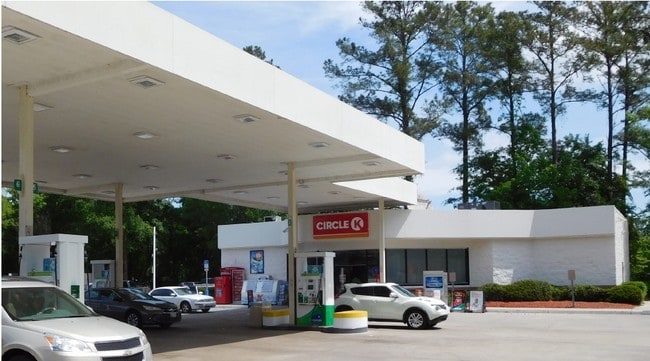
Property Detail
290 Robert Smalls Pky
Other Market Areas
Beaufort West Comm & New Town
Hilton Head Island-Bluffton-Port Royal, SC
LOT B POR OF JOHN GRAY'S PROP PB53 P77 PB56 P103 PB78 P131
R122-029-000-0205-0000
Beaufort
Conveniencestore
South Carolina
2025
b
2024
1.46 AC
000502
Hilton Head/Beaufort
3,284 SF
DEMOGRAPHICS near 290 Robert Smalls Pky
1 Mile
3 Mile
5 Mile
2024 Total Population
1,886
21,738
44,089
2029 Population
2,087
24,065
48,702
Pop Growth 2024-2029
+ 10.66%
+ 10.70%
+ 10.46%
Average Age
36
39
38
2024 Total Households
737
8,753
17,059
HH Growth 2024-2029
+ 10.58%
+ 10.25%
+ 10.45%
Median Household Inc
$48,958
$55,588
$58,061
Avg Household Size
2.50
2.40
2.40
2024 Avg HH Vehicles
2.00
2.00
2.00
Median Home Value
$303,082
$244,758
$271,683
Median Year Built
1997
1990
1991
Nearby Places
Map Layers
Map Styles
 Street
 Aerial
- Restaurants
- Banks
- Shops
- Fitness
- Groceries
PUBLIC TRANSPORTATION
AIRPORT
Hilton Head
DRIVE
WALK
Distance
Hilton Head
46 min
34.8 mi
Savannah/Hilton Head International
DRIVE
WALK
Distance
Savannah/Hilton Head International
60 min
45.9 mi
Freight Ports
Georgia Ports - Savannah
DRIVE
WALK
Distance
Georgia Ports - Savannah
57 min
44.3 mi
SALE & LEASE HISTORY
LISTING DATE
SALE/LEASE

Sep 24, 2016
For Sale
Dec 05, 2017
For Sale
Nearby Properties
Address
Land Use
TOTAL SIZE
Lot Size
Zoning
Address
Land Use
TOTAL SIZE
Lot Size
Zoning
245,864 SF
19.36 AC
6601
Address
Land Use
TOTAL SIZE
Lot Size
Zoning
4,613 AC
6601
Address
Land Use
TOTAL SIZE
Lot Size
Zoning
243,644 SF
13.23 AC
6601
Address
Land Use
TOTAL SIZE
Lot Size
Zoning
24,000 SF
4.45 AC
6601
Address
Land Use
TOTAL SIZE
Lot Size
Zoning
22,944 SF
16.59 AC
6101
Address
Land Use
TOTAL SIZE
Lot Size
Zoning
23,136 SF
9.67 AC
6101
Address
Land Use
TOTAL SIZE
Lot Size
Zoning
101,304 SF
6.47 AC
6611
Address
Land Use
TOTAL SIZE
Lot Size
Zoning
217,792 SF
60 AC
6611
Address
Land Use
TOTAL SIZE
Lot Size
Zoning
103,282 SF
19.22 AC
Address
Land Use
TOTAL SIZE
Lot Size
Zoning
85,656 SF
22.54 AC
6611
Address
Land Use
TOTAL SIZE
Lot Size
Zoning
39,296 SF
2.05 AC
6611
Address
Land Use
TOTAL SIZE
Lot Size
Zoning
34,200 SF
4.18 AC
6601
Address
Land Use
TOTAL SIZE
Lot Size
Zoning
142,753 SF
47.79 AC
6611
Address
Land Use
TOTAL SIZE
Lot Size
Zoning
116,067 SF
27 AC
6611
Address
Land Use
TOTAL SIZE
Lot Size
Zoning
214,795 SF
24.94 AC
6611
Address
Land Use
TOTAL SIZE
Lot Size
Zoning
4,928 SF
4.76 AC
6611
Address
Land Use
TOTAL SIZE
Lot Size
Zoning
60,814 SF
3 AC
Address
Land Use
TOTAL SIZE
Lot Size
Zoning
2,760 SF
4.16 AC
6611
Address
Land Use
TOTAL SIZE
Lot Size
Zoning
6,024 SF
10.60 AC
6611
Address
Land Use
TOTAL SIZE
Lot Size
Zoning
92,125 SF
10.14 AC
6611
Address
Land Use
TOTAL SIZE
Lot Size
Zoning
134,446 SF
19.90 AC
6611
Address
Land Use
TOTAL SIZE
Lot Size
Zoning
67,773 SF
20.19 AC
6611
Address
Land Use
TOTAL SIZE
Lot Size
Zoning
53,684 SF
24.30 AC
6611
Address
Land Use
TOTAL SIZE
Lot Size
Zoning
71,309 SF
2.30 AC
6601
Address
Land Use
TOTAL SIZE
Lot Size
Zoning
44,312 SF
1.87 AC
Address
Land Use
TOTAL SIZE
Lot Size
Zoning
52,322 SF
6.86 AC
6601
Address
Land Use
TOTAL SIZE
Lot Size
Zoning
20,800 SF
12.55 AC
6611
Address
Land Use
TOTAL SIZE
Lot Size
Zoning
53,704 SF
4.76 AC
6611
Address
Land Use
TOTAL SIZE
Lot Size
Zoning
36,020 SF
3.46 AC
6611
The World's #1 Commercial Real Estate Marketplace
Connect with us
© 2026 CoStar Group
The information above has been obtained from sources believed reliable. While we do not doubt its accuracy we have not verified it and make no guarantee, warranty or representation about it. It is your responsibility to independently confirm its accuracy and completeness. Any projections, opinions, assumptions, or estimates used are for example only and do not represent the current or future performance of the property. The value of this transaction to you depends on tax and other factors which should be evaluated by your tax, financial, and legal advisors. You and your advisors should conduct a careful, independent investigation of the property to determine to your satisfaction the suitability of the property for your needs.