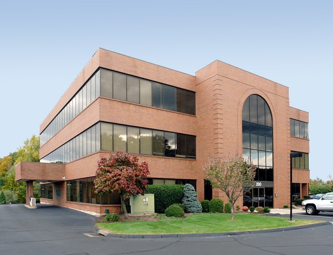
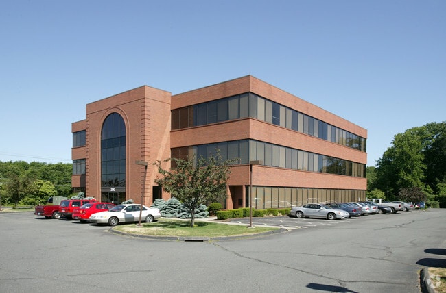
Property Record
290 Roberts St, East Hartford, CT 06108
Current Lease Availabilities
NEARBY LISTINGS FOR SALE OR LEASE
Property Detail
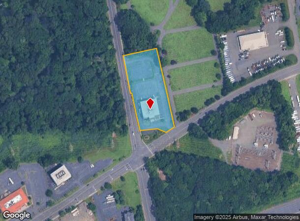
290 Roberts St
EHAR-000035-000000-000012
Hartford
Commercialbuilding
Connecticut
X
12
09003C0388F
2.17 AC
2025
East Hartford
2025
Hartford
510500
Hartford-West Hartford-East Hartford, CT
31,080 SF
DEMOGRAPHICS near 290 Roberts St
1 Mile
3 Mile
5 Mile
2024 Total Population
10,021
62,754
233,549
2029 Population
9,987
62,842
232,631
Pop Growth 2024-2029
(0.34%)
+ 0.14%
(0.39%)
Average Age
37
39
38
2024 Total Households
4,012
25,885
94,654
HH Growth 2024-2029
(0.32%)
+ 0.40%
(0.29%)
Median Household Inc
$51,368
$59,263
$55,232
Avg Household Size
2.40
2.30
2.30
2024 Avg HH Vehicles
1.00
2.00
1.00
Median Home Value
$177,253
$184,593
$209,242
Median Year Built
1965
1963
1959
Nearby Places
Map Layers
Map Styles
 Street
 Aerial
- Restaurants
- Banks
- Shops
- Fitness
- Groceries
PUBLIC TRANSPORTATION
COMMUTER RAIL
DRIVE
WALK
Distance
7 min
3.6 mi
DRIVE
WALK
Distance
7 min
3.6 mi
AIRPORT
Bradley International
DRIVE
WALK
Distance
Bradley International
36 min
19.6 mi
Tweed/New Haven
DRIVE
WALK
Distance
Tweed/New Haven
58 min
42.6 mi
Nearby Properties
Address
Land Use
TOTAL SIZE
Lot Size
Zoning
Address
Land Use
TOTAL SIZE
Lot Size
Zoning
173,601 SF
1.56 AC
DT-1
Address
Land Use
TOTAL SIZE
Lot Size
Zoning
482,566 SF
0.65 AC
DT-2
Address
Land Use
TOTAL SIZE
Lot Size
Zoning
4.13 AC
DT-1
Address
Land Use
TOTAL SIZE
Lot Size
Zoning
213,017 SF
6.21 AC
DT-3
Address
Land Use
TOTAL SIZE
Lot Size
Zoning
149.23 AC
DDD1
Address
Land Use
TOTAL SIZE
Lot Size
Zoning
112.42 AC
DDD1
Address
Land Use
TOTAL SIZE
Lot Size
Zoning
69.42 AC
CT R
Address
Land Use
TOTAL SIZE
Lot Size
Zoning
2,500 SF
74.98 AC
I-2
Address
Land Use
TOTAL SIZE
Lot Size
Zoning
1,125,149 SF
1.14 AC
DT-1
Address
Land Use
TOTAL SIZE
Lot Size
Zoning
9.92 AC
DDD1
Address
Land Use
TOTAL SIZE
Lot Size
Zoning
14.56 AC
SDD/BG
Address
Land Use
TOTAL SIZE
Lot Size
Zoning
235,476 SF
198.32 AC
CT R
Address
Land Use
TOTAL SIZE
Lot Size
Zoning
109,276 SF
11 AC
DDD1
Address
Land Use
TOTAL SIZE
Lot Size
Zoning
36.69 AC
R-5
Address
Land Use
TOTAL SIZE
Lot Size
Zoning
6.63 AC
DT-1
Address
Land Use
TOTAL SIZE
Lot Size
Zoning
2.13 AC
DT-1
Address
Land Use
TOTAL SIZE
Lot Size
Zoning
4.50 AC
DT-1
Address
Land Use
TOTAL SIZE
Lot Size
Zoning
2.04 AC
DT-3
Address
Land Use
TOTAL SIZE
Lot Size
Zoning
10.74 AC
ID-1
Address
Land Use
TOTAL SIZE
Lot Size
Zoning
319,127 SF
2.51 AC
DT-3
Address
Land Use
TOTAL SIZE
Lot Size
Zoning
132,110 SF
1 AC
I
Address
Land Use
TOTAL SIZE
Lot Size
Zoning
13.34 AC
PD
Address
Land Use
TOTAL SIZE
Lot Size
Zoning
43,711 SF
1 AC
I
Address
Land Use
TOTAL SIZE
Lot Size
Zoning
348,943 SF
51.21 AC
R-2
Address
Land Use
TOTAL SIZE
Lot Size
Zoning
717,358 SF
1.70 AC
DT-1
Address
Land Use
TOTAL SIZE
Lot Size
Zoning
457,762 SF
3.54 AC
DT-1
Address
Land Use
TOTAL SIZE
Lot Size
Zoning
742,021 SF
1.32 AC
DT-1
Address
Land Use
TOTAL SIZE
Lot Size
Zoning
130,151 SF
1.05 AC
DT-3
Address
Land Use
TOTAL SIZE
Lot Size
Zoning
Address
Land Use
TOTAL SIZE
Lot Size
Zoning
160,936 SF
2.40 AC
CX-1
The World's #1 Commercial Real Estate Marketplace
Connect with us
© 2026 CoStar Group
The information above has been obtained from sources believed reliable. While we do not doubt its accuracy we have not verified it and make no guarantee, warranty or representation about it. It is your responsibility to independently confirm its accuracy and completeness. Any projections, opinions, assumptions, or estimates used are for example only and do not represent the current or future performance of the property. The value of this transaction to you depends on tax and other factors which should be evaluated by your tax, financial, and legal advisors. You and your advisors should conduct a careful, independent investigation of the property to determine to your satisfaction the suitability of the property for your needs.