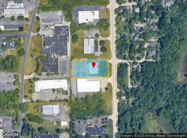
Property Record
290 S Wagner Rd, Ann Arbor, MI 48103


NEARBY LISTINGS FOR SALE OR LEASE
Property Detail
290 S Wagner Rd
Ann Arbor, MI
Jackson Plaza Business Park Sub
08-26-105-013
LOT 3 JACKSON PLAZA BUSINESS PARK SUB.
Commercialnec
Washtenaw
X
Michigan
26161C0241E
3
2025
1.37 AC
2025
Washtenaw W of 23
456000
Detroit
10,200 SF
DEMOGRAPHICS near 290 S Wagner Rd
1 Mile
3 Mile
5 Mile
2024 Total Population
4,196
53,485
124,006
2029 Population
4,153
53,181
122,825
Pop Growth 2024-2029
(1.02%)
(0.57%)
(0.95%)
Average Age
41
39
36
2024 Total Households
1,815
23,509
50,346
HH Growth 2024-2029
(1.10%)
(0.66%)
(0.91%)
Median Household Inc
$108,996
$97,518
$85,081
Avg Household Size
2.30
2.20
2.20
2024 Avg HH Vehicles
2.00
2.00
2.00
Median Home Value
$398,236
$442,912
$442,597
Median Year Built
1985
1970
1976
Nearby Places
Map Layers
Map Styles
 Street
 Aerial
- Restaurants
- Banks
- Shops
- Fitness
- Groceries
PUBLIC TRANSPORTATION
COMMUTER RAIL
Ann Arbor Amtrak Station (Wolverine - Amtrak)
DRIVE
WALK
Distance
Ann Arbor Amtrak Station (Wolverine - Amtrak)
8 min
3.7 mi
AIRPORT
Detroit Metro Wayne County
DRIVE
WALK
Distance
Detroit Metro Wayne County
35 min
28.6 mi
Freight Ports
Port of Toledo
DRIVE
WALK
Distance
Port of Toledo
78 min
61.8 mi
Nearby Properties
Address
Land Use
TOTAL SIZE
Lot Size
Zoning
Address
Land Use
TOTAL SIZE
Lot Size
Zoning
212,047 SF
1.15 AC
D2
Address
Land Use
TOTAL SIZE
Lot Size
Zoning
268,612 SF
0.74 AC
D1
Address
Land Use
TOTAL SIZE
Lot Size
Zoning
186,029 SF
2.06 AC
D2
Address
Land Use
TOTAL SIZE
Lot Size
Zoning
189,221 SF
0.58 AC
D1
Address
Land Use
TOTAL SIZE
Lot Size
Zoning
140,840 SF
0.50 AC
D1
Address
Land Use
TOTAL SIZE
Lot Size
Zoning
140,670 SF
1.63 AC
C2B
Address
Land Use
TOTAL SIZE
Lot Size
Zoning
133,830 SF
0.59 AC
D1
Address
Land Use
TOTAL SIZE
Lot Size
Zoning
177,763 SF
0.91 AC
D2
Address
Land Use
TOTAL SIZE
Lot Size
Zoning
303,524 SF
19.40 AC
R4B
Address
Land Use
TOTAL SIZE
Lot Size
Zoning
333,275 SF
0.65 AC
D1
Address
Land Use
TOTAL SIZE
Lot Size
Zoning
268,002 SF
18.34 AC
Address
Land Use
TOTAL SIZE
Lot Size
Zoning
137,874 SF
0.55 AC
PUD
Address
Land Use
TOTAL SIZE
Lot Size
Zoning
234,076 SF
24.18 AC
R4A
Address
Land Use
TOTAL SIZE
Lot Size
Zoning
359,701 SF
37.70 AC
R4A
Address
Land Use
TOTAL SIZE
Lot Size
Zoning
116,650 SF
0.32 AC
D1
Address
Land Use
TOTAL SIZE
Lot Size
Zoning
231,262 SF
25.82 AC
C3
Address
Land Use
TOTAL SIZE
Lot Size
Zoning
179,981 SF
14.55 AC
R4A
Address
Land Use
TOTAL SIZE
Lot Size
Zoning
3,840 SF
1.55 AC
R4D
Address
Land Use
TOTAL SIZE
Lot Size
Zoning
177,474 SF
58.03 AC
C-2
Address
Land Use
TOTAL SIZE
Lot Size
Zoning
55,700 SF
1.21 AC
R4C
Address
Land Use
TOTAL SIZE
Lot Size
Zoning
182,625 SF
15.89 AC
C3
Address
Land Use
TOTAL SIZE
Lot Size
Zoning
13.77 AC
MR-3
Address
Land Use
TOTAL SIZE
Lot Size
Zoning
74,152 SF
31.63 AC
BI
Address
Land Use
TOTAL SIZE
Lot Size
Zoning
59.07 AC
R-C
Address
Land Use
TOTAL SIZE
Lot Size
Zoning
320 SF
20.95 AC
MR-3
Address
Land Use
TOTAL SIZE
Lot Size
Zoning
80,088 SF
1.44 AC
R4B
Address
Land Use
TOTAL SIZE
Lot Size
Zoning
121,860 SF
0.82 AC
D1
Address
Land Use
TOTAL SIZE
Lot Size
Zoning
102,760 SF
1.10 AC
D1
Address
Land Use
TOTAL SIZE
Lot Size
Zoning
92,340 SF
0.71 AC
PUD
Address
Land Use
TOTAL SIZE
Lot Size
Zoning
85,468 SF
0.33 AC
PUD
The World's #1 Commercial Real Estate Marketplace
Connect with us
© 2025 CoStar Group
The information above has been obtained from sources believed reliable. While we do not doubt its accuracy we have not verified it and make no guarantee, warranty or representation about it. It is your responsibility to independently confirm its accuracy and completeness. Any projections, opinions, assumptions, or estimates used are for example only and do not represent the current or future performance of the property. The value of this transaction to you depends on tax and other factors which should be evaluated by your tax, financial, and legal advisors. You and your advisors should conduct a careful, independent investigation of the property to determine to your satisfaction the suitability of the property for your needs.