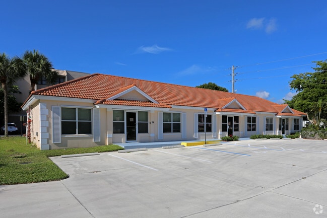
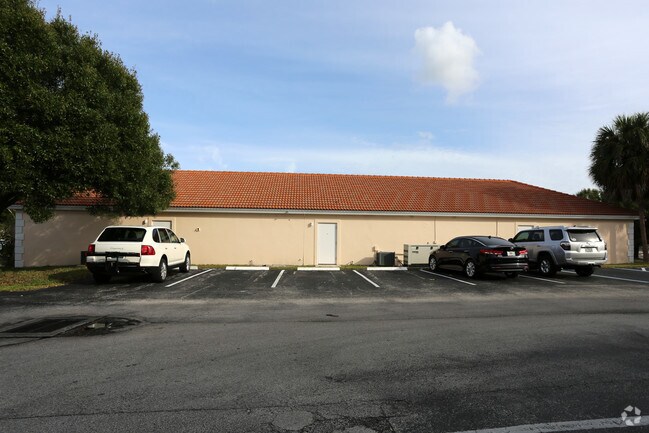
Property Record
290 Se Florida St, Stuart, FL 34994
NEARBY LISTINGS FOR SALE OR LEASE
Property Detail
290 Se Florida St
Port St. Lucie, FL
Hillcrest And Lincoln Park
04-38-41-009-001-00380-5
THE SOUTH 12.5 FEET OF LOT 38 & ALL OF LOTS 39 40 41 AND 42 BLOCK 1 HILLCREST ACCORDING TO THE PLAT THEREOF RECORDED IN PLAT BOOK 5 PAGE 14 PUBLIC RECORDS PALM BEACH NOW MARTIN COUNTY FLORIDA
Storemultistory
Martin
X
Florida
12085C0153H
38,39
2024
0.31 AC
2025
Port St Lucie
001000
Port St Lucie/Fort Pierce
3,520 SF
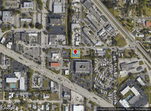
DEMOGRAPHICS near 290 Se Florida St
1 mile
3 mile
5 mile
2024 Total Population
8,260
52,849
105,445
2029 Population
8,806
56,011
112,290
Pop Growth 2024-2029
+ 6.61%
+ 5.98%
+ 6.49%
Average Age
47
48
48
2024 Total Households
3,595
23,838
46,484
HH Growth 2024-2029
+ 6.70%
+ 6.09%
+ 6.63%
Median Household Inc
$46,739
$58,069
$66,803
Avg Household Size
2.00
2.10
2.20
2024 Avg HH Vehicles
1.00
2.00
2.00
Median Home Value
$189,802
$294,924
$352,875
Median Year Built
1977
1983
1985
Nearby Places
Map Layers
Map Styles
 Street
 Aerial
Transit
 Traffic
 Biking
Places
Listings with unknown addresses are not visible on the map
- Restaurants
- Banks
- Shops
- Fitness
- Groceries
SALE & LEASE HISTORY
LISTING DATE
SALE/LEASE

Nov 01, 2016
For Lease
Jun 28, 2017
For Lease
Jun 20, 2019
For Lease
Jun 20, 2019
For Sale
Aug 29, 2017
For Sale
Nearby Properties
Address
Land Use
TOTAL SIZE
Lot Size
Zoning
Address
Land Use
TOTAL SIZE
Lot Size
Zoning
609,195 SF
13.77 AC
H
Address
Land Use
TOTAL SIZE
Lot Size
Zoning
436,532 SF
636.83 AC
PAF
Address
Land Use
TOTAL SIZE
Lot Size
Zoning
309,276 SF
13.73 AC
CPUD
Address
Land Use
TOTAL SIZE
Lot Size
Zoning
232,042 SF
30.99 AC
PUDR
Address
Land Use
TOTAL SIZE
Lot Size
Zoning
15.79 AC
Address
Land Use
TOTAL SIZE
Lot Size
Zoning
378,814 SF
34.25 AC
PUDR
Address
Land Use
TOTAL SIZE
Lot Size
Zoning
14.86 AC
M1
Address
Land Use
TOTAL SIZE
Lot Size
Zoning
310,460 SF
48.85 AC
PS2
Address
Land Use
TOTAL SIZE
Lot Size
Zoning
6.66 AC
RPUD
Address
Land Use
TOTAL SIZE
Lot Size
Zoning
23.08 AC
RM8
Address
Land Use
TOTAL SIZE
Lot Size
Zoning
9.45 AC
RS6
Address
Land Use
TOTAL SIZE
Lot Size
Zoning
200,686 SF
9.98 AC
RPUD
Address
Land Use
TOTAL SIZE
Lot Size
Zoning
284,610 SF
33.04 AC
R3
Address
Land Use
TOTAL SIZE
Lot Size
Zoning
195,729 SF
20.25 AC
CPUD
Address
Land Use
TOTAL SIZE
Lot Size
Zoning
545,151 SF
62.49 AC
PAF
Address
Land Use
TOTAL SIZE
Lot Size
Zoning
85,872 SF
7.91 AC
CPUD
Address
Land Use
TOTAL SIZE
Lot Size
Zoning
334,117 SF
54 AC
RPUD
Address
Land Use
TOTAL SIZE
Lot Size
Zoning
127,238 SF
3.62 AC
P
Address
Land Use
TOTAL SIZE
Lot Size
Zoning
307,010 SF
33.70 AC
CPUD
Address
Land Use
TOTAL SIZE
Lot Size
Zoning
189,035 SF
20.63 AC
R3
Address
Land Use
TOTAL SIZE
Lot Size
Zoning
212,454 SF
33.77 AC
CPUD
Address
Land Use
TOTAL SIZE
Lot Size
Zoning
171,655 SF
15.17 AC
B2
Address
Land Use
TOTAL SIZE
Lot Size
Zoning
136,615 SF
21.72 AC
Address
Land Use
TOTAL SIZE
Lot Size
Zoning
1,050 SF
5.33 AC
R3
Address
Land Use
TOTAL SIZE
Lot Size
Zoning
23,640 SF
15.28 AC
B2
Address
Land Use
TOTAL SIZE
Lot Size
Zoning
59,023 SF
12.31 AC
Address
Land Use
TOTAL SIZE
Lot Size
Zoning
124,082 SF
4.60 AC
P
Address
Land Use
TOTAL SIZE
Lot Size
Zoning
10,520 SF
88.85 AC
TP
Address
Land Use
TOTAL SIZE
Lot Size
Zoning
2,221 SF
18.12 AC
R3A
Address
Land Use
TOTAL SIZE
Lot Size
Zoning
2,400 SF
7.31 AC
INDUST
The World's #1 Commercial Real Estate Marketplace
Connect with us
© 2026 CoStar Group
The information above has been obtained from sources believed reliable. While we do not doubt its accuracy we have not verified it and make no guarantee, warranty or representation about it. It is your responsibility to independently confirm its accuracy and completeness. Any projections, opinions, assumptions, or estimates used are for example only and do not represent the current or future performance of the property. The value of this transaction to you depends on tax and other factors which should be evaluated by your tax, financial, and legal advisors. You and your advisors should conduct a careful, independent investigation of the property to determine to your satisfaction the suitability of the property for your needs.