Property Record
290 Summer St, Yarmouth Port, MA 02675
NEARBY LISTINGS FOR SALE OR LEASE
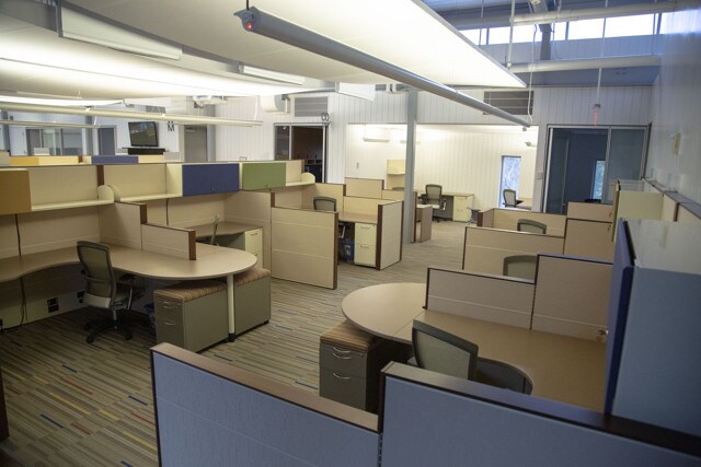
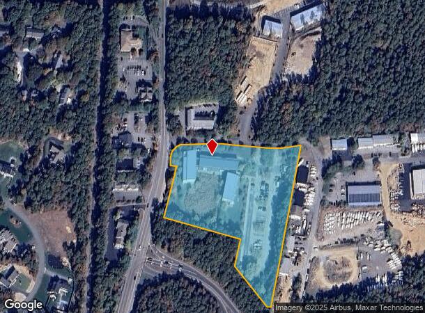
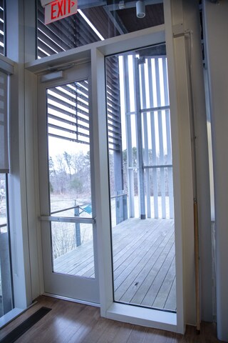
Property Detail
290 Summer St
Charitableorganization
Barnstable
X
Massachusetts
25001C0559J
5.13 AC
0
Other Market Areas
2025
Barnstable Town, MA
011802
YARM-000093-000034-010000
37,182 SF
DEMOGRAPHICS near 290 Summer St
1 Mile
3 Mile
5 Mile
2024 Total Population
815
21,866
56,280
2029 Population
810
22,312
58,088
Pop Growth 2024-2029
(0.61%)
+ 2.04%
+ 3.21%
Average Age
49
47
48
2024 Total Households
340
9,536
25,095
HH Growth 2024-2029
(0.88%)
+ 1.88%
+ 3.19%
Median Household Inc
$115,073
$74,343
$72,704
Avg Household Size
2.30
2.20
2.10
2024 Avg HH Vehicles
2.00
2.00
2.00
Median Home Value
$487,825
$437,491
$451,955
Median Year Built
1980
1975
1973
Nearby Places
Map Layers
Map Styles
 Street
 Aerial
- Restaurants
- Banks
- Shops
- Fitness
- Groceries
PUBLIC TRANSPORTATION
COMMUTER RAIL
Hyannis (CapeFLYER - Cape Cod Regional Transit Authority)
DRIVE
WALK
Distance
Hyannis (CapeFLYER - Cape Cod Regional Transit Authority)
5 min
2.4 mi
AIRPORT
Martha's Vineyard
DRIVE
WALK
Distance
Martha's Vineyard
110 min
42.6 mi
Freight Ports
Port of New Bedford Harbor
DRIVE
WALK
Distance
Port of New Bedford Harbor
68 min
49.1 mi
SALE & LEASE HISTORY
LISTING DATE
SALE/LEASE

Feb 11, 2019
For Lease
Nearby Properties
Address
Land Use
TOTAL SIZE
Lot Size
Zoning
Address
Land Use
TOTAL SIZE
Lot Size
Zoning
10.68 AC
Address
Land Use
TOTAL SIZE
Lot Size
Zoning
25.88 AC
HB;B
Address
Land Use
TOTAL SIZE
Lot Size
Zoning
298,272 SF
9.34 AC
IN
Address
Land Use
TOTAL SIZE
Lot Size
Zoning
17.95 AC
VB-A;R
Address
Land Use
TOTAL SIZE
Lot Size
Zoning
11,698 SF
34.50 AC
Address
Land Use
TOTAL SIZE
Lot Size
Zoning
14.34 AC
B;IND
Address
Land Use
TOTAL SIZE
Lot Size
Zoning
110,415 SF
70 AC
Address
Land Use
TOTAL SIZE
Lot Size
Zoning
12.82 AC
B;HB
Address
Land Use
TOTAL SIZE
Lot Size
Zoning
43.50 AC
IN
Address
Land Use
TOTAL SIZE
Lot Size
Zoning
177,385 SF
39.53 AC
Address
Land Use
TOTAL SIZE
Lot Size
Zoning
54,172 SF
17.97 AC
IND;B;
Address
Land Use
TOTAL SIZE
Lot Size
Zoning
67,000 SF
9.15 AC
HB;B
Address
Land Use
TOTAL SIZE
Lot Size
Zoning
117,584 SF
9.68 AC
IND;B
Address
Land Use
TOTAL SIZE
Lot Size
Zoning
32.95 AC
IN
Address
Land Use
TOTAL SIZE
Lot Size
Zoning
106,197 SF
8.13 AC
Address
Land Use
TOTAL SIZE
Lot Size
Zoning
167,800 SF
9.73 AC
IN
Address
Land Use
TOTAL SIZE
Lot Size
Zoning
90,837 SF
11.66 AC
IN
Address
Land Use
TOTAL SIZE
Lot Size
Zoning
13.46 AC
IN
Address
Land Use
TOTAL SIZE
Lot Size
Zoning
118,274 SF
7.42 AC
Address
Land Use
TOTAL SIZE
Lot Size
Zoning
99,248 SF
4.73 AC
HB;B
Address
Land Use
TOTAL SIZE
Lot Size
Zoning
54,688 SF
10.02 AC
B;RG;R
Address
Land Use
TOTAL SIZE
Lot Size
Zoning
4,800 SF
414.61 AC
Address
Land Use
TOTAL SIZE
Lot Size
Zoning
7.08 AC
Address
Land Use
TOTAL SIZE
Lot Size
Zoning
5.01 AC
HVB;HD
Address
Land Use
TOTAL SIZE
Lot Size
Zoning
8.09 AC
Address
Land Use
TOTAL SIZE
Lot Size
Zoning
16.63 AC
IN
Address
Land Use
TOTAL SIZE
Lot Size
Zoning
180,973 SF
11.78 AC
Address
Land Use
TOTAL SIZE
Lot Size
Zoning
74,841 SF
6.45 AC
HB;B
Address
Land Use
TOTAL SIZE
Lot Size
Zoning
80,464 SF
3.50 AC
HB;B
Address
Land Use
TOTAL SIZE
Lot Size
Zoning
2,084 SF
20.03 AC
The World's #1 Commercial Real Estate Marketplace
Connect with us
© 2026 CoStar Group
The information above has been obtained from sources believed reliable. While we do not doubt its accuracy we have not verified it and make no guarantee, warranty or representation about it. It is your responsibility to independently confirm its accuracy and completeness. Any projections, opinions, assumptions, or estimates used are for example only and do not represent the current or future performance of the property. The value of this transaction to you depends on tax and other factors which should be evaluated by your tax, financial, and legal advisors. You and your advisors should conduct a careful, independent investigation of the property to determine to your satisfaction the suitability of the property for your needs.