Property Record
290 Towpath Rd, Fairless Hills, PA 19030
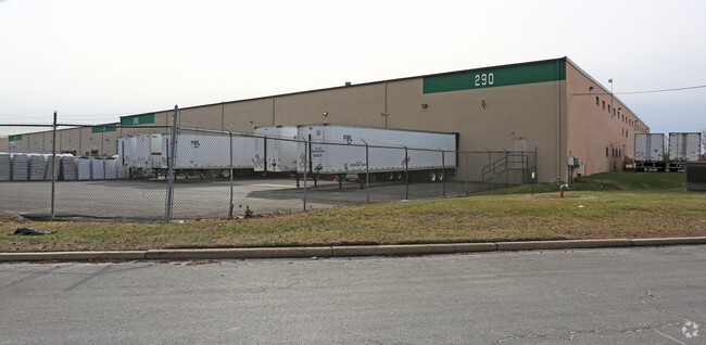


Property Detail
290 Towpath Rd
13-028-090
4.23 AC 558 W S CANAL RD 3303 N NEWBOLD RD WS OF CANAL RD
Warehouse
BUCKS
PIP
Pennsylvania
B and X Area of moderate flood hazard, usually the area between the limits of the 100-year and 500-year floods.
4.23 AC
2024
Bucks
2025
Philadelphia
105809
Philadelphia-Camden-Wilmington, PA-NJ-DE-MD
61,200 SF
NEARBY LISTINGS FOR SALE OR LEASE
DEMOGRAPHICS near 290 Towpath Rd
1 mile
3 mile
5 mile
2025 Total Population
2,523
108,729
257,412
2030 Population
2,526
110,928
262,610
Pop Growth 2025-2030
+ 0.12%
+ 2.02%
+ 2.02%
Average Age
40
38
40
2025 Total Households
1,043
39,003
94,347
HH Growth 2025-2030
+ 0.10%
+ 2.18%
+ 2.17%
Median Household Inc
$88,993
$68,523
$77,901
Avg Household Size
2.40
2.70
2.60
2025 Avg HH Vehicles
2.00
2.00
2.00
Median Home Value
$264,034
$315,875
$315,531
Median Year Built
1954
1953
1955
Nearby Places
Map Layers
Map Styles
 Street
 Aerial
Layers
 Traffic
 Biking
Places
Listings with unknown addresses are not visible on the map
- Restaurants
- Banks
- Shops
- Fitness
- Groceries
PUBLIC TRANSPORTATION
COMMUTER RAIL
Drive
Walk
Distance
11 min
5.2 mi
Levittown (R7 - Southeastern Pennsylvania Transportation Authority Regional Rail (SEPTA Regional Rail))
Drive
Walk
Distance
Levittown (R7 - Southeastern Pennsylvania Transportation Authority Regional Rail (SEPTA Regional Rail))
11 min
5.3 mi
AIRPORT
Trenton Mercer
Drive
Walk
Distance
Trenton Mercer
21 min
10.0 mi
Philadelphia International
Drive
Walk
Distance
Philadelphia International
63 min
38.6 mi
Freight Ports
Port of Philadelphia
Drive
Walk
Distance
Port of Philadelphia
43 min
25.0 mi
SALE & LEASE HISTORY
LISTING DATE
SALE/LEASE

Feb 21, 2018
For Lease
Nearby Properties
Address
Land Use
TOTAL SIZE
Lot Size
Zoning
Address
Land Use
TOTAL SIZE
Lot Size
Zoning
8.23 AC
BA
Address
Land Use
TOTAL SIZE
Lot Size
Zoning
26 AC
HIST
Address
Land Use
TOTAL SIZE
Lot Size
Zoning
6.69 AC
BA
Address
Land Use
TOTAL SIZE
Lot Size
Zoning
13.73 AC
Address
Land Use
TOTAL SIZE
Lot Size
Zoning
Address
Land Use
TOTAL SIZE
Lot Size
Zoning
879,376 SF
2.54 AC
BA
Address
Land Use
TOTAL SIZE
Lot Size
Zoning
43,715 SF
49.95 AC
Address
Land Use
TOTAL SIZE
Lot Size
Zoning
125,000 SF
3.68 AC
MU
Address
Land Use
TOTAL SIZE
Lot Size
Zoning
104,448 SF
8.49 AC
IA
Address
Land Use
TOTAL SIZE
Lot Size
Zoning
288,000 SF
1.23 AC
BA
Address
Land Use
TOTAL SIZE
Lot Size
Zoning
0.24 AC
BA
Address
Land Use
TOTAL SIZE
Lot Size
Zoning
186,960 SF
2.37 AC
BA
Address
Land Use
TOTAL SIZE
Lot Size
Zoning
212,074 SF
0.82 AC
BA
Address
Land Use
TOTAL SIZE
Lot Size
Zoning
13.85 AC
MU
Address
Land Use
TOTAL SIZE
Lot Size
Zoning
58,620 SF
1.95 AC
PM
Address
Land Use
TOTAL SIZE
Lot Size
Zoning
161,080 SF
2.21 AC
BA
Address
Land Use
TOTAL SIZE
Lot Size
Zoning
41,000 SF
0.91 AC
HIST
Address
Land Use
TOTAL SIZE
Lot Size
Zoning
7,724 SF
2.06 AC
BA
Address
Land Use
TOTAL SIZE
Lot Size
Zoning
4.07 AC
MU
Address
Land Use
TOTAL SIZE
Lot Size
Zoning
357 SF
0.96 AC
HIST
Address
Land Use
TOTAL SIZE
Lot Size
Zoning
260,160 SF
0.84 AC
BA
Address
Land Use
TOTAL SIZE
Lot Size
Zoning
57,500 SF
0.77 AC
BA
Address
Land Use
TOTAL SIZE
Lot Size
Zoning
112,840 SF
Address
Land Use
TOTAL SIZE
Lot Size
Zoning
2.60 AC
BA
Address
Land Use
TOTAL SIZE
Lot Size
Zoning
120,120 SF
0.90 AC
BA
Address
Land Use
TOTAL SIZE
Lot Size
Zoning
91,550 SF
5.35 AC
IA
Address
Land Use
TOTAL SIZE
Lot Size
Zoning
106,832 SF
0.77 AC
BA
Address
Land Use
TOTAL SIZE
Lot Size
Zoning
43,608 SF
0.80 AC
BB
Address
Land Use
TOTAL SIZE
Lot Size
Zoning
173,385 SF
1.78 AC
MU
Address
Land Use
TOTAL SIZE
Lot Size
Zoning
2.69 AC
BA
The World's #1 Commercial Real Estate Marketplace
Connect with us
© 2026 CoStar Group
The information above has been obtained from sources believed reliable. While we do not doubt its accuracy we have not verified it and make no guarantee, warranty or representation about it. It is your responsibility to independently confirm its accuracy and completeness. Any projections, opinions, assumptions, or estimates used are for example only and do not represent the current or future performance of the property. The value of this transaction to you depends on tax and other factors which should be evaluated by your tax, financial, and legal advisors. You and your advisors should conduct a careful, independent investigation of the property to determine to your satisfaction the suitability of the property for your needs.