Property Record
290 W Copans Rd, Pompano Beach, FL 33064


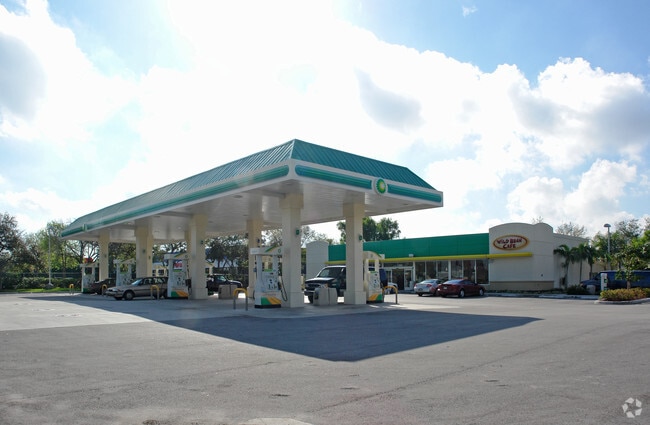

Property Detail
290 W Copans Rd
48-42-26-33-0010
COPANS COMMERCIAL #1 114-19 B PARCEL A LESS COMM NE COR SAID PARCEL A;W ALG N/L PAR A 112.35 TO POB CONT W 67.69;SW 3.55;E 70.22;NE 2.50 TO POB DESC IN OR 43724/873 FOR RD
Servicestationmarket
Broward
B-2
Florida
AH Areas with a 1% annual chance of shallow flooding, usually in the form of a pond, withan average depth ranging from 1 to 3 feet. These areas have a 26% chance of flooding over the life of a 30-year mortgage.
1 AC
2025
Pompano Beach
2026
South Florida
030302
Fort Lauderdale-Pompano Beach-Sunrise, FL
4,224 SF
NEARBY LISTINGS FOR SALE OR LEASE
DEMOGRAPHICS near 290 W Copans Rd
1 mile
3 mile
5 mile
2025 Total Population
15,102
134,281
341,931
2030 Population
15,861
143,186
367,026
Pop Growth 2025-2030
+ 5.03%
+ 6.63%
+ 7.34%
Average Age
39
42
45
2025 Total Households
5,020
53,707
150,738
HH Growth 2025-2030
+ 4.82%
+ 6.74%
+ 7.55%
Median Household Inc
$64,508
$64,948
$67,685
Avg Household Size
2.80
2.30
2.20
2025 Avg HH Vehicles
2.00
2.00
1.00
Median Home Value
$281,167
$392,803
$410,170
Median Year Built
1971
1974
1976
Nearby Places
Map Layers
Map Styles
 Street
 Aerial
Layers
 Traffic
 Biking
Places
Listings with unknown addresses are not visible on the map
- Restaurants
- Banks
- Shops
- Fitness
- Groceries
PUBLIC TRANSPORTATION
COMMUTER RAIL
Pompano Beach (Tri-County Commuter - South Florida Regional Transportation Authority (Tri-Rail))
Drive
Walk
Distance
Pompano Beach (Tri-County Commuter - South Florida Regional Transportation Authority (Tri-Rail))
5 min
1.9 mi
Cypress Creek (Tri-County Commuter - South Florida Regional Transportation Authority (Tri-Rail))
Drive
Walk
Distance
Cypress Creek (Tri-County Commuter - South Florida Regional Transportation Authority (Tri-Rail))
10 min
5.6 mi
AIRPORT
Fort Lauderdale/Hollywood International
Drive
Walk
Distance
Fort Lauderdale/Hollywood International
25 min
16.9 mi
Palm Beach International
Drive
Walk
Distance
Palm Beach International
43 min
33.1 mi
Miami International
Drive
Walk
Distance
Miami International
61 min
42.0 mi
Nearby Properties
Address
Land Use
TOTAL SIZE
Lot Size
Zoning
Address
Land Use
TOTAL SIZE
Lot Size
Zoning
1,724,503 SF
64.97 AC
LAC
Address
Land Use
TOTAL SIZE
Lot Size
Zoning
696,020 SF
31.74 AC
OPC
Address
Land Use
TOTAL SIZE
Lot Size
Zoning
32,538 SF
331.51 AC
P
Address
Land Use
TOTAL SIZE
Lot Size
Zoning
513,748 SF
2.99 AC
TO-EOD
Address
Land Use
TOTAL SIZE
Lot Size
Zoning
561,250 SF
137.82 AC
T
Address
Land Use
TOTAL SIZE
Lot Size
Zoning
467,722 SF
36.71 AC
I-1
Address
Land Use
TOTAL SIZE
Lot Size
Zoning
667,120 SF
12.75 AC
PCD
Address
Land Use
TOTAL SIZE
Lot Size
Zoning
161,512 SF
16.39 AC
RPC
Address
Land Use
TOTAL SIZE
Lot Size
Zoning
396,092 SF
1.81 AC
TO-DPOD
Address
Land Use
TOTAL SIZE
Lot Size
Zoning
457,033 SF
1.96 AC
TO-EOD
Address
Land Use
TOTAL SIZE
Lot Size
Zoning
380,866 SF
26.23 AC
O-IP/PCD
Address
Land Use
TOTAL SIZE
Lot Size
Zoning
392,222 SF
5.33 AC
RPUD
Address
Land Use
TOTAL SIZE
Lot Size
Zoning
285,335 SF
8.56 AC
RM-45
Address
Land Use
TOTAL SIZE
Lot Size
Zoning
406,839 SF
1.61 AC
RPUD
Address
Land Use
TOTAL SIZE
Lot Size
Zoning
434,859 SF
38.72 AC
CF
Address
Land Use
TOTAL SIZE
Lot Size
Zoning
548,682 SF
21.63 AC
CF
Address
Land Use
TOTAL SIZE
Lot Size
Zoning
399,854 SF
1.60 AC
TO-EOD
Address
Land Use
TOTAL SIZE
Lot Size
Zoning
374,776 SF
23.52 AC
I-1
Address
Land Use
TOTAL SIZE
Lot Size
Zoning
184,184 SF
2.98 AC
RM-45/HR
Address
Land Use
TOTAL SIZE
Lot Size
Zoning
192,214 SF
10.84 AC
B-3/PCD
Address
Land Use
TOTAL SIZE
Lot Size
Zoning
435,201 SF
23.78 AC
I-1
Address
Land Use
TOTAL SIZE
Lot Size
Zoning
283,330 SF
27.02 AC
I-1/PCI
Address
Land Use
TOTAL SIZE
Lot Size
Zoning
313,030 SF
37.22 AC
CF
Address
Land Use
TOTAL SIZE
Lot Size
Zoning
10,315 SF
37.74 AC
PCD
Address
Land Use
TOTAL SIZE
Lot Size
Zoning
304,201 SF
1.24 AC
TO-EOD
Address
Land Use
TOTAL SIZE
Lot Size
Zoning
224,769 SF
15.48 AC
I-1
Address
Land Use
TOTAL SIZE
Lot Size
Zoning
248,274 SF
13.10 AC
RM-20
Address
Land Use
TOTAL SIZE
Lot Size
Zoning
171,306 SF
0.81 AC
TO-EOD
Address
Land Use
TOTAL SIZE
Lot Size
Zoning
249,657 SF
17.49 AC
I-1/PCD
Address
Land Use
TOTAL SIZE
Lot Size
Zoning
210,299 SF
15.19 AC
B-3/PCD
The World's #1 Commercial Real Estate Marketplace
Connect with us
© 2026 CoStar Group
The information above has been obtained from sources believed reliable. While we do not doubt its accuracy we have not verified it and make no guarantee, warranty or representation about it. It is your responsibility to independently confirm its accuracy and completeness. Any projections, opinions, assumptions, or estimates used are for example only and do not represent the current or future performance of the property. The value of this transaction to you depends on tax and other factors which should be evaluated by your tax, financial, and legal advisors. You and your advisors should conduct a careful, independent investigation of the property to determine to your satisfaction the suitability of the property for your needs.