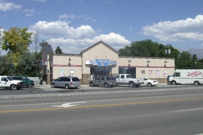
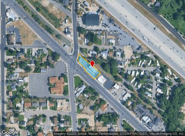
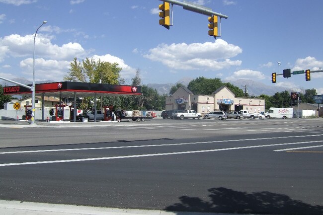
Property Record
290 W State St, Lehi, UT 84043
NEARBY LISTINGS FOR SALE OR LEASE
Property Detail
290 W State St
Provo-Orem, UT
COM N 1119.93 FT & W 1330.25 FT FR E 1/4 COR. SEC. 8, T5S, R1E, SLB&M.; S 49 DEG 33 0 E 277.19 FT; S 44 DEG 30 0 W 90 FT; N 45 DEG 43 0 W 128.7 FT; N 44 DEG 1 6 E 15.99 FT; N 45 DEG 58 54 W 93 FT; N 18 DEG 22 20 W 36.27 FT; N 14 DEG 44 52 E 45.12 FT
12-040-0075
Utah
Storebuilding
Utah
2024
0.43 AC
2025
Utah County
000102
Salt Lake City
3,333 SF
DEMOGRAPHICS near 290 W State St
1 Mile
3 Mile
5 Mile
2024 Total Population
10,807
89,739
177,899
2029 Population
12,647
105,503
209,542
Pop Growth 2024-2029
+ 17.03%
+ 17.57%
+ 17.79%
Average Age
32
30
31
2024 Total Households
3,043
23,955
48,532
HH Growth 2024-2029
+ 17.42%
+ 17.98%
+ 18.22%
Median Household Inc
$97,686
$117,634
$113,945
Avg Household Size
3.50
3.70
3.60
2024 Avg HH Vehicles
3.00
2.00
2.00
Median Home Value
$497,398
$540,693
$520,875
Median Year Built
1993
2006
2007
Nearby Places
Map Layers
Map Styles
 Street
 Aerial
- Restaurants
- Banks
- Shops
- Fitness
- Groceries
PUBLIC TRANSPORTATION
COMMUTER RAIL
Lehi Station (FrontRunner - Utah Transit Authority (UTA))
DRIVE
WALK
Distance
Lehi Station (FrontRunner - Utah Transit Authority (UTA))
8 min
3.1 mi
American Fork Station (FrontRunner - Utah Transit Authority (UTA))
DRIVE
WALK
Distance
American Fork Station (FrontRunner - Utah Transit Authority (UTA))
7 min
3.4 mi
AIRPORT
Provo Municipal
DRIVE
WALK
Distance
Provo Municipal
25 min
18.6 mi
Salt Lake City International
DRIVE
WALK
Distance
Salt Lake City International
38 min
32.0 mi
Freight Ports
Port of Stockton
DRIVE
WALK
Distance
Port of Stockton
738 min
722.3 mi
Nearby Properties
Address
Land Use
TOTAL SIZE
Lot Size
Zoning
Address
Land Use
TOTAL SIZE
Lot Size
Zoning
2,586,860 SF
99.85 AC
Address
Land Use
TOTAL SIZE
Lot Size
Zoning
264,805 SF
16.20 AC
Address
Land Use
TOTAL SIZE
Lot Size
Zoning
130,480 SF
27.19 AC
Address
Land Use
TOTAL SIZE
Lot Size
Zoning
36.17 AC
Address
Land Use
TOTAL SIZE
Lot Size
Zoning
313,847 SF
35.44 AC
Address
Land Use
TOTAL SIZE
Lot Size
Zoning
130,480 SF
25.12 AC
Address
Land Use
TOTAL SIZE
Lot Size
Zoning
376,499 SF
5.22 AC
Address
Land Use
TOTAL SIZE
Lot Size
Zoning
330,039 SF
10.08 AC
Address
Land Use
TOTAL SIZE
Lot Size
Zoning
386,065 SF
26.62 AC
Address
Land Use
TOTAL SIZE
Lot Size
Zoning
301,411 SF
13.27 AC
Address
Land Use
TOTAL SIZE
Lot Size
Zoning
166,233 SF
8.70 AC
Address
Land Use
TOTAL SIZE
Lot Size
Zoning
118,569 SF
23.63 AC
Address
Land Use
TOTAL SIZE
Lot Size
Zoning
374,937 SF
18.37 AC
Address
Land Use
TOTAL SIZE
Lot Size
Zoning
545,572 SF
182.84 AC
Address
Land Use
TOTAL SIZE
Lot Size
Zoning
281,215 SF
15.30 AC
Address
Land Use
TOTAL SIZE
Lot Size
Zoning
359,445 SF
6.46 AC
Address
Land Use
TOTAL SIZE
Lot Size
Zoning
186,256 SF
4.19 AC
Address
Land Use
TOTAL SIZE
Lot Size
Zoning
131,961 SF
7.57 AC
Address
Land Use
TOTAL SIZE
Lot Size
Zoning
194,033 SF
7.76 AC
Address
Land Use
TOTAL SIZE
Lot Size
Zoning
214,607 SF
7.31 AC
Address
Land Use
TOTAL SIZE
Lot Size
Zoning
194,767 SF
7.35 AC
Address
Land Use
TOTAL SIZE
Lot Size
Zoning
216,478 SF
7.38 AC
Address
Land Use
TOTAL SIZE
Lot Size
Zoning
305,553 SF
13.08 AC
Address
Land Use
TOTAL SIZE
Lot Size
Zoning
255,672 SF
6.21 AC
Address
Land Use
TOTAL SIZE
Lot Size
Zoning
206,456 SF
6.55 AC
Address
Land Use
TOTAL SIZE
Lot Size
Zoning
215,516 SF
4.93 AC
Address
Land Use
TOTAL SIZE
Lot Size
Zoning
181,908 SF
1.43 AC
Address
Land Use
TOTAL SIZE
Lot Size
Zoning
147,368 SF
6.91 AC
Address
Land Use
TOTAL SIZE
Lot Size
Zoning
304,991 SF
7.05 AC
Address
Land Use
TOTAL SIZE
Lot Size
Zoning
139,088 SF
9.14 AC
The World's #1 Commercial Real Estate Marketplace
Connect with us
© 2025 CoStar Group
The information above has been obtained from sources believed reliable. While we do not doubt its accuracy we have not verified it and make no guarantee, warranty or representation about it. It is your responsibility to independently confirm its accuracy and completeness. Any projections, opinions, assumptions, or estimates used are for example only and do not represent the current or future performance of the property. The value of this transaction to you depends on tax and other factors which should be evaluated by your tax, financial, and legal advisors. You and your advisors should conduct a careful, independent investigation of the property to determine to your satisfaction the suitability of the property for your needs.