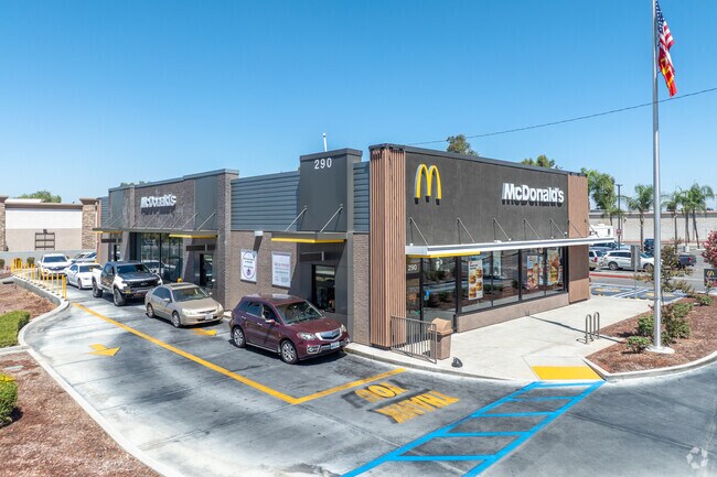
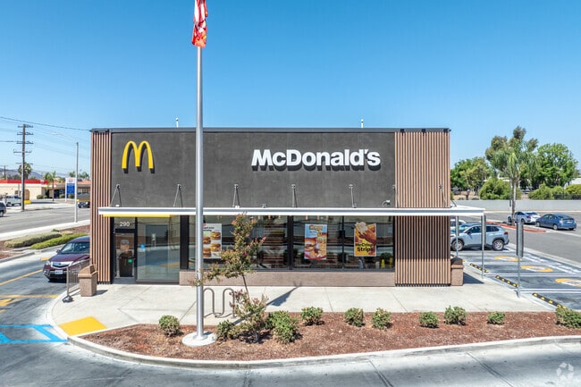
Property Record
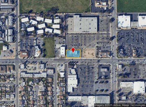
290 W Stetson Ave, Hemet, CA 92543
NEARBY LISTINGS FOR SALE OR LEASE
Property Detail
290 W Stetson Ave
446-290-016
ACRES 0.48000000 ACREAGEQUALCODE ML LOTTYPE P PARCEL 1 MAPPLATB 247 MAPPLATP 023 SUBDIVISIONNAME PM 37348
Restaurantbuilding
Riverside
X
California
06065C2105G
0.48 AC
2024
Beaumont/Hemet
2025
Inland Empire (California)
043307
Riverside-San Bernardino-Ontario, CA
4,456 SF
DEMOGRAPHICS near 290 W Stetson Ave
1 mile
3 mile
5 mile
2024 Total Population
21,178
102,848
177,790
2029 Population
23,235
112,116
193,799
Pop Growth 2024-2029
+ 9.71%
+ 9.01%
+ 9.00%
Average Age
40
40
38
2024 Total Households
7,553
35,982
57,950
HH Growth 2024-2029
+ 9.48%
+ 8.78%
+ 8.80%
Median Household Inc
$47,960
$55,648
$63,160
Avg Household Size
2.60
2.70
2.90
2024 Avg HH Vehicles
2.00
2.00
2.00
Median Home Value
$251,091
$322,243
$377,461
Median Year Built
1973
1979
1984
Nearby Places
Map Layers
Map Styles
 Street
 Aerial
Transit
 Traffic
 Biking
Places
Listings with unknown addresses are not visible on the map
- Restaurants
- Banks
- Shops
- Fitness
- Groceries
PUBLIC TRANSPORTATION
AIRPORT
Palm Springs International
Drive
Walk
Distance
Palm Springs International
60 min
47.4 mi
Nearby Properties
Address
Land Use
TOTAL SIZE
Lot Size
Zoning
Address
Land Use
TOTAL SIZE
Lot Size
Zoning
850,640 SF
42.40 AC
Address
Land Use
TOTAL SIZE
Lot Size
Zoning
19,856 SF
128.14 AC
C1
Address
Land Use
TOTAL SIZE
Lot Size
Zoning
168,761 SF
20.67 AC
Address
Land Use
TOTAL SIZE
Lot Size
Zoning
4,550 SF
127.73 AC
Address
Land Use
TOTAL SIZE
Lot Size
Zoning
306,540 SF
7.69 AC
Address
Land Use
TOTAL SIZE
Lot Size
Zoning
5.96 AC
Address
Land Use
TOTAL SIZE
Lot Size
Zoning
94,476 SF
4.86 AC
R3
Address
Land Use
TOTAL SIZE
Lot Size
Zoning
63,960 SF
8.57 AC
R3
Address
Land Use
TOTAL SIZE
Lot Size
Zoning
21,120 SF
45.06 AC
MIX
Address
Land Use
TOTAL SIZE
Lot Size
Zoning
193,123 SF
19.92 AC
Address
Land Use
TOTAL SIZE
Lot Size
Zoning
165,401 SF
13.45 AC
C1
Address
Land Use
TOTAL SIZE
Lot Size
Zoning
459,613 SF
18.24 AC
Address
Land Use
TOTAL SIZE
Lot Size
Zoning
9,184 SF
4.75 AC
R3
Address
Land Use
TOTAL SIZE
Lot Size
Zoning
50,160 SF
5.93 AC
R3
Address
Land Use
TOTAL SIZE
Lot Size
Zoning
27,964 SF
5.47 AC
Address
Land Use
TOTAL SIZE
Lot Size
Zoning
53,140 SF
6.74 AC
C2
Address
Land Use
TOTAL SIZE
Lot Size
Zoning
89,317 SF
5.77 AC
Address
Land Use
TOTAL SIZE
Lot Size
Zoning
40,880 SF
6 AC
R3
Address
Land Use
TOTAL SIZE
Lot Size
Zoning
66,482 SF
9.11 AC
A1
Address
Land Use
TOTAL SIZE
Lot Size
Zoning
167,396 SF
9.36 AC
Address
Land Use
TOTAL SIZE
Lot Size
Zoning
122,037 SF
5.52 AC
Address
Land Use
TOTAL SIZE
Lot Size
Zoning
23.04 AC
Address
Land Use
TOTAL SIZE
Lot Size
Zoning
1,488 SF
36.75 AC
Address
Land Use
TOTAL SIZE
Lot Size
Zoning
28,145 SF
4.67 AC
R3
Address
Land Use
TOTAL SIZE
Lot Size
Zoning
59,680 SF
5.80 AC
C2
Address
Land Use
TOTAL SIZE
Lot Size
Zoning
42,064 SF
4.71 AC
C1
Address
Land Use
TOTAL SIZE
Lot Size
Zoning
69,306 SF
6.02 AC
Address
Land Use
TOTAL SIZE
Lot Size
Zoning
79,683 SF
7.97 AC
C1
Address
Land Use
TOTAL SIZE
Lot Size
Zoning
24,656 SF
4.32 AC
R3
The World's #1 Commercial Real Estate Marketplace
Connect with us
© 2026 CoStar Group
The information above has been obtained from sources believed reliable. While we do not doubt its accuracy we have not verified it and make no guarantee, warranty or representation about it. It is your responsibility to independently confirm its accuracy and completeness. Any projections, opinions, assumptions, or estimates used are for example only and do not represent the current or future performance of the property. The value of this transaction to you depends on tax and other factors which should be evaluated by your tax, financial, and legal advisors. You and your advisors should conduct a careful, independent investigation of the property to determine to your satisfaction the suitability of the property for your needs.