Property Record
2900 Avenue B, Birmingham, AL 35218


NEARBY LISTINGS FOR SALE OR LEASE
Property Detail
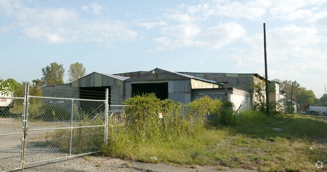
2900 Avenue B
Birmingham-Hoover, AL
Ensley Development Co
30-00-01-1-013-001.000
LOTS 7 THRU 12 BLK 3 & LOTS 7 THRU 12 BLK 9 & LOTS 7 THRU 12 BLK 10 ENSLEY DEV CO PB 5 PG 31 LESS & EXC RR R/W
Warehouse
Jefferson
X
Alabama
01073C0368G
7-12
2023
2.28 AC
2024
Bessemer
003400
Birmingham
24,328 SF
DEMOGRAPHICS near 2900 Avenue B
1 Mile
3 Mile
5 Mile
2024 Total Population
6,340
49,925
116,306
2029 Population
6,405
50,225
116,609
Pop Growth 2024-2029
+ 1.03%
+ 0.60%
+ 0.26%
Average Age
40
41
41
2024 Total Households
2,691
20,824
49,102
HH Growth 2024-2029
+ 0.97%
+ 0.59%
+ 0.31%
Median Household Inc
$34,552
$37,311
$37,882
Avg Household Size
2.30
2.20
2.20
2024 Avg HH Vehicles
2.00
2.00
2.00
Median Home Value
$58,429
$72,442
$88,274
Median Year Built
1955
1958
1963
Nearby Places
Map Layers
Map Styles
 Street
 Aerial
- Restaurants
- Banks
- Shops
- Fitness
- Groceries
PUBLIC TRANSPORTATION
COMMUTER RAIL
Birmingham (Crescent - Amtrak)
DRIVE
WALK
Distance
Birmingham (Crescent - Amtrak)
11 min
7.3 mi
AIRPORT
Birmingham-Shuttlesworth International
DRIVE
WALK
Distance
Birmingham-Shuttlesworth International
18 min
12.1 mi
Freight Ports
Port of Mobile
DRIVE
WALK
Distance
Port of Mobile
287 min
261.7 mi
Nearby Properties
Address
Land Use
TOTAL SIZE
Lot Size
Zoning
Address
Land Use
TOTAL SIZE
Lot Size
Zoning
127,240 SF
3.50 AC
R4
Address
Land Use
TOTAL SIZE
Lot Size
Zoning
200,650 SF
19.48 AC
R4
Address
Land Use
TOTAL SIZE
Lot Size
Zoning
32,922 SF
15 AC
I3
Address
Land Use
TOTAL SIZE
Lot Size
Zoning
250,918 SF
10 AC
B-2
Address
Land Use
TOTAL SIZE
Lot Size
Zoning
46,155 SF
0.77 AC
R4
Address
Land Use
TOTAL SIZE
Lot Size
Zoning
225,942 SF
7.30 AC
M1
Address
Land Use
TOTAL SIZE
Lot Size
Zoning
41,695 SF
5.40 AC
R4
Address
Land Use
TOTAL SIZE
Lot Size
Zoning
101,671 SF
14.73 AC
B2
Address
Land Use
TOTAL SIZE
Lot Size
Zoning
211,517 SF
9.50 AC
M1
Address
Land Use
TOTAL SIZE
Lot Size
Zoning
218,210 SF
11.24 AC
CM-2
Address
Land Use
TOTAL SIZE
Lot Size
Zoning
37,619 SF
9.36 AC
R3
Address
Land Use
TOTAL SIZE
Lot Size
Zoning
65,260 SF
5.29 AC
B2
Address
Land Use
TOTAL SIZE
Lot Size
Zoning
128,484 SF
8.70 AC
QB1
Address
Land Use
TOTAL SIZE
Lot Size
Zoning
147,113 SF
18.31 AC
M2
Address
Land Use
TOTAL SIZE
Lot Size
Zoning
92,678 SF
2.07 AC
R4
Address
Land Use
TOTAL SIZE
Lot Size
Zoning
157,183 SF
6.50 AC
B2
Address
Land Use
TOTAL SIZE
Lot Size
Zoning
39,347 SF
6.03 AC
B2
Address
Land Use
TOTAL SIZE
Lot Size
Zoning
65,371 SF
1.27 AC
B2
Address
Land Use
TOTAL SIZE
Lot Size
Zoning
104,775 SF
9.40 AC
B-2
Address
Land Use
TOTAL SIZE
Lot Size
Zoning
94,026 SF
4.90 AC
I2R2
Address
Land Use
TOTAL SIZE
Lot Size
Zoning
111,846 SF
6.80 AC
M1
Address
Land Use
TOTAL SIZE
Lot Size
Zoning
45,666 SF
3.46 AC
R5
Address
Land Use
TOTAL SIZE
Lot Size
Zoning
96,543 SF
8.80 AC
B2
Address
Land Use
TOTAL SIZE
Lot Size
Zoning
1 SF
10.67 AC
QB1
Address
Land Use
TOTAL SIZE
Lot Size
Zoning
34,509 SF
0.52 AC
R3
Address
Land Use
TOTAL SIZE
Lot Size
Zoning
98,280 SF
5.60 AC
M1
Address
Land Use
TOTAL SIZE
Lot Size
Zoning
95,991 SF
4.66 AC
R5
Address
Land Use
TOTAL SIZE
Lot Size
Zoning
37,793 SF
2.57 AC
R3
Address
Land Use
TOTAL SIZE
Lot Size
Zoning
35,286 SF
0.74 AC
R4
Address
Land Use
TOTAL SIZE
Lot Size
Zoning
34,476 SF
0.98 AC
R5
The World's #1 Commercial Real Estate Marketplace
Connect with us
© 2026 CoStar Group
The information above has been obtained from sources believed reliable. While we do not doubt its accuracy we have not verified it and make no guarantee, warranty or representation about it. It is your responsibility to independently confirm its accuracy and completeness. Any projections, opinions, assumptions, or estimates used are for example only and do not represent the current or future performance of the property. The value of this transaction to you depends on tax and other factors which should be evaluated by your tax, financial, and legal advisors. You and your advisors should conduct a careful, independent investigation of the property to determine to your satisfaction the suitability of the property for your needs.