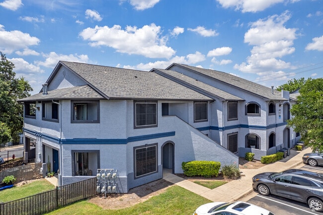
Property Record
2900 E Sunridge Dr, Austin, TX 78741


Property Detail
2900 E Sunridge Dr
Austin-Round Rock-San Marcos, TX
LOT 1-2 SUNRIDGE PARK SEC 1
507793
TRAVIS
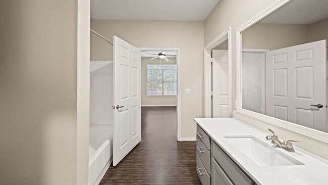
Multifamilydwelling
Texas
B and X Area of moderate flood hazard, usually the area between the limits of the 100-year and 500-year floods.
1-2
2025
21.34 AC
2025
Parker Lane
002313
Austin
286,768 SF
NEARBY LISTINGS FOR SALE OR LEASE
DEMOGRAPHICS near 2900 E Sunridge Dr
1 mile
3 mile
5 mile
2025 Total Population
19,603
132,495
325,109
2030 Population
20,476
140,086
343,514
Pop Growth 2025-2030
+ 4.45%
+ 5.73%
+ 5.66%
Average Age
33
35
35
2025 Total Households
9,748
59,767
144,788
HH Growth 2025-2030
+ 4.97%
+ 6.45%
+ 6.49%
Median Household Inc
$59,077
$80,383
$85,647
Avg Household Size
1.90
2.10
2.10
2025 Avg HH Vehicles
1.00
2.00
2.00
Median Home Value
$444,334
$577,888
$621,887
Median Year Built
1988
1999
2000
Nearby Places
Map Layers
Map Styles
 Street
 Aerial
Transit
 Traffic
 Biking
Places
Listings with unknown addresses are not visible on the map
- Restaurants
- Banks
- Shops
- Fitness
- Groceries
PUBLIC TRANSPORTATION
COMMUTER RAIL
Austin (Texas Eagle - Amtrak)
Drive
Walk
Distance
Austin (Texas Eagle - Amtrak)
12 min
5.6 mi
AIRPORT
Austin-Bergstrom International
Drive
Walk
Distance
Austin-Bergstrom International
19 min
7.7 mi
Freight Ports
Calhoun Port
Drive
Walk
Distance
Calhoun Port
184 min
151.2 mi
Nearby Properties
Address
Land Use
TOTAL SIZE
Lot Size
Zoning
Address
Land Use
TOTAL SIZE
Lot Size
Zoning
9,768 SF
386.80 AC
Address
Land Use
TOTAL SIZE
Lot Size
Zoning
20,550 SF
14.15 AC
Address
Land Use
TOTAL SIZE
Lot Size
Zoning
1,156,135 SF
1.74 AC
Address
Land Use
TOTAL SIZE
Lot Size
Zoning
9,034 SF
28.69 AC
Address
Land Use
TOTAL SIZE
Lot Size
Zoning
498,684 SF
61.86 AC
Address
Land Use
TOTAL SIZE
Lot Size
Zoning
1,400,000 SF
3.07 AC
Address
Land Use
TOTAL SIZE
Lot Size
Zoning
999,200 SF
25 AC
Address
Land Use
TOTAL SIZE
Lot Size
Zoning
341,096 SF
0.31 AC
Address
Land Use
TOTAL SIZE
Lot Size
Zoning
533,917 SF
0.81 AC
Address
Land Use
TOTAL SIZE
Lot Size
Zoning
400,000 SF
0.27 AC
Address
Land Use
TOTAL SIZE
Lot Size
Zoning
6.12 AC
Address
Land Use
TOTAL SIZE
Lot Size
Zoning
8,213 SF
36.95 AC
Address
Land Use
TOTAL SIZE
Lot Size
Zoning
372,000 SF
1.35 AC
Address
Land Use
TOTAL SIZE
Lot Size
Zoning
237,066 SF
2.19 AC
Address
Land Use
TOTAL SIZE
Lot Size
Zoning
8.17 AC
Address
Land Use
TOTAL SIZE
Lot Size
Zoning
368,349 SF
17.13 AC
Address
Land Use
TOTAL SIZE
Lot Size
Zoning
433,044 SF
2.58 AC
Address
Land Use
TOTAL SIZE
Lot Size
Zoning
356,147 SF
10.48 AC
Address
Land Use
TOTAL SIZE
Lot Size
Zoning
492,715 SF
9.22 AC
Address
Land Use
TOTAL SIZE
Lot Size
Zoning
456,650 SF
15 AC
Address
Land Use
TOTAL SIZE
Lot Size
Zoning
224,624 SF
4.61 AC
Address
Land Use
TOTAL SIZE
Lot Size
Zoning
42,373 SF
2.09 AC
Address
Land Use
TOTAL SIZE
Lot Size
Zoning
307,610 SF
8.95 AC
Address
Land Use
TOTAL SIZE
Lot Size
Zoning
269,203 SF
1.46 AC
Address
Land Use
TOTAL SIZE
Lot Size
Zoning
263,052 SF
0.99 AC
Address
Land Use
TOTAL SIZE
Lot Size
Zoning
268,140 SF
1.53 AC
Address
Land Use
TOTAL SIZE
Lot Size
Zoning
454,740 SF
27.77 AC
Address
Land Use
TOTAL SIZE
Lot Size
Zoning
387,267 SF
3.25 AC
Address
Land Use
TOTAL SIZE
Lot Size
Zoning
290,643 SF
13.59 AC
Address
Land Use
TOTAL SIZE
Lot Size
Zoning
300,883 SF
3.47 AC
The World's #1 Commercial Real Estate Marketplace
Connect with us
© 2026 CoStar Group
The information above has been obtained from sources believed reliable. While we do not doubt its accuracy we have not verified it and make no guarantee, warranty or representation about it. It is your responsibility to independently confirm its accuracy and completeness. Any projections, opinions, assumptions, or estimates used are for example only and do not represent the current or future performance of the property. The value of this transaction to you depends on tax and other factors which should be evaluated by your tax, financial, and legal advisors. You and your advisors should conduct a careful, independent investigation of the property to determine to your satisfaction the suitability of the property for your needs.