Property Record
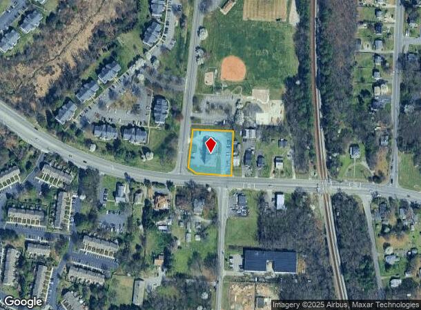
2900 Hungary Rd, Henrico, VA 23228

NEARBY LISTINGS FOR SALE OR LEASE
Property Detail
2900 Hungary Rd
769-759-7739
00510A0000 0006; N L HUNGARY ROAD AC .889 92 A2 8
Officebuilding
Henrico
X
Virginia
51085C0295C
0.89 AC
2025
Parham East
2025
Richmond VA
200416
Richmond, VA
9,162 SF
DEMOGRAPHICS near 2900 Hungary Rd
1 Mile
3 Mile
5 Mile
2024 Total Population
9,185
81,556
180,948
2029 Population
9,108
81,227
181,622
Pop Growth 2024-2029
(0.84%)
(0.40%)
+ 0.37%
Average Age
40
39
41
2024 Total Households
3,881
33,696
75,497
HH Growth 2024-2029
(0.88%)
(0.41%)
+ 0.48%
Median Household Inc
$68,788
$72,904
$79,851
Avg Household Size
2.30
2.30
2.30
2024 Avg HH Vehicles
2.00
2.00
2.00
Median Home Value
$243,950
$273,629
$308,350
Median Year Built
1985
1981
1979
Nearby Places
Map Layers
Map Styles
 Street
 Aerial
- Restaurants
- Banks
- Shops
- Fitness
- Groceries
PUBLIC TRANSPORTATION
COMMUTER RAIL
DRIVE
WALK
Distance
5 min
2.1 mi
DRIVE
WALK
Distance
20 min
9.8 mi
AIRPORT
Richmond International
DRIVE
WALK
Distance
Richmond International
29 min
18.0 mi
Freight Ports
Virginia Port Authority - Richmond
DRIVE
WALK
Distance
Virginia Port Authority - Richmond
27 min
16.3 mi
Nearby Properties
Address
Land Use
TOTAL SIZE
Lot Size
Zoning
Address
Land Use
TOTAL SIZE
Lot Size
Zoning
172,000 SF
48.58 AC
R-3
Address
Land Use
TOTAL SIZE
Lot Size
Zoning
43,929 SF
46.83 AC
O-S
Address
Land Use
TOTAL SIZE
Lot Size
Zoning
585,792 SF
38.94 AC
R-5
Address
Land Use
TOTAL SIZE
Lot Size
Zoning
597,042 SF
41.03 AC
R-6C
Address
Land Use
TOTAL SIZE
Lot Size
Zoning
173,400 SF
42 AC
MIXE
Address
Land Use
TOTAL SIZE
Lot Size
Zoning
527,410 SF
40.70 AC
A-1
Address
Land Use
TOTAL SIZE
Lot Size
Zoning
104,972 SF
108.49 AC
MIXE
Address
Land Use
TOTAL SIZE
Lot Size
Zoning
266,138 SF
96.10 AC
R-2C
Address
Land Use
TOTAL SIZE
Lot Size
Zoning
347,648 SF
24.75 AC
R-5
Address
Land Use
TOTAL SIZE
Lot Size
Zoning
309,500 SF
29.78 AC
MIXE
Address
Land Use
TOTAL SIZE
Lot Size
Zoning
271,060 SF
18.31 AC
R-6
Address
Land Use
TOTAL SIZE
Lot Size
Zoning
250,146 SF
20.41 AC
R-5
Address
Land Use
TOTAL SIZE
Lot Size
Zoning
1,404 SF
30.52 AC
R-5
Address
Land Use
TOTAL SIZE
Lot Size
Zoning
224,768 SF
18.08 AC
R-6
Address
Land Use
TOTAL SIZE
Lot Size
Zoning
296,784 SF
23.11 AC
R-5
Address
Land Use
TOTAL SIZE
Lot Size
Zoning
17,850 SF
33 AC
A-1
Address
Land Use
TOTAL SIZE
Lot Size
Zoning
500,400 SF
31.15 AC
R-5
Address
Land Use
TOTAL SIZE
Lot Size
Zoning
232,368 SF
26.11 AC
R-5
Address
Land Use
TOTAL SIZE
Lot Size
Zoning
182,264 SF
15.91 AC
R-5
Address
Land Use
TOTAL SIZE
Lot Size
Zoning
227,905 SF
58.94 AC
R-3
Address
Land Use
TOTAL SIZE
Lot Size
Zoning
180,070 SF
17.13 AC
R-5
Address
Land Use
TOTAL SIZE
Lot Size
Zoning
158,900 SF
18.52 AC
R-5
Address
Land Use
TOTAL SIZE
Lot Size
Zoning
167,576 SF
14.29 AC
R-5
Address
Land Use
TOTAL SIZE
Lot Size
Zoning
213,344 SF
16.28 AC
R-5
Address
Land Use
TOTAL SIZE
Lot Size
Zoning
158,568 SF
13.36 AC
R-5C
Address
Land Use
TOTAL SIZE
Lot Size
Zoning
24,165 SF
72.13 AC
C-1
Address
Land Use
TOTAL SIZE
Lot Size
Zoning
176,936 SF
6 AC
B-2C
Address
Land Use
TOTAL SIZE
Lot Size
Zoning
301,185 SF
24.65 AC
R-5
Address
Land Use
TOTAL SIZE
Lot Size
Zoning
295,074 SF
24.89 AC
R-5
Address
Land Use
TOTAL SIZE
Lot Size
Zoning
185,988 SF
14.55 AC
R-5
The World's #1 Commercial Real Estate Marketplace
Connect with us
© 2025 CoStar Group
The information above has been obtained from sources believed reliable. While we do not doubt its accuracy we have not verified it and make no guarantee, warranty or representation about it. It is your responsibility to independently confirm its accuracy and completeness. Any projections, opinions, assumptions, or estimates used are for example only and do not represent the current or future performance of the property. The value of this transaction to you depends on tax and other factors which should be evaluated by your tax, financial, and legal advisors. You and your advisors should conduct a careful, independent investigation of the property to determine to your satisfaction the suitability of the property for your needs.